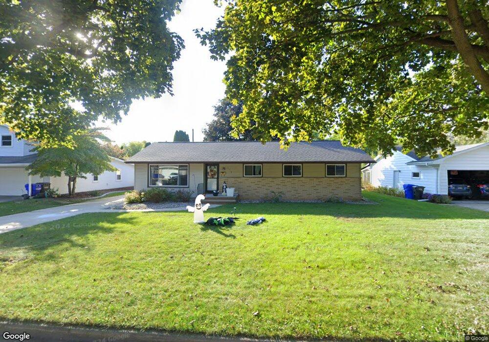
1719 S Mohawk Dr Appleton, WI 54914
West Appleton NeighborhoodEstimated Value: $291,634 - $319,000
4
Beds
2
Baths
2,088
Sq Ft
$147/Sq Ft
Est. Value
About This Home
This home is located at 1719 S Mohawk Dr, Appleton, WI 54914 and is currently estimated at $305,909, approximately $146 per square foot. 1719 S Mohawk Dr is a home located in Outagamie County with nearby schools including Jefferson Elementary School, Wilson Middle School, and Appleton West High School.
Ownership History
Date
Name
Owned For
Owner Type
Purchase Details
Closed on
May 12, 2017
Sold by
Aronson Eric S and Aronson Hollie L
Bought by
Barnhart Nathanial L and Barnhart Christina J
Current Estimated Value
Purchase Details
Closed on
Feb 15, 2012
Sold by
Aronson Eric S
Bought by
Aronson Eric S
Purchase Details
Closed on
Jun 22, 2007
Sold by
Cournoyer Louis E and Cournoyer Adele M
Bought by
Aronson Eric S
Create a Home Valuation Report for This Property
The Home Valuation Report is an in-depth analysis detailing your home's value as well as a comparison with similar homes in the area
Home Values in the Area
Average Home Value in this Area
Purchase History
| Date | Buyer | Sale Price | Title Company |
|---|---|---|---|
| Barnhart Nathanial L | $155,000 | -- | |
| Aronson Eric S | -- | -- | |
| Aronson Eric S | $141,750 | -- |
Source: Public Records
Tax History
| Year | Tax Paid | Tax Assessment Tax Assessment Total Assessment is a certain percentage of the fair market value that is determined by local assessors to be the total taxable value of land and additions on the property. | Land | Improvement |
|---|---|---|---|---|
| 2023 | $3,616 | $239,600 | $36,400 | $203,200 |
| 2022 | $3,887 | $189,500 | $28,500 | $161,000 |
| 2021 | $3,707 | $189,500 | $28,500 | $161,000 |
| 2020 | $3,355 | $173,000 | $28,500 | $144,500 |
| 2019 | $3,252 | $173,000 | $28,500 | $144,500 |
| 2018 | $2,961 | $138,500 | $24,700 | $113,800 |
| 2017 | $2,948 | $138,500 | $24,700 | $113,800 |
| 2016 | $2,895 | $138,500 | $24,700 | $113,800 |
| 2015 | $2,894 | $136,300 | $24,700 | $111,600 |
| 2014 | $2,868 | $136,300 | $24,700 | $111,600 |
| 2013 | $2,875 | $136,300 | $24,700 | $111,600 |
Source: Public Records
Map
Nearby Homes
- 1719 S Seminole Rd
- 1831 S Mayfair Dr
- 2400 W Cherokee Dr
- 30 Weatherstone Dr
- 1312 S Riverdale Dr
- 2905 Fox Run
- 801 S Olson Ave Unit A
- 720 S Westhaven Place Unit F
- 71 Spencer Village Ct Unit 12
- 144 Baldwin Ct
- 22 Spencer Village Ct
- 3182 Justin Ct Unit 5
- 610 Stonehedge Ln Unit 3-A
- 2895 W 4th St Unit 2A
- 3667 W Quaker Ridge Ln
- 2661 Northern Rd Unit E
- 2661 Northern Rd Unit I
- 1710 Lakeshore Dr
- 2190 Carleton Ave
- 1303 W Prospect Ave
- 1713 S Mohawk Dr
- 1725 S Mohawk Dr
- 1731 S Mohawk Dr
- 1701 S Mohawk Dr
- 1707 S Mohawk Dr
- 1700 S Mayfair Dr
- 1706 S Mayfair Dr
- 1726 S Mohawk Dr
- 1718 S Mohawk Dr
- 1712 S Mohawk Dr
- 1630 S Mayfair Dr
- 1706 S Mohawk Dr
- 1712 S Mayfair Dr
- 1718 S Mayfair Dr
- 1624 S Mayfair Dr
- 1627 S Mohawk Dr
- 1711 S Mayfair Dr
- 1621 S Mohawk Dr
- 1707 S Mayfair Dr
- 1636 S Mohawk Dr
Your Personal Tour Guide
Ask me questions while you tour the home.