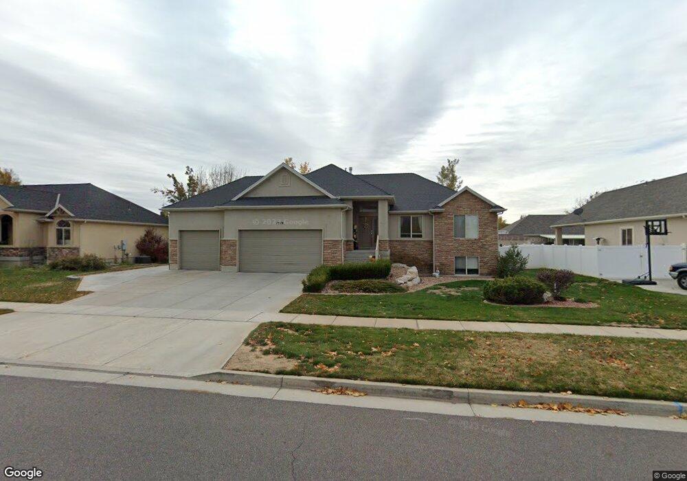
1719 W 2475 S Syracuse, UT 84075
Estimated Value: $601,000 - $645,000
5
Beds
3
Baths
1,524
Sq Ft
$409/Sq Ft
Est. Value
About This Home
This home is located at 1719 W 2475 S, Syracuse, UT 84075 and is currently estimated at $623,744, approximately $409 per square foot. 1719 W 2475 S is a home located in Davis County with nearby schools including Syracuse Elementary School, Syracuse Junior High School, and Syracuse High School.
Ownership History
Date
Name
Owned For
Owner Type
Purchase Details
Closed on
Jun 25, 2025
Sold by
Chesmer Donald J and Chesmer Stephanie H
Bought by
Chesmer Family Trust and Chesmer
Current Estimated Value
Purchase Details
Closed on
Jul 2, 2003
Sold by
Rainey Homes Inc
Bought by
Chesmer Donald J and Chesmer Stephanie H
Home Financials for this Owner
Home Financials are based on the most recent Mortgage that was taken out on this home.
Original Mortgage
$184,404
Interest Rate
5.26%
Mortgage Type
Purchase Money Mortgage
Create a Home Valuation Report for This Property
The Home Valuation Report is an in-depth analysis detailing your home's value as well as a comparison with similar homes in the area
Home Values in the Area
Average Home Value in this Area
Purchase History
| Date | Buyer | Sale Price | Title Company |
|---|---|---|---|
| Chesmer Family Trust | -- | None Listed On Document | |
| Chesmer Donald J | -- | Heritage West Title Insuranc |
Source: Public Records
Mortgage History
| Date | Status | Borrower | Loan Amount |
|---|---|---|---|
| Previous Owner | Chesmer Donald J | $184,404 |
Source: Public Records
Tax History Compared to Growth
Tax History
| Year | Tax Paid | Tax Assessment Tax Assessment Total Assessment is a certain percentage of the fair market value that is determined by local assessors to be the total taxable value of land and additions on the property. | Land | Improvement |
|---|---|---|---|---|
| 2025 | $3,352 | $323,400 | $124,377 | $199,023 |
| 2024 | $3,324 | $322,850 | $102,310 | $220,540 |
| 2023 | $3,125 | $553,000 | $142,589 | $410,411 |
| 2022 | $3,282 | $318,450 | $82,156 | $236,294 |
| 2021 | $2,936 | $441,000 | $121,346 | $319,654 |
| 2020 | $2,634 | $383,000 | $105,986 | $277,014 |
| 2019 | $2,522 | $362,000 | $103,253 | $258,747 |
| 2018 | $2,358 | $336,000 | $99,905 | $236,095 |
| 2016 | $2,193 | $163,900 | $38,358 | $125,542 |
| 2015 | $2,164 | $154,000 | $38,358 | $115,642 |
| 2014 | $2,084 | $151,164 | $38,358 | $112,806 |
| 2013 | -- | $140,103 | $36,655 | $103,448 |
Source: Public Records
Map
Nearby Homes
- 2503 S 1875 W
- 1836 W 2400 S
- 2744 S Allison Way Unit 211
- 2742 S Allison Way Unit 212
- 2463 S 1375 W
- 1697 W 2770 S Unit 202
- 1695 W 2770 S Unit 203
- 1667 W 2770 S Unit 206
- 2208 W 2615 S Unit 141
- 2198 W 2615 S Unit 140
- 2158 W 2615 S Unit 137
- 2194 S 1800 W
- 2223 S Allison Way
- 2650 S 2000 W
- 1315 W 2325 S
- 2082 S 1730 W
- 1295 W 2325 S
- 1286 W 2325 S
- 1806 Park Dr
- 1276 W 2325 S