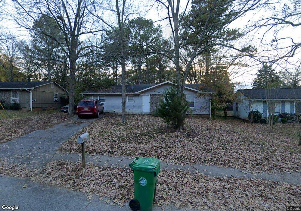
1719 W Austin Rd Decatur, GA 30032
Estimated Value: $215,000 - $245,000
5
Beds
2
Baths
1,456
Sq Ft
$157/Sq Ft
Est. Value
About This Home
This home is located at 1719 W Austin Rd, Decatur, GA 30032 and is currently estimated at $228,811, approximately $157 per square foot. 1719 W Austin Rd is a home located in DeKalb County with nearby schools including Snapfinger Elementary School, Columbia Middle School, and Columbia High School.
Ownership History
Date
Name
Owned For
Owner Type
Purchase Details
Closed on
Aug 25, 2021
Sold by
Johnson Charles A
Bought by
Lee Yolanda A
Current Estimated Value
Purchase Details
Closed on
Mar 1, 2002
Sold by
Lee Curtis A and Lee Carol S
Bought by
Jonhson Charles A and Jonhson Yolanda A
Home Financials for this Owner
Home Financials are based on the most recent Mortgage that was taken out on this home.
Original Mortgage
$90,155
Interest Rate
6.8%
Mortgage Type
New Conventional
Create a Home Valuation Report for This Property
The Home Valuation Report is an in-depth analysis detailing your home's value as well as a comparison with similar homes in the area
Home Values in the Area
Average Home Value in this Area
Purchase History
| Date | Buyer | Sale Price | Title Company |
|---|---|---|---|
| Lee Yolanda A | $10,000 | -- | |
| Lee Yolanda A | $10,000 | -- | |
| Lee Yolanda A | $10,000 | -- | |
| Jonhson Charles A | $94,900 | -- |
Source: Public Records
Mortgage History
| Date | Status | Borrower | Loan Amount |
|---|---|---|---|
| Previous Owner | Jonhson Charles A | $90,155 |
Source: Public Records
Tax History Compared to Growth
Tax History
| Year | Tax Paid | Tax Assessment Tax Assessment Total Assessment is a certain percentage of the fair market value that is determined by local assessors to be the total taxable value of land and additions on the property. | Land | Improvement |
|---|---|---|---|---|
| 2025 | $3,861 | $78,600 | $52,000 | $26,600 |
| 2024 | $3,221 | $64,040 | $52,000 | $12,040 |
| 2023 | $3,221 | $64,200 | $31,720 | $32,480 |
| 2022 | $2,899 | $58,920 | $16,000 | $42,920 |
| 2021 | $2,634 | $52,880 | $16,000 | $36,880 |
| 2020 | $2,218 | $43,400 | $16,000 | $27,400 |
| 2019 | $2,118 | $41,120 | $16,000 | $25,120 |
| 2018 | $1,505 | $32,000 | $4,080 | $27,920 |
| 2017 | $1,528 | $24,680 | $4,080 | $20,600 |
| 2016 | $1,439 | $25,480 | $4,080 | $21,400 |
| 2014 | $904 | $13,040 | $4,080 | $8,960 |
Source: Public Records
Map
Nearby Homes
- 1729 W Austin Rd
- 1669 Freedom Valley
- 1674 Freedom Valley
- 3842 Brookcrest Cir
- 3651 Tulip Dr
- 1733 Hollyhock Terrace
- 1603 Hollyhock Terrace
- 3682 Daisy Dr
- 1688 Danrich Dr
- 3711 Daisy Dr
- 3705 Daisy Dr
- 3513 Larkspur Terrace
- 1581 Hollyhock Terrace
- 3738 Larkspur Terrace
- 3519 Larkspur Terrace
- 3699 Larkspur Terrace
- 1701 Corey Blvd
- 3465 Tulip Dr
- 3401 Tulip Dr
- 4366 Glenwood Pkwy
- 1623 Liberty Valley
- 1685 Liberty Valley Unit 2
- 1633 Liberty Valley
- 1677 Liberty Valley
- 1723 W Austin Rd
- 1643 Liberty Valley
- 1720 W Austin Rd
- 1718 W Austin Rd
- 1722 W Austin Rd
- 1653 Liberty Valley
- 1693 Liberty Valley
- 1669 Liberty Valley
- 1624 Liberty Valley
- 1724 W Austin Rd
- 1716 W Austin Rd
- 1725 W Austin Rd
- 1698 Liberty Valley
- 1630 Liberty Valley
- 1726 W Austin Rd
- 1620 Freedom Valley