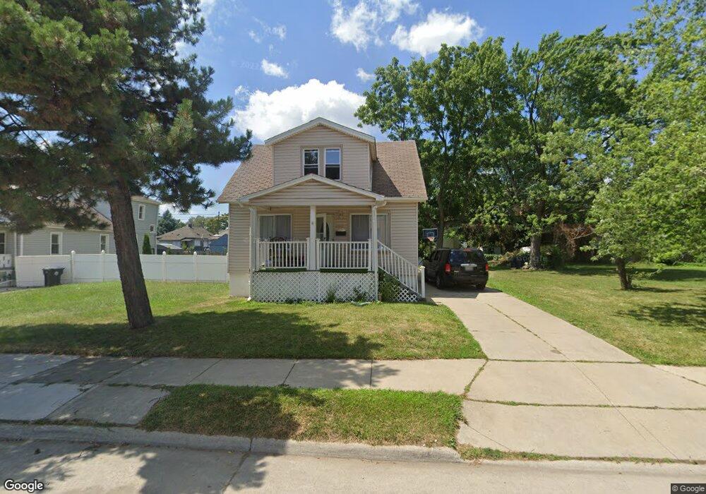
17193 Francis St Unit Bldg-Unit Melvindale, MI 48122
Estimated Value: $118,000 - $176,217
--
Bed
1
Bath
1,200
Sq Ft
$122/Sq Ft
Est. Value
About This Home
This home is located at 17193 Francis St Unit Bldg-Unit, Melvindale, MI 48122 and is currently estimated at $146,304, approximately $121 per square foot. 17193 Francis St Unit Bldg-Unit is a home located in Wayne County with nearby schools including Rogers Early Elementary School, Allendale Elementary School, and Julian O. Strong Middle School.
Ownership History
Date
Name
Owned For
Owner Type
Purchase Details
Closed on
Apr 12, 2021
Sold by
Quraish Ahmed Mohammed
Bought by
Mohamed
Current Estimated Value
Purchase Details
Closed on
Jan 4, 2017
Sold by
Saif Fathi and Harhara Fatima
Bought by
Quraish Ahmed
Purchase Details
Closed on
Dec 24, 2015
Sold by
Saif Fathi and Harhara Fatima
Bought by
Saif Fathi and Ahmed Noor
Create a Home Valuation Report for This Property
The Home Valuation Report is an in-depth analysis detailing your home's value as well as a comparison with similar homes in the area
Home Values in the Area
Average Home Value in this Area
Purchase History
| Date | Buyer | Sale Price | Title Company |
|---|---|---|---|
| Mohamed | $50,000 | -- | |
| Mohamed | -- | None Available | |
| Quraish Ahmed | $60,000 | None Available | |
| Saif Fathi | -- | None Available | |
| Quraish Ahmed | -- | Title Connect |
Source: Public Records
Mortgage History
| Date | Status | Borrower | Loan Amount |
|---|---|---|---|
| Closed | Mohamed | $0 |
Source: Public Records
Tax History Compared to Growth
Tax History
| Year | Tax Paid | Tax Assessment Tax Assessment Total Assessment is a certain percentage of the fair market value that is determined by local assessors to be the total taxable value of land and additions on the property. | Land | Improvement |
|---|---|---|---|---|
| 2025 | $1,923 | $72,400 | $0 | $0 |
| 2024 | $1,923 | $64,400 | $0 | $0 |
| 2023 | $1,832 | $54,700 | $0 | $0 |
| 2022 | $3,560 | $49,500 | $0 | $0 |
| 2021 | $1,569 | $32,900 | $0 | $0 |
| 2020 | $1,952 | $29,100 | $0 | $0 |
| 2019 | $1,831 | $27,300 | $0 | $0 |
| 2018 | $1,239 | $24,200 | $0 | $0 |
| 2017 | $1,076 | $21,600 | $0 | $0 |
| 2016 | $1,738 | $20,600 | $0 | $0 |
| 2015 | $1,849 | $18,600 | $0 | $0 |
| 2013 | $1,800 | $18,900 | $0 | $0 |
| 2012 | $1,235 | $18,400 | $1,400 | $17,000 |
Source: Public Records
Map
Nearby Homes
- 17206 Flora St
- 17150 Flora St
- 17083 Dora St
- 17172 Eddon St
- 17579 Park St
- 2326 Fisher St
- 3589 Caryn St
- 3595 Elizabeth St
- 2527 Corbin St
- 0002 Prospect St
- 0001 Prospect St
- 12836 Conway St
- 17951 Prospect St
- 17182 Henry St
- 1415 S Liddesdale St
- 1409 S Liddesdale St
- 2523 David St
- 2601 S Fort St
- 2800 David St
- 17632 Henry St
- 17193 Francis St
- 17205 Francis St
- 17234 Flora St
- 17165 Francis St
- 17242 Flora St
- 17220 Flora St
- 17256 Flora St
- 17214 Flora St Unit Bldg-Unit
- 17214 Flora St
- 17180 Francis St
- 17264 Flora St
- 17276 Flora St
- 17288 Flora St
- 17223 Flora St
- 17229 Flora St
- 17237 Flora St
- 17209 Flora St
- 17243 Flora St
- 17186 Flora St
- 17251 Flora St