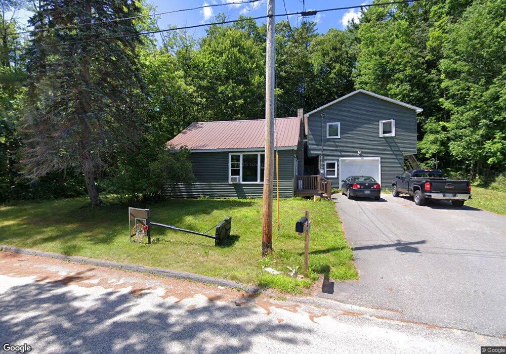
172 Andrew Dr Auburn, ME 04210
Estimated Value: $365,981 - $410,000
4
Beds
2
Baths
1,896
Sq Ft
$203/Sq Ft
Est. Value
About This Home
This home is located at 172 Andrew Dr, Auburn, ME 04210 and is currently estimated at $384,745, approximately $202 per square foot. 172 Andrew Dr is a home located in Androscoggin County with nearby schools including East Auburn Community School, Auburn Middle School, and Edward Little High School.
Ownership History
Date
Name
Owned For
Owner Type
Purchase Details
Closed on
Nov 10, 2022
Sold by
Farrell Gail A
Bought by
Farrell Bryan P
Current Estimated Value
Home Financials for this Owner
Home Financials are based on the most recent Mortgage that was taken out on this home.
Original Mortgage
$180,000
Outstanding Balance
$174,022
Interest Rate
6.92%
Mortgage Type
Purchase Money Mortgage
Estimated Equity
$210,723
Purchase Details
Closed on
Apr 17, 2019
Sold by
Farrell Gail A
Bought by
Farrell Bryan and Farrell Brad
Create a Home Valuation Report for This Property
The Home Valuation Report is an in-depth analysis detailing your home's value as well as a comparison with similar homes in the area
Home Values in the Area
Average Home Value in this Area
Purchase History
| Date | Buyer | Sale Price | Title Company |
|---|---|---|---|
| Farrell Bryan P | $225,000 | None Available | |
| Farrell Bryan P | $225,000 | None Available | |
| Farrell Bryan | -- | -- | |
| Farrell Bryan | -- | -- |
Source: Public Records
Mortgage History
| Date | Status | Borrower | Loan Amount |
|---|---|---|---|
| Open | Farrell Bryan P | $180,000 | |
| Closed | Farrell Bryan P | $180,000 |
Source: Public Records
Tax History Compared to Growth
Tax History
| Year | Tax Paid | Tax Assessment Tax Assessment Total Assessment is a certain percentage of the fair market value that is determined by local assessors to be the total taxable value of land and additions on the property. | Land | Improvement |
|---|---|---|---|---|
| 2024 | $6,261 | $281,400 | $40,600 | $240,800 |
| 2023 | $5,692 | $250,200 | $36,100 | $214,100 |
| 2022 | $3,335 | $146,600 | $36,100 | $110,500 |
| 2021 | $2,453 | $103,000 | $30,100 | $72,900 |
| 2020 | $2,446 | $103,000 | $30,100 | $72,900 |
| 2019 | $2,446 | $103,000 | $30,100 | $72,900 |
| 2018 | $2,439 | $103,000 | $30,100 | $72,900 |
| 2017 | $1,908 | $103,000 | $30,100 | $72,900 |
| 2016 | $2,302 | $103,000 | $30,100 | $72,900 |
| 2015 | $1,976 | $103,000 | $30,100 | $72,900 |
| 2013 | -- | $103,400 | $30,100 | $73,300 |
Source: Public Records
Map
Nearby Homes
- 180 Andrew Dr
- 175 Andrew Dr
- 188 Andrew Dr
- 199 Andrew Dr
- 147 Andrew Dr
- 208 Andrew Dr
- 0 Andrew Dr Unit 735572
- 0 Andrew Dr Unit 1406968
- 279 Oak Hill Rd
- 245 Oak Hill Rd
- 257 Oak Hill Rd
- 235 Oak Hill Rd
- 150 Andrew Dr
- 240 Andrew Dr
- 256 Oak Hill Rd
- 251 Andrew Dr
- 230 Oak Hill Rd
- 209 Oak Hill Rd
- 222 Oak Hill Rd
- 208 Oak Hill Rd