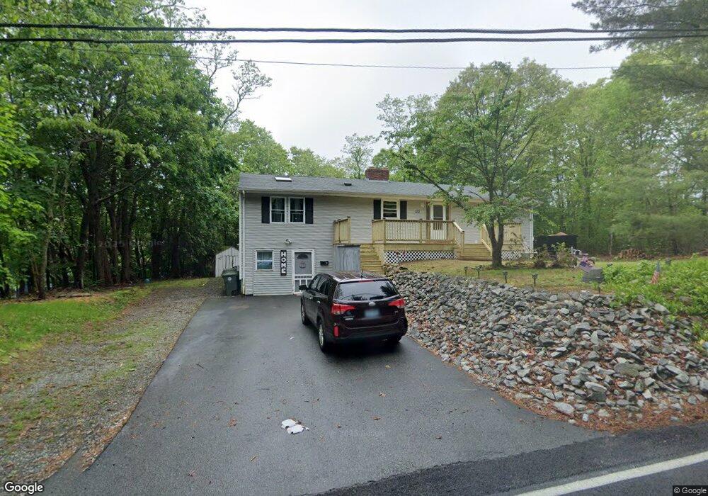
172 Boston St Coventry, RI 02816
Estimated Value: $369,234 - $424,000
3
Beds
3
Baths
1,444
Sq Ft
$278/Sq Ft
Est. Value
About This Home
This home is located at 172 Boston St, Coventry, RI 02816 and is currently estimated at $401,309, approximately $277 per square foot. 172 Boston St is a home located in Kent County with nearby schools including Alan Shawn Feinstein Ms Of Cov, Coventry High School, and Father John V. Doyle School.
Ownership History
Date
Name
Owned For
Owner Type
Purchase Details
Closed on
Sep 12, 2005
Sold by
Browne Donald J and Browne Cathleen E
Bought by
Bjorklund John E and Bjorklund Melvy J
Current Estimated Value
Create a Home Valuation Report for This Property
The Home Valuation Report is an in-depth analysis detailing your home's value as well as a comparison with similar homes in the area
Home Values in the Area
Average Home Value in this Area
Purchase History
| Date | Buyer | Sale Price | Title Company |
|---|---|---|---|
| Bjorklund John E | $210,000 | -- |
Source: Public Records
Mortgage History
| Date | Status | Borrower | Loan Amount |
|---|---|---|---|
| Open | Bjorklund John E | $159,000 | |
| Closed | Browne Donald J | $21,000 | |
| Closed | Browne Donald J | $12,500 | |
| Closed | Browne Donald J | $25,000 | |
| Closed | Browne Donald J | $10,000 |
Source: Public Records
Tax History Compared to Growth
Tax History
| Year | Tax Paid | Tax Assessment Tax Assessment Total Assessment is a certain percentage of the fair market value that is determined by local assessors to be the total taxable value of land and additions on the property. | Land | Improvement |
|---|---|---|---|---|
| 2024 | $4,609 | $291,000 | $85,100 | $205,900 |
| 2023 | $4,461 | $291,000 | $85,100 | $205,900 |
| 2022 | $4,290 | $219,200 | $81,400 | $137,800 |
| 2021 | $4,252 | $219,200 | $81,400 | $137,800 |
| 2020 | $4,875 | $219,200 | $81,400 | $137,800 |
| 2019 | $3,783 | $170,100 | $51,800 | $118,300 |
| 2018 | $3,674 | $170,000 | $51,800 | $118,200 |
| 2017 | $3,567 | $170,000 | $51,800 | $118,200 |
| 2016 | $3,415 | $159,500 | $49,000 | $110,500 |
| 2015 | $3,322 | $159,500 | $49,000 | $110,500 |
| 2014 | $3,253 | $159,500 | $49,000 | $110,500 |
| 2013 | $3,460 | $185,400 | $57,600 | $127,800 |
Source: Public Records
Map
Nearby Homes
- 48 Breezy Lake Dr
- 1 White Rock Rd
- 7 Beaulieu Ave
- 14 Dawn Ln
- 9 Regent St Unit 11
- 4 Union St
- 20 Maplewood Dr
- 82 Doolittle St
- 35 Meredith Dr
- 14 Sheri Dr
- 22 Glenwood Dr
- 2 Country View Dr
- 26 Anderson Ave
- 11 Taft St
- 104 Knotty Oak Rd
- 2 Hawthorne Rd
- 105 Read Ave
- 27 Matteson St
- 6 Hornbeam Rd Unit 42
- 52 Ginger Trail