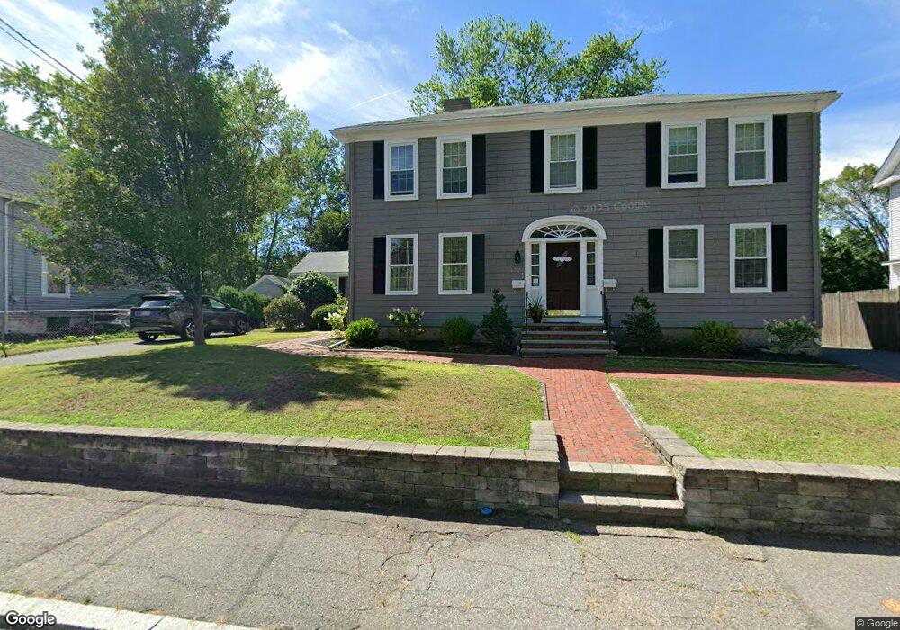
172 Broad St North Attleboro, MA 02760
North Attleboro NeighborhoodEstimated Value: $709,000 - $911,000
5
Beds
3
Baths
3,101
Sq Ft
$247/Sq Ft
Est. Value
About This Home
This home is located at 172 Broad St, North Attleboro, MA 02760 and is currently estimated at $766,987, approximately $247 per square foot. 172 Broad St is a home located in Bristol County with nearby schools including North Attleboro High School and Cadence Academy Preschool - North Attleborough.
Ownership History
Date
Name
Owned For
Owner Type
Purchase Details
Closed on
Mar 25, 2009
Sold by
Desilets Lucille E and Desilets Albert J
Bought by
Desilets Holding Llc
Current Estimated Value
Create a Home Valuation Report for This Property
The Home Valuation Report is an in-depth analysis detailing your home's value as well as a comparison with similar homes in the area
Home Values in the Area
Average Home Value in this Area
Purchase History
| Date | Buyer | Sale Price | Title Company |
|---|---|---|---|
| Desilets Holding Llc | $120,000 | -- |
Source: Public Records
Tax History Compared to Growth
Tax History
| Year | Tax Paid | Tax Assessment Tax Assessment Total Assessment is a certain percentage of the fair market value that is determined by local assessors to be the total taxable value of land and additions on the property. | Land | Improvement |
|---|---|---|---|---|
| 2025 | $7,962 | $675,300 | $126,200 | $549,100 |
| 2024 | $7,616 | $660,000 | $126,200 | $533,800 |
| 2023 | $6,936 | $542,300 | $126,200 | $416,100 |
| 2022 | $7,278 | $522,500 | $126,200 | $396,300 |
| 2021 | $5,378 | $469,800 | $126,200 | $343,600 |
| 2020 | $5,072 | $412,900 | $126,200 | $286,700 |
| 2019 | $5,716 | $401,400 | $114,700 | $286,700 |
| 2018 | $4,571 | $344,500 | $114,700 | $229,800 |
| 2017 | $4,303 | $344,500 | $114,700 | $229,800 |
| 2016 | $3,895 | $294,600 | $127,400 | $167,200 |
| 2015 | $3,955 | $301,000 | $133,800 | $167,200 |
| 2014 | $4,041 | $305,200 | $123,700 | $181,500 |
Source: Public Records
Map
Nearby Homes
- 20 South St
- 64 Smith St
- 35-R Whiting St
- 68 Fisher St
- 45 Moran St
- 19 Church St Unit A5
- 188 Smith St
- 8 Al Pace Dr Unit 8
- 85 Richards Ave
- 16 Richards Ave Unit 106
- 212 Fisher St Unit A5
- 16 Elizabeth St
- 93 Bank St
- 217 Fisher St
- 1066 Mount Hope St
- 880 Landry Ave Unit 2
- 0 Landry 2nd Unit 73350867
- 42 2nd Ave Unit 24
- 99 Arnold Rd
- 20 Holbrook Ave
- 166 Broad St
- 176 Broad St
- 162 Broad St
- 180 Broad St
- 171 Broad St
- 184 Broad St
- 128 Broad St Unit 4
- 128 Broad St Unit 3
- 128 Broad St Unit 2
- 128 Broad St Unit 1
- 165 Broad St
- 177 Broad St
- 183 Broad St
- 188 Broad St
- 188 Broad St Unit 1
- 188 Broad St Unit 2
- 188 Broad St Unit 3
- 158 Broad St Unit 4
- 158 Broad St Unit 3
- 158 Broad St Unit 2