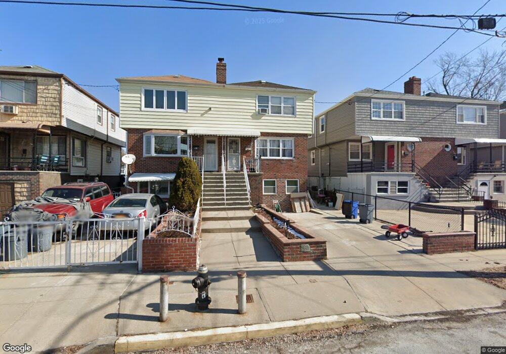
172 Calhoun Ave Bronx, NY 10465
Throgs Neck-Edgewater Park NeighborhoodEstimated Value: $711,284 - $805,000
3
Beds
2
Baths
1,782
Sq Ft
$420/Sq Ft
Est. Value
About This Home
This home is located at 172 Calhoun Ave, Bronx, NY 10465 and is currently estimated at $748,571, approximately $420 per square foot. 172 Calhoun Ave is a home located in Bronx County with nearby schools including P.S. 72 - Dr. William Dorney, Herbert H Lehman High School, and St. Frances de Chantal School.
Ownership History
Date
Name
Owned For
Owner Type
Purchase Details
Closed on
Dec 22, 2011
Sold by
Martin Elvira and Marzella Marianne
Bought by
Ofori Anita B and Osei David N A
Current Estimated Value
Home Financials for this Owner
Home Financials are based on the most recent Mortgage that was taken out on this home.
Original Mortgage
$337,500
Interest Rate
3.99%
Mortgage Type
New Conventional
Purchase Details
Closed on
Dec 28, 2010
Sold by
Martin Elvira
Bought by
Marzella Marianne
Create a Home Valuation Report for This Property
The Home Valuation Report is an in-depth analysis detailing your home's value as well as a comparison with similar homes in the area
Home Values in the Area
Average Home Value in this Area
Purchase History
| Date | Buyer | Sale Price | Title Company |
|---|---|---|---|
| Ofori Anita B | $375,000 | -- | |
| Marzella Marianne | -- | -- |
Source: Public Records
Mortgage History
| Date | Status | Borrower | Loan Amount |
|---|---|---|---|
| Previous Owner | Ofori Anita B | $337,500 |
Source: Public Records
Tax History
| Year | Tax Paid | Tax Assessment Tax Assessment Total Assessment is a certain percentage of the fair market value that is determined by local assessors to be the total taxable value of land and additions on the property. | Land | Improvement |
|---|---|---|---|---|
| 2025 | $6,786 | $34,042 | $8,695 | $25,347 |
| 2024 | $6,786 | $33,785 | $7,818 | $25,967 |
| 2023 | $6,473 | $31,873 | $7,711 | $24,162 |
| 2022 | $6,003 | $37,800 | $9,900 | $27,900 |
| 2021 | $5,970 | $32,580 | $9,900 | $22,680 |
| 2020 | $6,005 | $32,880 | $9,900 | $22,980 |
| 2019 | $5,890 | $30,960 | $9,900 | $21,060 |
| 2018 | $5,414 | $26,561 | $9,548 | $17,013 |
| 2017 | $1,293 | $25,058 | $9,797 | $15,261 |
| 2016 | $4,105 | $23,640 | $9,900 | $13,740 |
| 2015 | $2,800 | $25,560 | $10,980 | $14,580 |
| 2014 | $2,800 | $25,560 | $10,980 | $14,580 |
Source: Public Records
Map
Nearby Homes
- 2832 Harding Ave
- 2829 Schurz Ave
- 149 Revere Ave
- 2819 Collis Place
- 220 Calhoun Ave
- 156 Revere Ave
- 2816 Collis Place
- 227 Calhoun Ave
- 249 Calhoun Ave
- 244 Revere Ave
- 238 Swinton Ave
- 4216 E Tremont Ave
- 249 Quincy Ave
- 260 Swinton Ave
- 4190 E Tremont Ave
- 192 Huntington Ave
- 252 Brinsmade Ave
- 239 Brinsmade Ave
- 2730 Schurz Ave Unit N3 & N4
- 276 Brinsmade Ave
- 170 Calhoun Ave Unit 1
- 170 Calhoun Ave
- 174 Calhoun Ave
- 176 Calhoun Ave
- 168 Calhoun Ave
- 166 Calhoun Ave
- 178 Calhoun Ave
- 164 Calhoun Ave
- 169 Revere Ave
- 171 Revere Ave
- 173 Revere Ave
- 167 Revere Ave
- 182 Calhoun Ave
- 175 Revere Ave
- 165 Revere Ave
- 177 Revere Ave
- 162 Calhoun Ave
- 184 Calhoun Ave
- 2839 Collis Place
- 163 Revere Ave
Your Personal Tour Guide
Ask me questions while you tour the home.