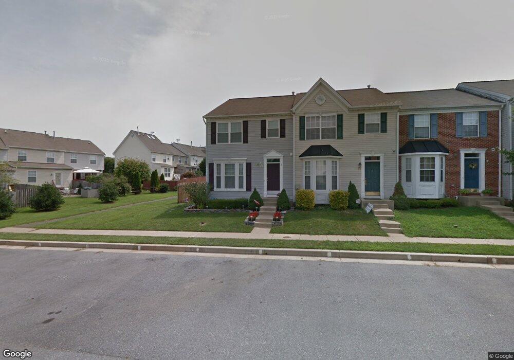
172 Carolstowne Rd Reisterstown, MD 21136
Estimated Value: $312,000 - $372,000
3
Beds
2
Baths
1,560
Sq Ft
$222/Sq Ft
Est. Value
About This Home
This home is located at 172 Carolstowne Rd, Reisterstown, MD 21136 and is currently estimated at $345,675, approximately $221 per square foot. 172 Carolstowne Rd is a home located in Baltimore County with nearby schools including Franklin Elementary School, Franklin Middle, and Franklin High.
Ownership History
Date
Name
Owned For
Owner Type
Purchase Details
Closed on
Nov 10, 2008
Sold by
Fatherlos David Dwyer
Bought by
Hampt Marc R and Moran Kerry L
Current Estimated Value
Home Financials for this Owner
Home Financials are based on the most recent Mortgage that was taken out on this home.
Original Mortgage
$247,656
Outstanding Balance
$162,969
Interest Rate
6.13%
Mortgage Type
FHA
Estimated Equity
$182,706
Purchase Details
Closed on
Oct 29, 2008
Sold by
Fatherlos David Dwyer
Bought by
Hampt Marc R and Moran Kerry L
Home Financials for this Owner
Home Financials are based on the most recent Mortgage that was taken out on this home.
Original Mortgage
$247,656
Outstanding Balance
$162,969
Interest Rate
6.13%
Mortgage Type
FHA
Estimated Equity
$182,706
Purchase Details
Closed on
Jun 2, 2003
Sold by
Lease Robert E
Bought by
Fatherlos David Dwyer and Tringali Heather Marie
Purchase Details
Closed on
Mar 8, 2000
Sold by
Bob Ward At Baltimore County Llc
Bought by
Lease Robert E
Create a Home Valuation Report for This Property
The Home Valuation Report is an in-depth analysis detailing your home's value as well as a comparison with similar homes in the area
Home Values in the Area
Average Home Value in this Area
Purchase History
| Date | Buyer | Sale Price | Title Company |
|---|---|---|---|
| Hampt Marc R | $249,000 | -- | |
| Hampt Marc R | $249,000 | -- | |
| Fatherlos David Dwyer | $168,000 | -- | |
| Lease Robert E | $125,995 | -- |
Source: Public Records
Mortgage History
| Date | Status | Borrower | Loan Amount |
|---|---|---|---|
| Open | Hampt Marc R | $247,656 | |
| Closed | Hampt Marc R | $247,656 |
Source: Public Records
Tax History Compared to Growth
Tax History
| Year | Tax Paid | Tax Assessment Tax Assessment Total Assessment is a certain percentage of the fair market value that is determined by local assessors to be the total taxable value of land and additions on the property. | Land | Improvement |
|---|---|---|---|---|
| 2025 | $3,793 | $255,267 | -- | -- |
| 2024 | $3,793 | $233,900 | $63,000 | $170,900 |
| 2023 | $1,843 | $227,667 | $0 | $0 |
| 2022 | $3,486 | $221,433 | $0 | $0 |
| 2021 | $3,292 | $215,200 | $63,000 | $152,200 |
| 2020 | $3,292 | $210,367 | $0 | $0 |
| 2019 | $3,292 | $205,533 | $0 | $0 |
| 2018 | $3,205 | $200,700 | $63,000 | $137,700 |
| 2017 | $3,044 | $197,500 | $0 | $0 |
| 2016 | $3,196 | $194,300 | $0 | $0 |
| 2015 | $3,196 | $191,100 | $0 | $0 |
| 2014 | $3,196 | $191,100 | $0 | $0 |
Source: Public Records
Map
Nearby Homes
- 4 Wolf Ave
- 131 Westminster Rd
- 100 1st Ave
- 223 New Ave
- 123 Glyndon Trace Dr
- 10 Pennyborough Ct
- 7 Butler Rd
- 65A Bond Ave
- 259 E Chatsworth Ave
- 13943 B Old Hanover Rd
- 13943 D Old Hanover Rd
- 13943 C Old Hanover Rd
- 3 Meadow Mist Ct
- 120 Lamport Rd
- 15 Gloucester Ct
- 225 Highmeadow Rd
- 9 Norris Run Ct
- 926 Nicodemus Rd
- 701 Cockeys Mill Rd
- 1015 Nicodemus Rd
- 168 Carolstowne Rd
- 166 Carolstowne Rd
- 164 Carolstowne Rd
- 243 Pidco Rd
- 245 Pidco Rd
- 162 Carolstowne Rd
- 247 Pidco Rd
- 241 Pidco Rd
- 239 Pidco Rd
- 160 Carolstowne Rd
- 156 Carolstowne Rd
- 235 Pidco Rd
- 154 Carolstowne Rd
- 199 Carolstowne Rd
- 152 Carolstowne Rd
- 197 Carolstowne Rd
- 233 Pidco Rd
- 195 Carolstowne Rd
- 201 Carolstowne Rd
- 150 Carolstowne Rd