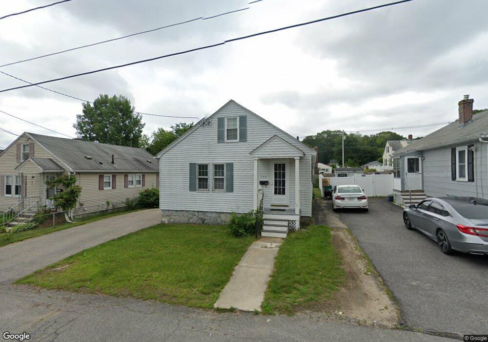
172 Dracut St Lowell, MA 01854
Pawtucketville NeighborhoodEstimated Value: $377,000 - $455,000
2
Beds
1
Bath
900
Sq Ft
$463/Sq Ft
Est. Value
About This Home
This home is located at 172 Dracut St, Lowell, MA 01854 and is currently estimated at $417,113, approximately $463 per square foot. 172 Dracut St is a home located in Middlesex County with nearby schools including Joseph McAvinnue Elementary School, Charlotte M. Murkland Elementary School, and Charles W. Morey Elementary School.
Ownership History
Date
Name
Owned For
Owner Type
Purchase Details
Closed on
Apr 27, 1999
Sold by
Obrien Rachel L
Bought by
Quinn David
Current Estimated Value
Home Financials for this Owner
Home Financials are based on the most recent Mortgage that was taken out on this home.
Original Mortgage
$110,000
Outstanding Balance
$28,375
Interest Rate
7.02%
Mortgage Type
Purchase Money Mortgage
Estimated Equity
$388,738
Purchase Details
Closed on
Sep 30, 1993
Sold by
Est King Marie E and Wallace Eleanor M
Bought by
Albert Rachel L
Home Financials for this Owner
Home Financials are based on the most recent Mortgage that was taken out on this home.
Original Mortgage
$74,575
Interest Rate
7%
Mortgage Type
Purchase Money Mortgage
Create a Home Valuation Report for This Property
The Home Valuation Report is an in-depth analysis detailing your home's value as well as a comparison with similar homes in the area
Home Values in the Area
Average Home Value in this Area
Purchase History
| Date | Buyer | Sale Price | Title Company |
|---|---|---|---|
| Quinn David | $119,000 | -- | |
| Quinn David | $119,000 | -- | |
| Albert Rachel L | $78,500 | -- | |
| Albert Rachel L | $78,500 | -- |
Source: Public Records
Mortgage History
| Date | Status | Borrower | Loan Amount |
|---|---|---|---|
| Open | Albert Rachel L | $110,000 | |
| Closed | Albert Rachel L | $110,000 | |
| Previous Owner | Albert Rachel L | $74,575 |
Source: Public Records
Tax History
| Year | Tax Paid | Tax Assessment Tax Assessment Total Assessment is a certain percentage of the fair market value that is determined by local assessors to be the total taxable value of land and additions on the property. | Land | Improvement |
|---|---|---|---|---|
| 2025 | $3,839 | $334,400 | $155,900 | $178,500 |
| 2024 | $3,884 | $326,100 | $164,700 | $161,400 |
| 2023 | $3,812 | $306,900 | $148,800 | $158,100 |
| 2022 | $3,365 | $265,200 | $135,300 | $129,900 |
| 2021 | $3,148 | $233,900 | $117,600 | $116,300 |
| 2020 | $2,872 | $215,000 | $100,200 | $114,800 |
| 2019 | $2,565 | $182,700 | $84,700 | $98,000 |
| 2018 | $2,479 | $172,300 | $80,700 | $91,600 |
| 2017 | $2,442 | $163,700 | $75,400 | $88,300 |
| 2016 | $2,521 | $166,300 | $73,200 | $93,100 |
| 2015 | $2,522 | $162,900 | $73,200 | $89,700 |
| 2013 | $2,492 | $166,000 | $85,600 | $80,400 |
Source: Public Records
Map
Nearby Homes
- 94 Hampson St
- 101 Donohue Rd Unit 19
- 30 4th Ave
- 39 Phoebe Ave
- 28 Sarah Ave
- 67 Glennon Ave
- 89 Mammoth Rd
- 49 Sparks St
- 105 Columbia Rd
- 2300 Skyline Dr Unit 3
- 15 Louis Farm Rd Unit 15
- 1400 Skyline Dr Unit 6
- 104 Woodward Ave
- 38 Starbird St
- 187 Varnum Ave
- 75 Sladen St
- 19 Louis Farm Rd Unit 19
- 13 Louis Farm Rd Unit 13
- 79 School St Unit 4
- 16 Peabody Ave
- 168 Dracut St
- 182 Dracut St
- 178 Dracut St
- 160 Dracut St
- 154 Dracut St
- 164 Dracut St
- 343 University Ave
- 335 University Ave
- 337 University Ave
- 337 University Ave Unit 337
- 351 University Ave
- 181 Dracut St
- 188 Dracut St
- 333 University Ave
- 333 University Ave Unit 329
- 333 University Ave Unit 333
- 333 University Ave Unit 331
- 185 Dracut St
- 329 University Ave
- 159 Dracut St
Your Personal Tour Guide
Ask me questions while you tour the home.