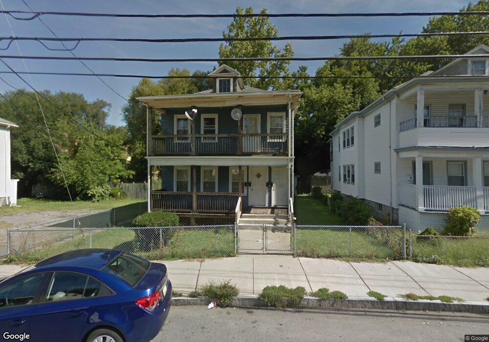
172 Florence St Roslindale, MA 02131
Roslindale NeighborhoodEstimated Value: $618,000 - $1,009,455
5
Beds
2
Baths
2,448
Sq Ft
$333/Sq Ft
Est. Value
About This Home
This home is located at 172 Florence St, Roslindale, MA 02131 and is currently estimated at $815,614, approximately $333 per square foot. 172 Florence St is a home located in Suffolk County with nearby schools including Brooke Charter School Roslindale, Sacred Heart STEM School, and St. Clare High School.
Ownership History
Date
Name
Owned For
Owner Type
Purchase Details
Closed on
Nov 16, 1988
Sold by
Puzinas James J
Bought by
Rivers Samuel M
Current Estimated Value
Create a Home Valuation Report for This Property
The Home Valuation Report is an in-depth analysis detailing your home's value as well as a comparison with similar homes in the area
Home Values in the Area
Average Home Value in this Area
Purchase History
| Date | Buyer | Sale Price | Title Company |
|---|---|---|---|
| Rivers Samuel M | $155,000 | -- |
Source: Public Records
Mortgage History
| Date | Status | Borrower | Loan Amount |
|---|---|---|---|
| Open | Rivers Samuel M | $211,000 | |
| Closed | Rivers Samuel M | $169,000 | |
| Closed | Rivers Samuel M | $158,000 |
Source: Public Records
Tax History Compared to Growth
Tax History
| Year | Tax Paid | Tax Assessment Tax Assessment Total Assessment is a certain percentage of the fair market value that is determined by local assessors to be the total taxable value of land and additions on the property. | Land | Improvement |
|---|---|---|---|---|
| 2025 | $8,061 | $696,100 | $234,600 | $461,500 |
| 2024 | $7,895 | $724,300 | $243,700 | $480,600 |
| 2023 | $7,408 | $689,800 | $232,100 | $457,700 |
| 2022 | $7,014 | $644,700 | $216,900 | $427,800 |
| 2021 | $6,679 | $626,000 | $210,600 | $415,400 |
| 2020 | $5,759 | $545,400 | $196,800 | $348,600 |
| 2019 | $5,372 | $509,700 | $166,400 | $343,300 |
| 2018 | $4,856 | $463,400 | $166,400 | $297,000 |
| 2017 | $4,858 | $458,700 | $166,400 | $292,300 |
| 2016 | $4,760 | $432,700 | $166,400 | $266,300 |
| 2015 | $4,903 | $404,900 | $131,100 | $273,800 |
| 2014 | $4,481 | $356,200 | $131,100 | $225,100 |
Source: Public Records
Map
Nearby Homes
- 187 Florence St Unit 2L
- 108 Florence St Unit 3
- 108 Florence St Unit 1
- 108 Florence St Unit 4
- 348-350 Hyde Park Ave Unit 2
- 36 Neponset Ave Unit 1
- 27 Rowe St
- 32 Jewett St
- 620 South St
- 71 Wyvern St
- 4031 Washington St
- 67 Cummins Hwy Unit 101
- 4012 Washington St
- 19 Delford St
- 19 Delford St Unit 1
- 18-20 Northbourne Rd Unit 18
- 50 Southbourne Rd
- 543 Hyde Park Ave Unit 1
- 105 Neponset Ave Unit 105
- 103-105 Neponset Ave
- 176 Florence St
- 164 Florence St Unit 164A
- 164 Florence St Unit 1,164
- 180 Florence St
- 8 Harrison St
- 184 Florence St
- 175 Florence St
- 171 Florence St Unit 4
- 171 Florence St Unit 3
- 171 Florence St Unit 2
- 171 Florence St Unit 1
- 171 Florence St
- 10 Harrison St Unit 12
- 10 Harrison St
- 10 Harrison St Unit 2
- 179 Florence St
- 196 Sycamore St
- 14 Harrison St Unit 16
- 16 Harrison St Unit 6
- 16 Harrison St