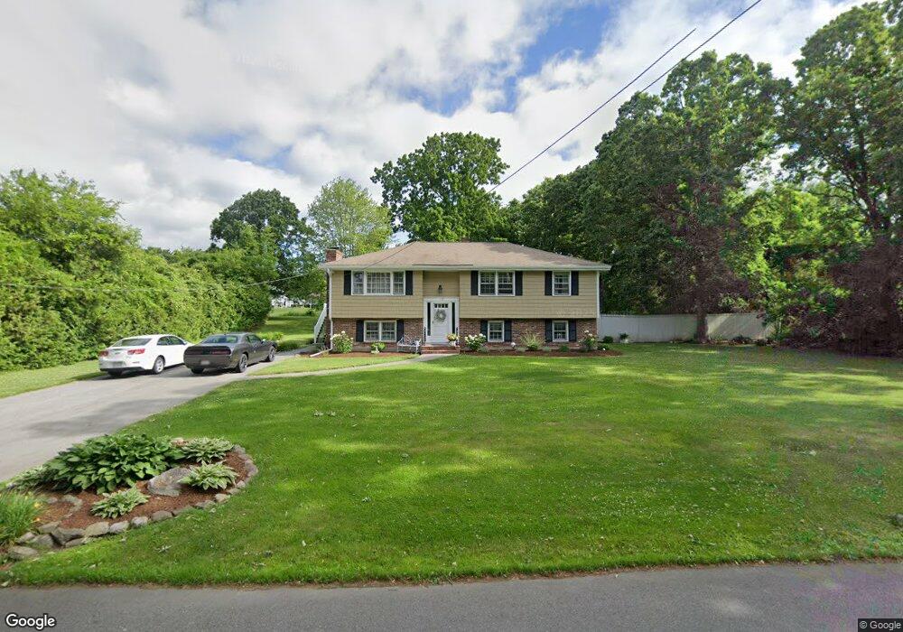
172 Fox Ave Dracut, MA 01826
Dracut AreaEstimated Value: $580,300 - $659,000
About This Home
This home is located at 172 Fox Ave, Dracut, MA 01826 and is currently estimated at $622,825, approximately $457 per square foot. 172 Fox Ave is a home located in Middlesex County with nearby schools including Greenmont Avenue School, Richardson Middle School, and Dracut Senior High School.
Ownership History
We collect this data history from publicly available records. To have your information removed, we recommend requesting removal directly through your county’s website.
Purchase Details
Purchase Details
Home Financials for this Owner
Home Financials are based on the most recent Mortgage that was taken out on this home.Purchase Details
Home Values in the Area
Average Home Value in this Area
Purchase History
We collect this data history from publicly available records. To have your information removed, we recommend requesting removal directly through your county’s website.
| Date | Buyer | Sale Price | Title Company |
|---|---|---|---|
| -- | None Available | ||
| -- | -- | ||
| -- | -- |
Mortgage History
We collect this data history from publicly available records. To have your information removed, we recommend requesting removal directly through your county’s website.
| Date | Status | Borrower | Loan Amount |
|---|---|---|---|
| Closed | $125,000 | ||
| Previous Owner | $200,000 | ||
| Closed | $75,000 | ||
| Closed | $40,000 | ||
| Previous Owner | $30,000 |
Tax History
We collect this data history from publicly available records. To have your information removed, we recommend requesting removal directly through your county’s website.
| Year | Tax Paid | Tax Assessment Tax Assessment Total Assessment is a certain percentage of the fair market value that is determined by local assessors to be the total taxable value of land and additions on the property. | Land | Improvement |
|---|---|---|---|---|
| 2025 | $5,273 | $521,000 | $229,100 | $291,900 |
| 2024 | $5,364 | $513,300 | $218,300 | $295,000 |
| 2023 | $5,353 | $462,300 | $189,900 | $272,400 |
| 2022 | $4,944 | $402,300 | $172,700 | $229,600 |
| 2021 | $4,924 | $378,500 | $156,800 | $221,700 |
| 2020 | $4,650 | $348,300 | $152,100 | $196,200 |
| 2019 | $4,648 | $338,000 | $144,800 | $193,200 |
| 2018 | $4,502 | $318,400 | $144,800 | $173,600 |
| 2017 | $4,334 | $318,400 | $144,800 | $173,600 |
| 2016 | $4,152 | $279,800 | $139,200 | $140,600 |
| 2015 | $4,021 | $269,300 | $139,200 | $130,100 |
| 2014 | $3,837 | $264,800 | $139,200 | $125,600 |
Map
- 103 Fox Ave
- 38 Montaup Ave
- 12 Fox Hill Ln Unit 12
- 23 Fox Hill Ln Unit 23
- 1544 Bridge St
- 15 Frank St Unit 1
- 50 Frank St Unit 50
- 10 Lanseigne St
- 1315 Bridge St
- 103 Meadow Creek Dr
- 13 Esther Way Unit 7
- 14 Wesley St
- 15 Esther Way Unit Lot 8
- 175 Willard St Unit 8
- 625 Broadway Rd
- 271 Humphrey St Unit 16
- 668 Robbins Ave Unit 3
- 112 Genest St Unit 18
- 112 Genest St Unit 17
- 95 Lillian Terrace
- 162 Fox Ave
- 25 Tally Ho Dr
- 173 Fox Ave
- 40 Blackberry Fields Rd
- 159 Fox Ave
- 152 Fox Ave
- 147 Fox Ave
- 28 Tally Ho Dr
- 41 Blackberry Fields Rd
- 34 Blackberry Fields Rd
- 41 Tally Ho Dr
- 40 Tally Ho Dr
- 136 Fox Ave
- 130 Kenney St
- 135 Fox Ave
- 241 Fox Ave
- 238 Fox Ave
- 112 Derby St
- 35 Blackberry Fields Rd
- 28 Blackberry Fields Rd
Ask me questions while you tour the home.