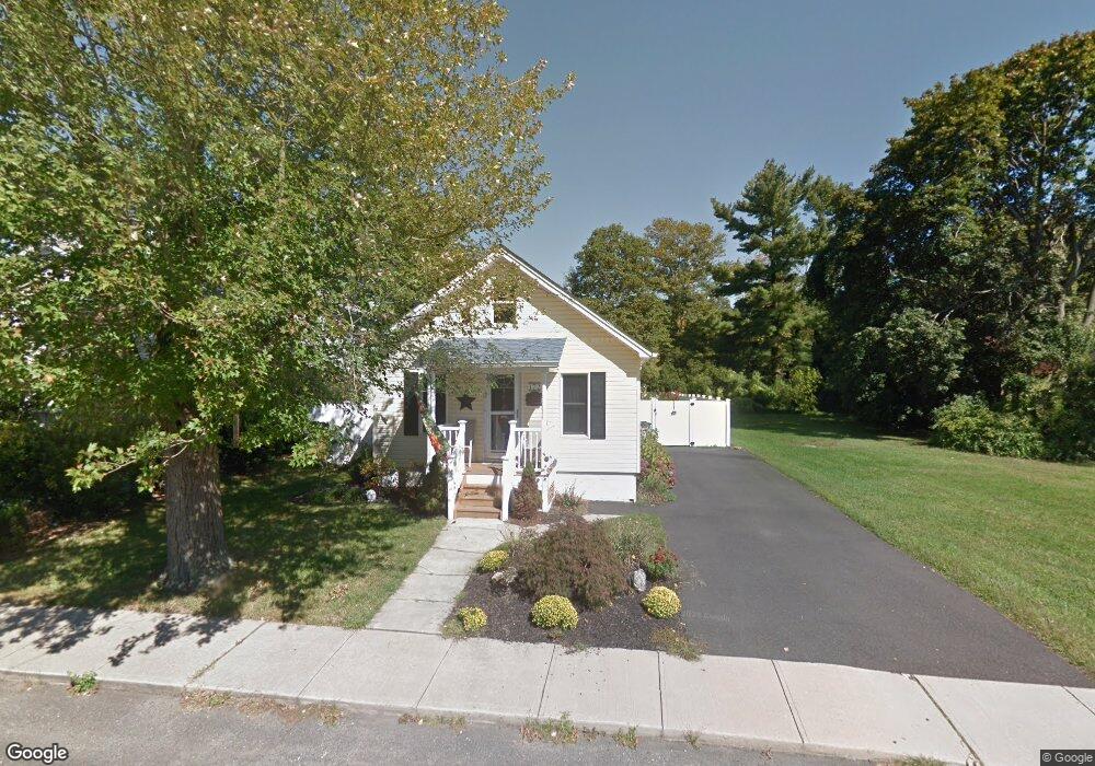
172 Grant Ave Hightstown, NJ 08520
Estimated Value: $366,224 - $432,000
2
Beds
1
Bath
1,058
Sq Ft
$386/Sq Ft
Est. Value
About This Home
This home is located at 172 Grant Ave, Hightstown, NJ 08520 and is currently estimated at $408,306, approximately $385 per square foot. 172 Grant Ave is a home located in Mercer County with nearby schools including Melvin H. Kreps Middle School, Hightstown High School, and SciCore Academy.
Ownership History
Date
Name
Owned For
Owner Type
Purchase Details
Closed on
Aug 14, 2025
Sold by
Johnson Jamie and Croshaw Jamie L
Bought by
Croshaw Jamie L and Croshaw Keith C
Current Estimated Value
Home Financials for this Owner
Home Financials are based on the most recent Mortgage that was taken out on this home.
Original Mortgage
$283,400
Outstanding Balance
$283,155
Interest Rate
6.72%
Mortgage Type
New Conventional
Estimated Equity
$125,151
Purchase Details
Closed on
Jun 19, 2009
Sold by
Key Investment Group Llc
Bought by
Johnson Jamie and Croshaw Keith
Home Financials for this Owner
Home Financials are based on the most recent Mortgage that was taken out on this home.
Original Mortgage
$183,672
Interest Rate
5.21%
Mortgage Type
New Conventional
Purchase Details
Closed on
Aug 22, 2008
Sold by
Reo Properties Corporation
Bought by
Key Investment Group Llc
Purchase Details
Closed on
Feb 26, 2008
Sold by
Sheriff Of Mercer
Bought by
Reo Prop Corp
Purchase Details
Closed on
Apr 27, 2005
Sold by
Watkins John
Bought by
Tumminia Phillip
Create a Home Valuation Report for This Property
The Home Valuation Report is an in-depth analysis detailing your home's value as well as a comparison with similar homes in the area
Home Values in the Area
Average Home Value in this Area
Purchase History
| Date | Buyer | Sale Price | Title Company |
|---|---|---|---|
| Croshaw Jamie L | -- | Vylla Title | |
| Johnson Jamie | $180,000 | Multiple | |
| Key Investment Group Llc | $82,500 | North American Title Agency | |
| Reo Prop Corp | -- | -- | |
| Tumminia Phillip | $175,000 | -- |
Source: Public Records
Mortgage History
| Date | Status | Borrower | Loan Amount |
|---|---|---|---|
| Open | Croshaw Jamie L | $283,400 | |
| Previous Owner | Johnson Jamie | $183,672 |
Source: Public Records
Tax History Compared to Growth
Tax History
| Year | Tax Paid | Tax Assessment Tax Assessment Total Assessment is a certain percentage of the fair market value that is determined by local assessors to be the total taxable value of land and additions on the property. | Land | Improvement |
|---|---|---|---|---|
| 2025 | $8,556 | $174,500 | $85,000 | $89,500 |
| 2024 | $8,468 | $174,500 | $85,000 | $89,500 |
| 2023 | $8,468 | $174,500 | $85,000 | $89,500 |
| 2022 | $8,175 | $174,500 | $85,000 | $89,500 |
| 2021 | $7,880 | $174,500 | $85,000 | $89,500 |
| 2020 | $7,701 | $174,500 | $85,000 | $89,500 |
| 2019 | $7,486 | $174,500 | $85,000 | $89,500 |
| 2018 | $5,635 | $135,300 | $85,000 | $50,300 |
| 2017 | $5,577 | $135,300 | $85,000 | $50,300 |
| 2016 | $5,528 | $135,300 | $85,000 | $50,300 |
| 2015 | $5,493 | $135,300 | $85,000 | $50,300 |
| 2014 | $5,528 | $135,300 | $85,000 | $50,300 |
Source: Public Records
Map
Nearby Homes