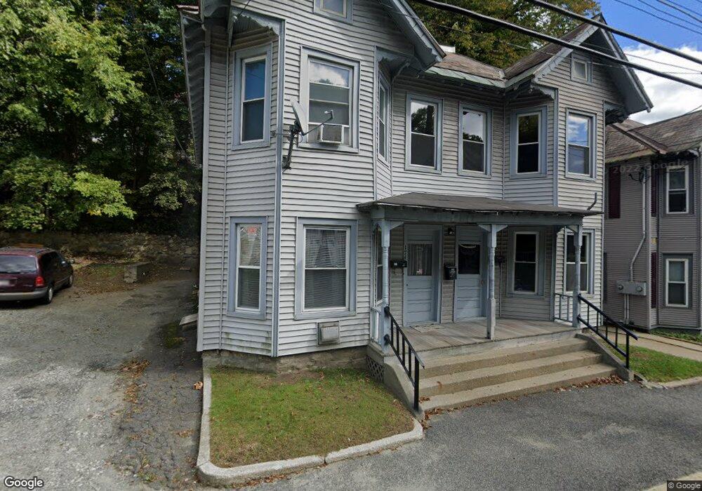
172 Houghton St Unit 174 North Adams, MA 01247
Estimated Value: $189,000 - $248,000
5
Beds
4
Baths
2,844
Sq Ft
$74/Sq Ft
Est. Value
About This Home
This home is located at 172 Houghton St Unit 174, North Adams, MA 01247 and is currently estimated at $209,333, approximately $73 per square foot. 172 Houghton St Unit 174 is a home located in Berkshire County with nearby schools including Greylock Elementary School and Drury High School.
Ownership History
Date
Name
Owned For
Owner Type
Purchase Details
Closed on
Oct 28, 1996
Sold by
Record Daniel Jude and Record Raymond M
Bought by
Bellard Robert F
Current Estimated Value
Home Financials for this Owner
Home Financials are based on the most recent Mortgage that was taken out on this home.
Original Mortgage
$40,286
Outstanding Balance
$4,016
Interest Rate
8.22%
Mortgage Type
Purchase Money Mortgage
Estimated Equity
$205,317
Create a Home Valuation Report for This Property
The Home Valuation Report is an in-depth analysis detailing your home's value as well as a comparison with similar homes in the area
Home Values in the Area
Average Home Value in this Area
Purchase History
| Date | Buyer | Sale Price | Title Company |
|---|---|---|---|
| Bellard Robert F | $39,900 | -- | |
| Bellard Robert F | $39,900 | -- |
Source: Public Records
Mortgage History
| Date | Status | Borrower | Loan Amount |
|---|---|---|---|
| Open | Bellard Robert F | $40,286 | |
| Closed | Bellard Robert F | $40,286 |
Source: Public Records
Tax History Compared to Growth
Tax History
| Year | Tax Paid | Tax Assessment Tax Assessment Total Assessment is a certain percentage of the fair market value that is determined by local assessors to be the total taxable value of land and additions on the property. | Land | Improvement |
|---|---|---|---|---|
| 2025 | $1,955 | $117,000 | $15,400 | $101,600 |
| 2024 | $1,836 | $107,100 | $14,100 | $93,000 |
| 2023 | $1,634 | $92,500 | $14,100 | $78,400 |
| 2022 | $1,714 | $92,500 | $14,100 | $78,400 |
| 2021 | $1,595 | $85,700 | $13,100 | $72,600 |
| 2020 | $1,650 | $88,600 | $13,300 | $75,300 |
| 2019 | $1,707 | $89,300 | $13,500 | $75,800 |
| 2018 | $1,610 | $91,200 | $14,500 | $76,700 |
| 2017 | $1,597 | $90,400 | $14,400 | $76,000 |
| 2016 | $1,572 | $90,400 | $14,400 | $76,000 |
| 2015 | $1,510 | $90,500 | $14,900 | $75,600 |
Source: Public Records
Map
Nearby Homes
- 166 Houghton St
- 137 Bracewell Ave
- 70-72 Chase Ave
- 0 River St
- 50 1/2 Williams St
- 51 Bracewell Ave
- 33-35 Hall St
- 24 Bryant St
- 19 N Church St Unit 12
- 19 N Church St Unit 14
- 19 N Church St Unit 11
- 19 N Church St Unit 7
- 333 Eagle St
- 16 Forrest St
- 24 Franklin St
- 20 Wesleyan St
- 35 Jackson St
- 0 Church St
- 22 Marietta St
- 38 Wesleyan St
- 170 Houghton St
- 186 Houghton St
- 168 Houghton St
- 13 Brook Terrace
- 1 Brook Terrace
- 164 Houghton St Unit 166
- 166 Houghton St
- 163 Houghton St Unit 167
- 7 Brook Terrace
- 1 Raymond Ct
- 160 Houghton St
- 1 Chase Hill
- 35 Chase Ave
- 198 Houghton St
- 200 Houghton St Unit 202
- 175 Bracewell Ave Unit 177
- 29 Chase Ave Unit 31
- 204 Houghton St Unit 206
- 18 Parker St
- 199 Houghton St