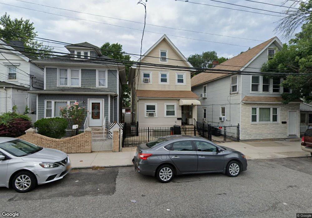
172 John St Staten Island, NY 10302
Port Richmond NeighborhoodEstimated Value: $523,000 - $611,192
4
Beds
3
Baths
1,600
Sq Ft
$350/Sq Ft
Est. Value
About This Home
This home is located at 172 John St, Staten Island, NY 10302 and is currently estimated at $560,548, approximately $350 per square foot. 172 John St is a home located in Richmond County with nearby schools including PS 21 Margaret Emery-Elm Park, I.S. 51 Edwin Markham, and Port Richmond High School.
Ownership History
Date
Name
Owned For
Owner Type
Purchase Details
Closed on
Feb 25, 2008
Sold by
Dotson David
Bought by
Dotson David and Barravecchia Michael
Current Estimated Value
Home Financials for this Owner
Home Financials are based on the most recent Mortgage that was taken out on this home.
Original Mortgage
$429,050
Outstanding Balance
$267,435
Interest Rate
5.75%
Mortgage Type
New Conventional
Estimated Equity
$293,113
Purchase Details
Closed on
Jun 6, 2003
Sold by
Davison Dorothy
Bought by
Dotson David
Home Financials for this Owner
Home Financials are based on the most recent Mortgage that was taken out on this home.
Original Mortgage
$165,000
Interest Rate
9.1%
Mortgage Type
Purchase Money Mortgage
Purchase Details
Closed on
Dec 2, 1999
Sold by
Payes Raul E
Bought by
Davison Dorothy
Home Financials for this Owner
Home Financials are based on the most recent Mortgage that was taken out on this home.
Original Mortgage
$128,937
Interest Rate
7.81%
Mortgage Type
FHA
Purchase Details
Closed on
Aug 8, 1997
Sold by
Rea Andrea and Rea Anna
Bought by
Payes Raul E
Create a Home Valuation Report for This Property
The Home Valuation Report is an in-depth analysis detailing your home's value as well as a comparison with similar homes in the area
Home Values in the Area
Average Home Value in this Area
Purchase History
| Date | Buyer | Sale Price | Title Company |
|---|---|---|---|
| Dotson David | -- | The Judicial Title Insurance | |
| Dotson David | -- | Lawyers Title Insurance Corp | |
| Davison Dorothy | $130,000 | Old Republic Natl Title Ins | |
| Payes Raul E | $116,000 | First American Title Ins Co |
Source: Public Records
Mortgage History
| Date | Status | Borrower | Loan Amount |
|---|---|---|---|
| Open | Dotson David | $429,050 | |
| Previous Owner | Dotson David | $165,000 | |
| Previous Owner | Davison Dorothy | $128,937 |
Source: Public Records
Tax History Compared to Growth
Tax History
| Year | Tax Paid | Tax Assessment Tax Assessment Total Assessment is a certain percentage of the fair market value that is determined by local assessors to be the total taxable value of land and additions on the property. | Land | Improvement |
|---|---|---|---|---|
| 2025 | $4,334 | $35,100 | $4,987 | $30,113 |
| 2024 | $4,346 | $29,100 | $5,970 | $23,130 |
| 2023 | $4,118 | $21,679 | $6,043 | $15,636 |
| 2022 | $3,796 | $25,860 | $7,560 | $18,300 |
| 2021 | $3,758 | $23,340 | $7,560 | $15,780 |
| 2020 | $3,788 | $23,640 | $7,560 | $16,080 |
| 2019 | $3,713 | $23,460 | $7,560 | $15,900 |
| 2018 | $3,385 | $18,066 | $6,394 | $11,672 |
| 2017 | $3,175 | $17,044 | $6,950 | $10,094 |
| 2016 | $2,905 | $16,080 | $7,560 | $8,520 |
| 2015 | $2,789 | $16,920 | $6,300 | $10,620 |
| 2014 | $2,789 | $16,123 | $6,003 | $10,120 |
Source: Public Records
Map
Nearby Homes
- 162 John St
- 145 Morningside Ave Unit 2C
- 98 Saint Josephs Ave
- 28 Morningstar Rd
- 211 Morningstar Rd
- 209 Nicholas Ave
- 54 Riverside Dr Unit 1AA
- 145 Clinton Place
- 231 Charles Ave
- 27 Wright Ave
- 38 Laforge Ave
- 306 Morningstar Rd
- 121 Harrison Ave
- 322 Morningstar Rd
- 28 Hooker Place
- 11 Laforge Ave
- 325 Pulaski Ave
- 327 Pulaski Ave
- 329 Pulaski Ave
- 331 Pulaski Ave