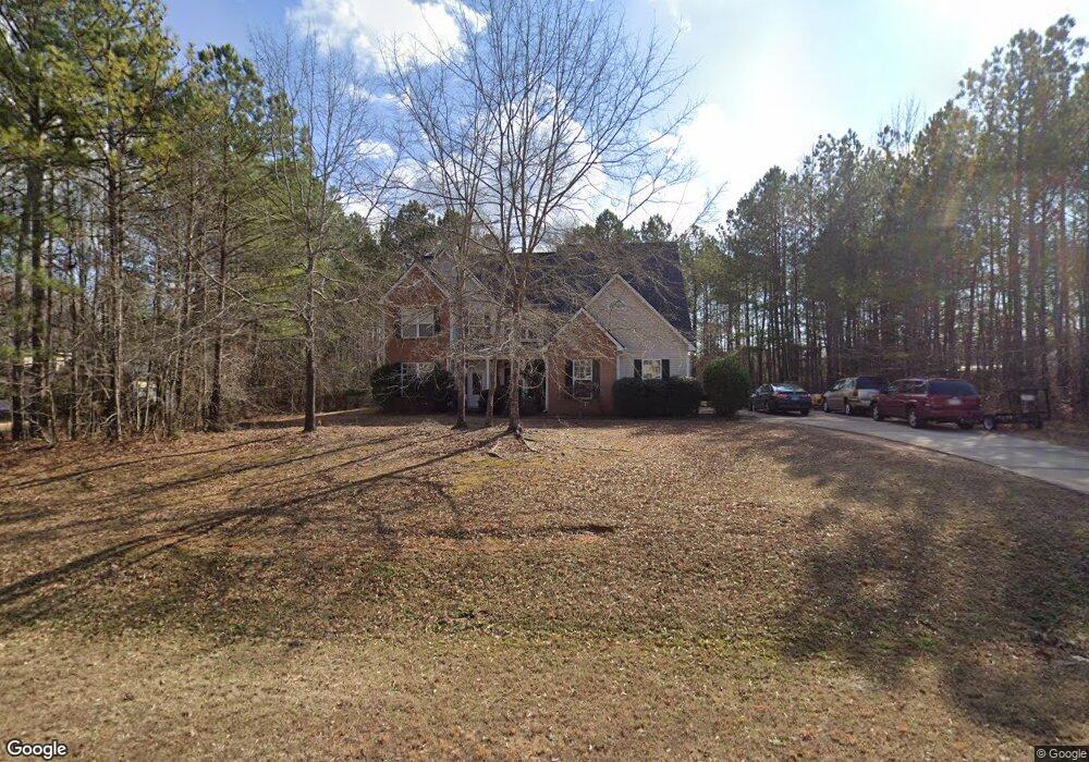
172 Liberty Trace Milner, GA 30257
Estimated Value: $370,402 - $399,000
4
Beds
3
Baths
2,880
Sq Ft
$133/Sq Ft
Est. Value
About This Home
This home is located at 172 Liberty Trace, Milner, GA 30257 and is currently estimated at $382,351, approximately $132 per square foot. 172 Liberty Trace is a home with nearby schools including Lamar County Primary School, Lamar County Elementary School, and Lamar County Middle School.
Ownership History
Date
Name
Owned For
Owner Type
Purchase Details
Closed on
Dec 30, 2010
Sold by
Citibank Na
Bought by
Carter Virginia
Current Estimated Value
Home Financials for this Owner
Home Financials are based on the most recent Mortgage that was taken out on this home.
Original Mortgage
$111,060
Outstanding Balance
$75,322
Interest Rate
4.48%
Mortgage Type
New Conventional
Estimated Equity
$307,029
Purchase Details
Closed on
Apr 6, 2010
Sold by
Barnes Michael D
Bought by
Citibank
Purchase Details
Closed on
May 19, 2006
Sold by
Heritage Homebuilders Inc
Bought by
Barnes Michael D
Purchase Details
Closed on
Oct 15, 2004
Sold by
Village Developers Llc
Bought by
Heritage Homebuilders Inc
Create a Home Valuation Report for This Property
The Home Valuation Report is an in-depth analysis detailing your home's value as well as a comparison with similar homes in the area
Purchase History
| Date | Buyer | Sale Price | Title Company |
|---|---|---|---|
| Carter Virginia | $123,400 | -- | |
| Citibank | -- | -- | |
| Barnes Michael D | $219,000 | -- | |
| Heritage Homebuilders Inc | $30,200 | -- |
Source: Public Records
Mortgage History
| Date | Status | Borrower | Loan Amount |
|---|---|---|---|
| Open | Carter Virginia | $111,060 |
Source: Public Records
Tax History
| Year | Tax Paid | Tax Assessment Tax Assessment Total Assessment is a certain percentage of the fair market value that is determined by local assessors to be the total taxable value of land and additions on the property. | Land | Improvement |
|---|---|---|---|---|
| 2025 | $3,668 | $151,242 | $8,000 | $143,242 |
| 2024 | $3,492 | $136,452 | $8,000 | $128,452 |
| 2023 | $3,683 | $133,430 | $8,000 | $125,430 |
| 2022 | $3,326 | $120,482 | $8,000 | $112,482 |
| 2021 | $2,856 | $94,984 | $8,000 | $86,984 |
| 2020 | $2,845 | $89,871 | $8,000 | $81,871 |
| 2019 | $1,954 | $61,564 | $4,000 | $57,564 |
| 2018 | $1,876 | $61,564 | $4,000 | $57,564 |
| 2017 | $1,866 | $61,564 | $4,000 | $57,564 |
| 2016 | $1,866 | $61,564 | $4,000 | $57,564 |
| 2015 | $1,864 | $61,564 | $4,000 | $57,564 |
| 2014 | $1,807 | $61,564 | $4,000 | $57,564 |
| 2013 | -- | $61,564 | $4,000 | $57,564 |
Source: Public Records
Map
Nearby Homes
- 1845 Georgia 36
- 158 Savannah Way
- 654 Liberty Hill Rd
- 269 Kennelsman Dr
- 261 Kennelsman Dr
- 234 Kennelsman Dr
- 226 Kennelsman Dr
- 248 Kennelsman Dr
- 111 Hatmaker Ct
- 171 Kennelsman Dr
- 174 Kennelsman Dr
- 128 Townsend Ct
- 268 Kennelsman Dr
- 103 Hounds Way
- 145 Hounds Way Unit LOT 94
- 238 Kennelsman Dr
- 245 Kennelsman Dr
- 242 Kennelsman Dr
- 2093 Highway 36 E
- 117 Bridle Path
- 178 Liberty Trace
- 168 Liberty Trace
- 171 Liberty Trace
- 179 Liberty Trace
- 185 Liberty Trac
- 188 Liberty Trace
- 153 Liberty Trace
- 192 Liberty Trace
- 199 Liberty Trace
- 147 Liberty Trace
- 209 Liberty Trace Unit 36
- 209 Liberty Trace
- 148 Liberty Trace
- 141 Liberty Trace
- 215 Liberty Trace
- 200 Liberty Trace
- 142 Liberty Trace
- 223 Liberty Trace
- 206 Liberty Trace Unit 20
- 206 Liberty Trace
Your Personal Tour Guide
Ask me questions while you tour the home.