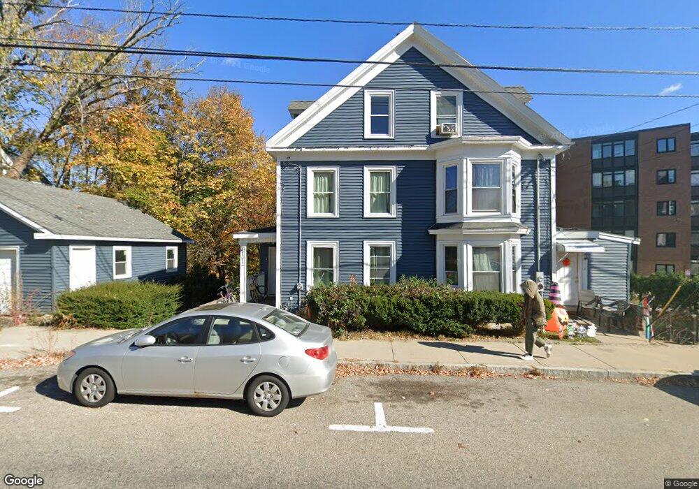
172 Main St Unit 1 Amesbury, MA 01913
Estimated Value: $650,000 - $742,000
4
Beds
2
Baths
1,600
Sq Ft
$435/Sq Ft
Est. Value
About This Home
This home is located at 172 Main St Unit 1, Amesbury, MA 01913 and is currently estimated at $696,439, approximately $435 per square foot. 172 Main St Unit 1 is a home located in Essex County with nearby schools including Amesbury High School and Amesbury Seventh-Day Adventist School.
Ownership History
Date
Name
Owned For
Owner Type
Purchase Details
Closed on
Nov 20, 2012
Sold by
Pereira Leonel and Pereira Luisa
Bought by
172-174 Main St Rt
Current Estimated Value
Purchase Details
Closed on
Sep 19, 2007
Sold by
Somers Esther S and Swartz Mark Lee
Bought by
Pereira Luisa F and Pereira Leonel R
Home Financials for this Owner
Home Financials are based on the most recent Mortgage that was taken out on this home.
Original Mortgage
$153,600
Interest Rate
6.63%
Mortgage Type
Purchase Money Mortgage
Create a Home Valuation Report for This Property
The Home Valuation Report is an in-depth analysis detailing your home's value as well as a comparison with similar homes in the area
Home Values in the Area
Average Home Value in this Area
Purchase History
| Date | Buyer | Sale Price | Title Company |
|---|---|---|---|
| 172-174 Main St Rt | -- | -- | |
| Pereira Luisa F | $192,000 | -- |
Source: Public Records
Mortgage History
| Date | Status | Borrower | Loan Amount |
|---|---|---|---|
| Previous Owner | Pereira Luisa F | $153,600 |
Source: Public Records
Tax History Compared to Growth
Tax History
| Year | Tax Paid | Tax Assessment Tax Assessment Total Assessment is a certain percentage of the fair market value that is determined by local assessors to be the total taxable value of land and additions on the property. | Land | Improvement |
|---|---|---|---|---|
| 2025 | $8,432 | $551,100 | $202,000 | $349,100 |
| 2024 | $8,328 | $532,500 | $190,600 | $341,900 |
| 2023 | $8,294 | $507,600 | $165,700 | $341,900 |
| 2022 | $7,386 | $417,500 | $144,100 | $273,400 |
| 2021 | $7,692 | $421,500 | $111,300 | $310,200 |
| 2020 | $6,891 | $401,100 | $107,000 | $294,100 |
| 2019 | $5,930 | $322,800 | $107,000 | $215,800 |
| 2018 | $5,501 | $289,700 | $102,000 | $187,700 |
| 2017 | $5,538 | $277,600 | $102,000 | $175,600 |
| 2016 | $5,427 | $267,600 | $102,000 | $165,600 |
| 2015 | $5,497 | $267,600 | $102,000 | $165,600 |
| 2014 | $5,612 | $267,600 | $102,000 | $165,600 |
Source: Public Records
Map
Nearby Homes
- 43 Aubin St Unit 43
- 93 Friend St
- 18 E Greenwood St
- 37 Millyard Unit 204
- 4 Greenwood St
- 13 High St Unit 2
- 4 Winter St
- 4 Clark St
- 5 Richs Ct Unit 3
- 97 Elm St
- 49 W Greenwood St
- 118 Elm St
- 161 Elm St Unit A
- 25 Cedar St Unit 4
- 25 Cedar St Unit 14
- 25 Cedar St Unit 7
- 25 Cedar St Unit 3
- 31 Whitter Meadows Dr Unit 31
- 48 Orchard St
- 3 Arlington St
- 172 Main St
- 168 Main St
- 169 Main St
- 6 Lincoln Ct Unit 6
- 2 Heritage Vale St Unit 2A Upper
- 167 Main St
- 5 Naysons Ct
- 177 Main St
- 177 Main St Unit 177 Main St Amesbury
- 177 Main St Unit A
- 1 Lincoln Ct
- 3 Lincoln Ct
- 3 Lincoln Ct Unit 3
- 165 Main St
- 8 Naysons Ct
- 163 Main St
- 5 Nayson's Ct
- 6 Naysons Ct
- 5 Lincoln Ct
- 5 Lincoln Ct Unit 5