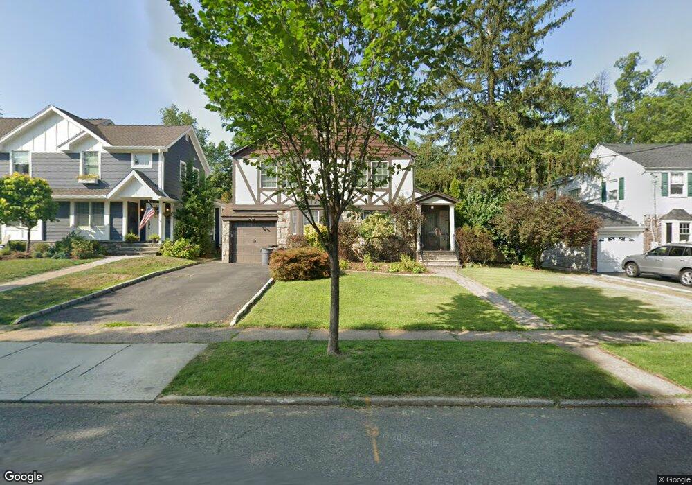
172 Manning Ave River Edge, NJ 07661
Estimated Value: $844,469 - $1,049,000
--
Bed
--
Bath
1,526
Sq Ft
$599/Sq Ft
Est. Value
About This Home
This home is located at 172 Manning Ave, River Edge, NJ 07661 and is currently estimated at $914,117, approximately $599 per square foot. 172 Manning Ave is a home located in Bergen County with nearby schools including Roosevelt Elementary School, River Dell Middle School, and River Dell Regional High School.
Ownership History
Date
Name
Owned For
Owner Type
Purchase Details
Closed on
May 8, 2006
Sold by
May David F
Bought by
Markman Mattew and Markman Darlene Joseph
Current Estimated Value
Purchase Details
Closed on
Jun 18, 2004
Sold by
Sabin Jonathan
Bought by
May David and May Tracy
Home Financials for this Owner
Home Financials are based on the most recent Mortgage that was taken out on this home.
Original Mortgage
$330,000
Interest Rate
6.25%
Purchase Details
Closed on
Apr 23, 1998
Sold by
Dipietro Mario and Dipietro Yvonne
Bought by
Sabin Jonathan and Sabin Lisa
Home Financials for this Owner
Home Financials are based on the most recent Mortgage that was taken out on this home.
Original Mortgage
$215,000
Interest Rate
7.04%
Create a Home Valuation Report for This Property
The Home Valuation Report is an in-depth analysis detailing your home's value as well as a comparison with similar homes in the area
Home Values in the Area
Average Home Value in this Area
Purchase History
| Date | Buyer | Sale Price | Title Company |
|---|---|---|---|
| Markman Mattew | $552,000 | -- | |
| May David | $430,000 | -- | |
| Sabin Jonathan | $255,000 | New Jersey Title Insurance C |
Source: Public Records
Mortgage History
| Date | Status | Borrower | Loan Amount |
|---|---|---|---|
| Previous Owner | May David | $330,000 | |
| Previous Owner | Sabin Jonathan | $215,000 |
Source: Public Records
Tax History Compared to Growth
Tax History
| Year | Tax Paid | Tax Assessment Tax Assessment Total Assessment is a certain percentage of the fair market value that is determined by local assessors to be the total taxable value of land and additions on the property. | Land | Improvement |
|---|---|---|---|---|
| 2025 | $14,353 | $674,200 | $345,000 | $329,200 |
| 2024 | $13,995 | $362,000 | $198,800 | $163,200 |
| 2023 | $13,394 | $362,000 | $198,800 | $163,200 |
| 2022 | $13,394 | $362,000 | $198,800 | $163,200 |
| 2021 | $13,130 | $362,000 | $198,800 | $163,200 |
| 2020 | $12,923 | $362,000 | $198,800 | $163,200 |
| 2019 | $12,554 | $362,000 | $198,800 | $163,200 |
| 2018 | $12,290 | $362,000 | $198,800 | $163,200 |
| 2017 | $12,170 | $362,000 | $198,800 | $163,200 |
| 2016 | $11,895 | $362,000 | $198,800 | $163,200 |
| 2015 | $11,646 | $362,000 | $198,800 | $163,200 |
| 2014 | $11,667 | $362,000 | $198,800 | $163,200 |
Source: Public Records
Map
Nearby Homes
- 168 Voorhis Ave
- 215 Kensington Rd
- 276 Greenway Terrace
- 378 Windsor Rd
- 421 Lafayette Ave
- 302 Howland Ave
- 712 6th Ave
- 12 Gainesborough Terrace Unit 1B
- 212 Lozier Terrace
- 293 Bogert Rd Unit 1A
- 1 Sipporta Ln
- 784 Millbrook Rd
- 761 6th Ave
- 189 Forest Ave Unit 409
- 189 Forest Ave Unit 303
- 766 7th Ave
- 42 Howland Ave
- 33 Lincoln Ave
- 150 Village Cir E
- 255 Bogert Rd Unit 2A
- 168 Manning Ave
- 176 Manning Ave
- 164 Manning Ave
- 180 Manning Ave
- 171 Concord Dr
- 175 Concord Dr
- 167 Concord Dr
- 179 Concord Dr
- 184 Manning Ave
- 163 Concord Dr
- 160 Manning Ave
- 171 Manning Ave
- 167 Manning Ave
- 175 Manning Ave
- 183 Concord Dr
- 163 Manning Ave
- 179 Manning Ave
- 159 Concord Dr
- 518 Elm Ave
- 528 Elm Ave