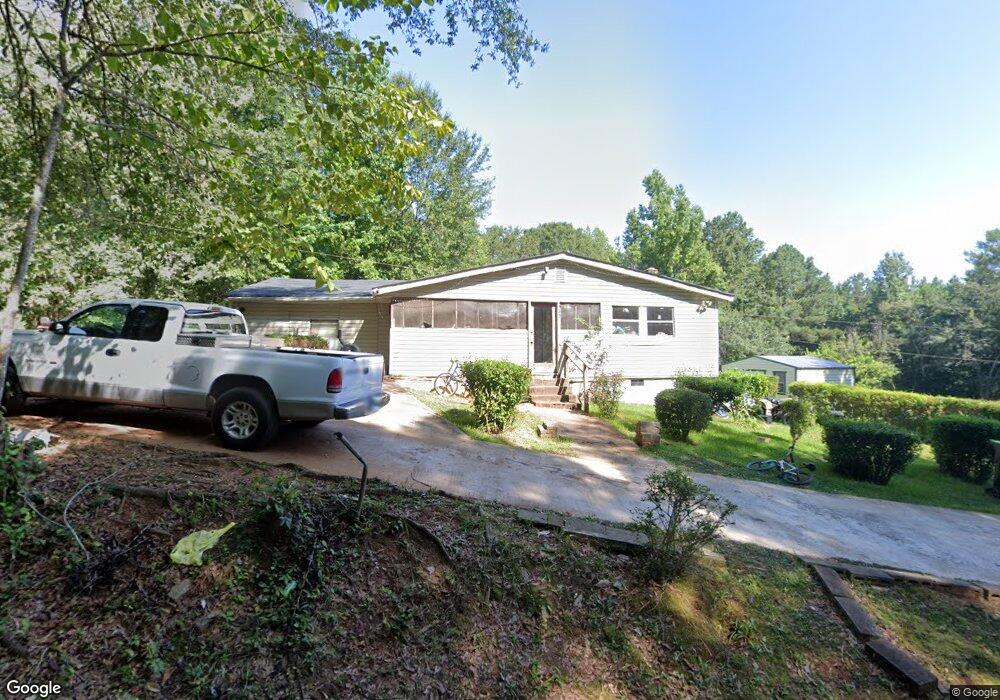
172 Perryman Rd Shiloh, GA 31826
Estimated Value: $78,242 - $312,000
2
Beds
1
Bath
933
Sq Ft
$181/Sq Ft
Est. Value
About This Home
This home is located at 172 Perryman Rd, Shiloh, GA 31826 and is currently estimated at $168,747, approximately $180 per square foot. 172 Perryman Rd is a home located in Talbot County with nearby schools including Central School.
Ownership History
Date
Name
Owned For
Owner Type
Purchase Details
Closed on
Sep 9, 2019
Sold by
Carter Brian
Bought by
Carter Brian and Ballard Julia
Current Estimated Value
Purchase Details
Closed on
Jun 3, 2019
Sold by
Carter John Henry
Bought by
Carter John Henry and Ballard Julia
Purchase Details
Closed on
Dec 23, 2005
Sold by
Ballard Julia
Bought by
Carter Edith
Purchase Details
Closed on
Aug 31, 1999
Sold by
Carter Edith and J T
Bought by
Carter John and Carter Bobby
Purchase Details
Closed on
Jun 29, 1999
Sold by
Carter Edith and J T
Bought by
Carter John
Purchase Details
Closed on
Jan 1, 1963
Bought by
Carter
Create a Home Valuation Report for This Property
The Home Valuation Report is an in-depth analysis detailing your home's value as well as a comparison with similar homes in the area
Home Values in the Area
Average Home Value in this Area
Purchase History
| Date | Buyer | Sale Price | Title Company |
|---|---|---|---|
| Carter Brian | -- | -- | |
| Ballard Julia | -- | -- | |
| Carter John Henry | -- | -- | |
| Carter Edith | -- | -- | |
| Carter John | -- | -- | |
| Carter John | -- | -- | |
| Carter | -- | -- |
Source: Public Records
Tax History Compared to Growth
Tax History
| Year | Tax Paid | Tax Assessment Tax Assessment Total Assessment is a certain percentage of the fair market value that is determined by local assessors to be the total taxable value of land and additions on the property. | Land | Improvement |
|---|---|---|---|---|
| 2024 | $842 | $16,353 | $3,029 | $13,324 |
| 2023 | $751 | $14,690 | $2,940 | $11,750 |
| 2022 | $472 | $15,328 | $2,940 | $12,388 |
| 2021 | $709 | $15,271 | $2,800 | $12,471 |
| 2020 | $637 | $14,258 | $2,800 | $11,458 |
| 2019 | $639 | $14,324 | $2,800 | $11,524 |
| 2018 | $431 | $14,324 | $2,800 | $11,524 |
| 2017 | $638 | $14,324 | $2,800 | $11,524 |
| 2016 | $540 | $11,007 | $2,800 | $8,207 |
| 2015 | -- | $11,210 | $4,743 | $6,467 |
| 2013 | -- | $15,771 | $4,972 | $10,798 |
Source: Public Records
Map
Nearby Homes
- 1755 Hunsinger Rd
- 1540 Flint Hill Hwy
- 324 ACRES Hunsinger Rd
- 2450 Chestnut Grove Rd Unit 2
- 2450 Chestnut Grove Rd
- 2819 Chestnut Grove Rd
- 232 Chestnut Grove Rd
- 5282 Scenic Heights Rd
- 7223 Scenic Heights
- 2385 Nebula Rd
- 624 Sunset Dr
- LOT 188 Pinecrest Dr
- 922 Linda Ln
- 621 Mayes Way
- 604 Farris Blvd
- 514 Farris Blvd
- 403 W Broxton Ln
- 522 4th St
- 3.26 ACRES Mountain Ridge Dr
- 408 Broad St
- 285 Perryman Rd
- 76 Perryman Rd
- 60 Perryman Rd
- 2370 Flint Hill Hwy
- 2340 Flint Hill Hwy
- 3224 Flint Hill Hwy
- 1915 Flint Hill Hwy
- 00 Old Shiloh Rd
- 1905 Flint Hill Hwy
- 3545 Flint Hill Hwy
- 1830 Flint Hill Hwy
- 0 Flint Hill Hwy (Ga 85) Unit 8028341
- 2230 Old Shiloh Rd
- 100 Saint Paul Loop
- 1741 Flint Hill Hwy
- 3514 Flint Hill Hwy
- 1661 Flint Hill Hwy
- 1615 Flint Hill Hwy
- 1976 Old Shiloh Rd
- 0 Saint Paul Loop