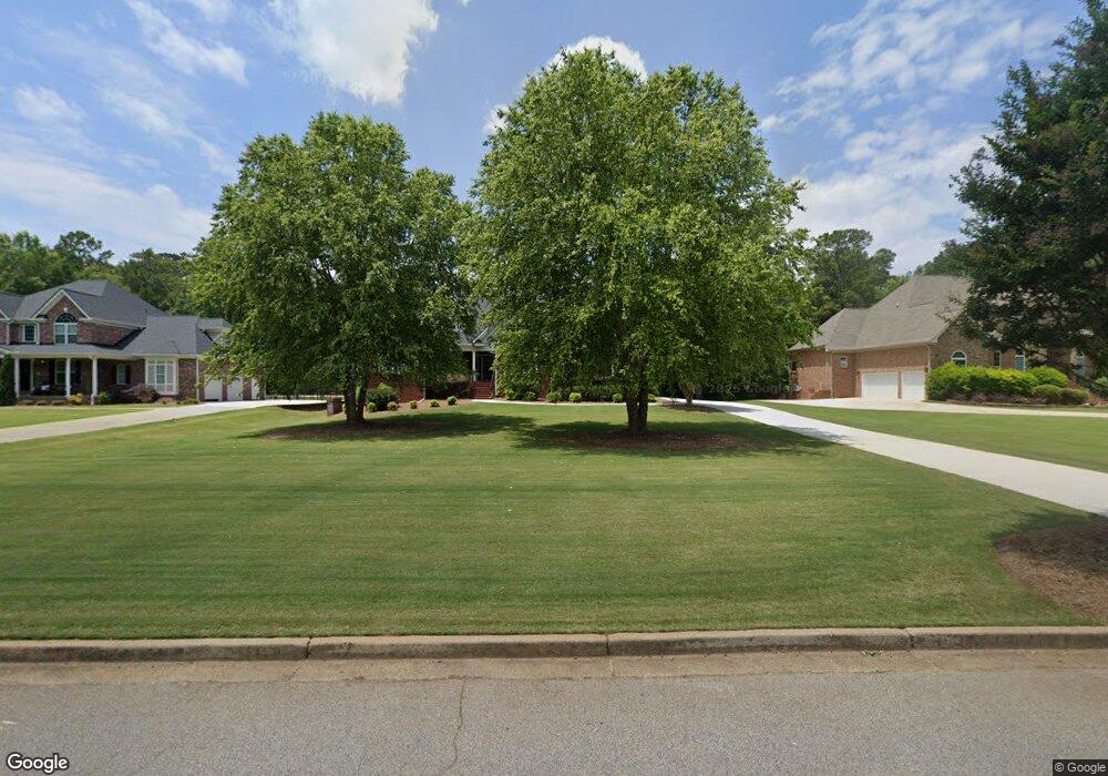
172 Saint Andrews Ct Social Circle, GA 30025
Estimated Value: $626,000 - $773,000
4
Beds
4
Baths
3,797
Sq Ft
$185/Sq Ft
Est. Value
About This Home
This home is located at 172 Saint Andrews Ct, Social Circle, GA 30025 and is currently estimated at $702,942, approximately $185 per square foot. 172 Saint Andrews Ct is a home located in Walton County with nearby schools including Social Circle Primary School, Social Circle Elementary School, and Social Circle Middle School.
Ownership History
Date
Name
Owned For
Owner Type
Purchase Details
Closed on
May 27, 2011
Sold by
Us Bankruptcy Court Nthrn Dist
Bought by
Henderson Ashley C and Henderson Christopher J
Current Estimated Value
Home Financials for this Owner
Home Financials are based on the most recent Mortgage that was taken out on this home.
Original Mortgage
$253,409
Outstanding Balance
$176,731
Interest Rate
4.88%
Mortgage Type
FHA
Estimated Equity
$526,211
Purchase Details
Closed on
Nov 7, 2006
Sold by
Horn Darrell V
Bought by
Hall John W
Purchase Details
Closed on
Sep 29, 2005
Sold by
Barrs Earl D
Bought by
Horn Darrell V
Home Financials for this Owner
Home Financials are based on the most recent Mortgage that was taken out on this home.
Original Mortgage
$275,000
Interest Rate
5.77%
Mortgage Type
Purchase Money Mortgage
Create a Home Valuation Report for This Property
The Home Valuation Report is an in-depth analysis detailing your home's value as well as a comparison with similar homes in the area
Home Values in the Area
Average Home Value in this Area
Purchase History
| Date | Buyer | Sale Price | Title Company |
|---|---|---|---|
| Henderson Ashley C | $260,000 | -- | |
| Hall John W | $333,185 | -- | |
| Horn Darrell V | $49,000 | -- |
Source: Public Records
Mortgage History
| Date | Status | Borrower | Loan Amount |
|---|---|---|---|
| Open | Henderson Ashley C | $253,409 | |
| Previous Owner | Horn Darrell V | $275,000 |
Source: Public Records
Tax History Compared to Growth
Tax History
| Year | Tax Paid | Tax Assessment Tax Assessment Total Assessment is a certain percentage of the fair market value that is determined by local assessors to be the total taxable value of land and additions on the property. | Land | Improvement |
|---|---|---|---|---|
| 2024 | $7,890 | $259,880 | $39,200 | $220,680 |
| 2023 | $7,841 | $252,040 | $35,200 | $216,840 |
| 2022 | $1,352 | $215,800 | $28,000 | $187,800 |
| 2021 | $1,352 | $183,720 | $20,000 | $163,720 |
| 2020 | $1,386 | $178,000 | $20,000 | $158,000 |
| 2019 | $1,416 | $159,080 | $20,000 | $139,080 |
| 2018 | $1,416 | $159,080 | $20,000 | $139,080 |
| 2017 | $6,173 | $147,720 | $20,000 | $127,720 |
| 2016 | $1,470 | $138,640 | $20,000 | $118,640 |
| 2015 | $1,312 | $120,680 | $16,000 | $104,680 |
| 2014 | -- | $113,640 | $16,000 | $97,640 |
Source: Public Records
Map
Nearby Homes
- 100 Saint Andrews Ct
- 318 Richmond Dr
- 226 Rogue Rd
- 246 Azalea Farms Rd
- 433 Clover Dr
- 380 Hickory St SW
- 357 W Hightower Trail
- 443 Windsong Ln
- 1077 Riverstone Dr
- 582 S Cherokee Rd
- (GA)The Ava | Front Entry Plan at Weslyn Park
- (GA)The Everett | Front Entry Plan at Weslyn Park
- (GA) The Brooks | Front Entry Plan at Weslyn Park
- (GA)The Hunter | Front Entry Plan at Weslyn Park
- (GA)The Carson | Front Entry Plan at Weslyn Park
- (GA)The Jackson | Front Entry Plan at Weslyn Park
- (GA)The Ellen | Front Entry Plan at Weslyn Park
- (GA)The Jefferson | Front Entry Plan at Weslyn Park
- (GA)The Hayden | Front Entry Plan at Weslyn Park
- 1244 Morrow Dr
- 184 St Andrews Ct
- 160 Saint Andrews Ct
- 184 Saint Andrews Ct
- 150 Saint Andrews Ct
- 196 Saint Andrews Ct
- 196 Saint Andrews Ct
- 0 Saint Andrews Ct Unit LOT 2 10039391
- 0 Saint Andrews Ct
- 196 St Andrews Ct
- 136 Saint Andrews Ct
- 356 Carnation Dr
- 208 Saint Andrews Ct
- 346 Carnation Dr Unit 1
- 173 Saint Andrews Ct
- 185 Saint Andrews Ct
- 161 Saint Andrews Ct
- 376 Carnation Dr
- 124 Saint Andrews Ct
- 197 Saint Andrews Ct
- 149 Saint Andrews Ct