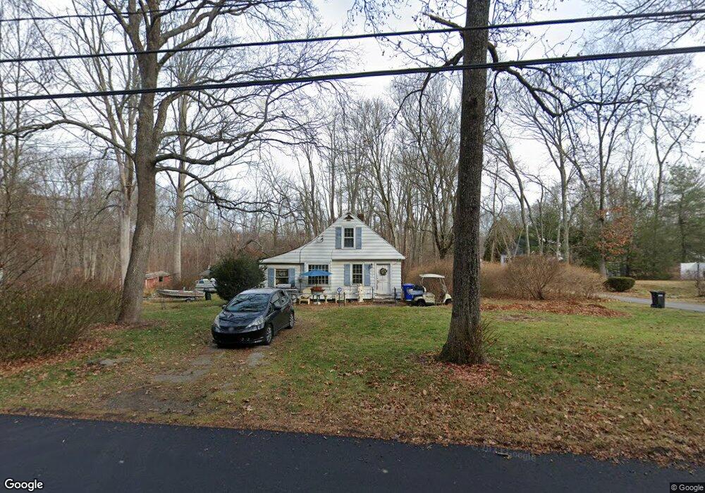
172 Seagraves Rd Coventry, CT 06238
Estimated Value: $305,257 - $335,000
3
Beds
1
Bath
1,147
Sq Ft
$279/Sq Ft
Est. Value
About This Home
This home is located at 172 Seagraves Rd, Coventry, CT 06238 and is currently estimated at $320,564, approximately $279 per square foot. 172 Seagraves Rd is a home located in Tolland County with nearby schools including George Hersey Robertson School, Coventry Grammar School, and Capt. Nathan Hale School.
Ownership History
Date
Name
Owned For
Owner Type
Purchase Details
Closed on
Mar 11, 2003
Sold by
Davis William and Davis Christine
Bought by
Holton Charles
Current Estimated Value
Home Financials for this Owner
Home Financials are based on the most recent Mortgage that was taken out on this home.
Original Mortgage
$149,250
Interest Rate
5.95%
Purchase Details
Closed on
Apr 30, 1998
Sold by
Murray Eve Est
Bought by
Davis William and Davis Christine
Create a Home Valuation Report for This Property
The Home Valuation Report is an in-depth analysis detailing your home's value as well as a comparison with similar homes in the area
Home Values in the Area
Average Home Value in this Area
Purchase History
| Date | Buyer | Sale Price | Title Company |
|---|---|---|---|
| Holton Charles | $152,000 | -- | |
| Davis William | $104,000 | -- | |
| Holton Charles | $152,000 | -- | |
| Davis William | $104,000 | -- |
Source: Public Records
Mortgage History
| Date | Status | Borrower | Loan Amount |
|---|---|---|---|
| Open | Davis William | $3,780 | |
| Open | Davis William | $151,443 | |
| Closed | Davis William | $149,250 |
Source: Public Records
Tax History
| Year | Tax Paid | Tax Assessment Tax Assessment Total Assessment is a certain percentage of the fair market value that is determined by local assessors to be the total taxable value of land and additions on the property. | Land | Improvement |
|---|---|---|---|---|
| 2025 | $4,082 | $171,800 | $48,500 | $123,300 |
| 2024 | $3,148 | $94,500 | $42,100 | $52,400 |
| 2023 | $2,999 | $94,500 | $42,100 | $52,400 |
| 2022 | $2,944 | $94,500 | $42,100 | $52,400 |
| 2021 | $2,944 | $94,500 | $42,100 | $52,400 |
| 2020 | $2,946 | $94,500 | $42,100 | $52,400 |
| 2019 | $3,043 | $94,500 | $42,100 | $52,400 |
| 2018 | $3,301 | $102,500 | $42,100 | $60,400 |
| 2017 | $3,280 | $102,500 | $42,100 | $60,400 |
| 2016 | $3,198 | $102,500 | $42,100 | $60,400 |
| 2015 | $3,198 | $102,500 | $42,100 | $60,400 |
| 2014 | $3,362 | $118,100 | $52,200 | $65,900 |
Source: Public Records
Map
Nearby Homes
- 27 Fox Trail
- 0 Hinkel Mae Dr
- 17 Ireland Dr
- 0 Daly Rd Unit 24146464
- 2478 Main St
- 152 Cheney Ln
- 0 Skinner Hill Rd Unit 24077239
- 198 Forest Rd
- 0 Woodland Rd
- 864 Boston Turnpike
- 0 Wheeling Rd Unit 24116879
- 498 Root Rd
- 550 High St
- 25 Wolf Hill Rd
- 55 Whites Hill Rd
- 37 Wolf Hill Lot (#40) Rd
- 37 Wolf Hill Rd Unit Lot 40
- 8 Times Farm Rd
- 499 Woodmont Dr
- 395 Grant Hill (Mill Race Drive) Lot #21 Rd
- 152 Seagraves Rd
- 77 Mohegan Trail
- 142 Seagraves Rd
- 49 Mohegan Trail
- 75 Tunxis Trail
- 67 Tunxis Trail
- 53 Tunxis Trail
- 110 Seagraves Rd
- 24 Mohegan Trail
- 94 Seagraves Rd
- 524 Daly Rd
- 556 Daly Rd
- 560 Daly Rd
- 516 Daly Rd
- 20 Mohawk Trail
- 0 Tunxis Trail Unit G10074824
- 86 Seagraves Rd
- 549 Daly Rd
- 618 Daly Rd
- 573 Daly Rd
Your Personal Tour Guide
Ask me questions while you tour the home.