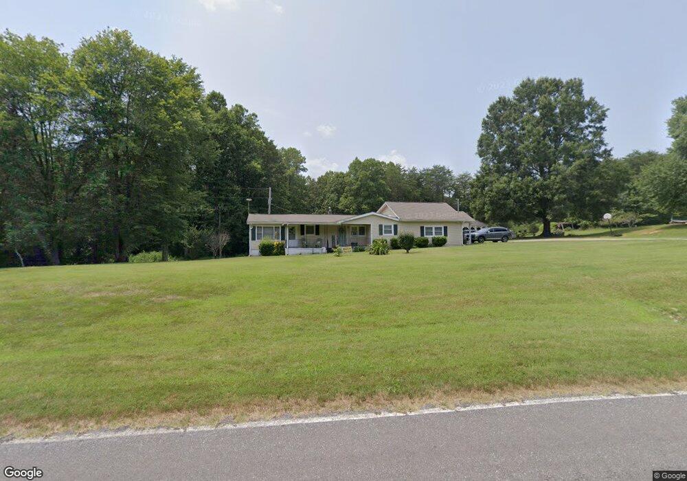
172 Sharp Rd Madison, NC 27025
Estimated Value: $196,000 - $273,000
3
Beds
1
Bath
1,684
Sq Ft
$136/Sq Ft
Est. Value
About This Home
This home is located at 172 Sharp Rd, Madison, NC 27025 and is currently estimated at $228,887, approximately $135 per square foot. 172 Sharp Rd is a home located in Rockingham County with nearby schools including Huntsville Elementary School, John W. Dillard Academy, and Western Rockingham Middle School.
Ownership History
Date
Name
Owned For
Owner Type
Purchase Details
Closed on
Nov 21, 2023
Sold by
Lowe Joy Creecy and Lowe Nicole Anne
Bought by
Lowe Stevie Morris
Current Estimated Value
Purchase Details
Closed on
Nov 7, 2023
Sold by
Fitzgerald Lowe Keith and Gonzalez Amparo
Bought by
Lowe Stevie Morris
Purchase Details
Closed on
Oct 18, 2023
Sold by
Brooks Sara Lowe and Brooks Earl Anthony
Bought by
Lowe Stevie Morris
Purchase Details
Closed on
Sep 25, 2023
Sold by
Lowe Charles Timothy
Bought by
Lowe Stevie Morris
Create a Home Valuation Report for This Property
The Home Valuation Report is an in-depth analysis detailing your home's value as well as a comparison with similar homes in the area
Purchase History
| Date | Buyer | Sale Price | Title Company |
|---|---|---|---|
| Lowe Stevie Morris | -- | None Listed On Document | |
| Lowe Stevie Morris | -- | None Listed On Document | |
| Lowe Stevie Morris | -- | None Listed On Document | |
| Lowe Stevie Morris | -- | None Listed On Document |
Source: Public Records
Tax History
| Year | Tax Paid | Tax Assessment Tax Assessment Total Assessment is a certain percentage of the fair market value that is determined by local assessors to be the total taxable value of land and additions on the property. | Land | Improvement |
|---|---|---|---|---|
| 2025 | $1,121 | $161,216 | $38,931 | $122,285 |
| 2024 | $1,072 | $161,216 | $38,931 | $122,285 |
| 2023 | $1,072 | $88,484 | $24,774 | $63,710 |
| 2022 | $699 | $88,484 | $24,774 | $63,710 |
| 2021 | $699 | $88,484 | $24,774 | $63,710 |
| 2020 | $699 | $88,484 | $24,774 | $63,710 |
| 2019 | $699 | $88,484 | $24,774 | $63,710 |
| 2018 | $397 | $88,364 | $31,235 | $57,129 |
| 2017 | $397 | $88,364 | $31,235 | $57,129 |
| 2015 | $401 | $88,364 | $31,235 | $57,129 |
| 2014 | $397 | $88,364 | $31,235 | $57,129 |
Source: Public Records
Map
Nearby Homes
- 624 Lowe Rd
- 1710 Bald Hill Loop
- 221 Fisher Rd
- 270 Morning Glory Rd
- 228 Sitting Rock Dr
- 219 Sitting Rock Dr
- 154 Sitting Rock Dr
- 183 Providence Trail
- 184 Providence Trail
- 448 Gold Hill Rd
- 254 Landreth Rd
- 4163 Nc Highway 704
- 1295, 1297 & 1350 Angell Rd
- 00 Mccollum Rd
- 00 Route 220 Hwy
- 834 Neal Rd
- 105 Levington Way
- 173 Carlton Rd
- 110 Levington Way
- 0 Griffin Rd