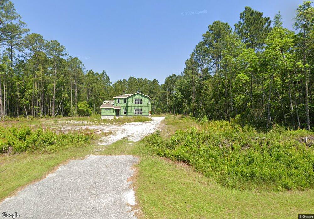
172 Village Dr Woodbine, GA 31569
Estimated Value: $264,000 - $363,000
3
Beds
2
Baths
2,227
Sq Ft
$145/Sq Ft
Est. Value
About This Home
This home is located at 172 Village Dr, Woodbine, GA 31569 and is currently estimated at $323,996, approximately $145 per square foot. 172 Village Dr is a home with nearby schools including Mamie Lou Gross Elementary School, Saint Marys Middle School, and Camden County High School.
Ownership History
Date
Name
Owned For
Owner Type
Purchase Details
Closed on
Mar 23, 2015
Sold by
The Heritage Bank
Bought by
Nelson Louis K and Nelson Tiffany Ashli Stephen
Current Estimated Value
Purchase Details
Closed on
Apr 6, 2010
Sold by
Patel Manisha K
Bought by
The Heritage Bank
Purchase Details
Closed on
Feb 20, 2008
Sold by
Patel Vipin C
Bought by
Patel Manisha K
Purchase Details
Closed on
Jun 13, 2006
Sold by
Not Provided
Bought by
Bank The Heritage Bank
Purchase Details
Closed on
Jun 9, 2006
Sold by
Not Provided
Bought by
Bank The Heritage Bank
Create a Home Valuation Report for This Property
The Home Valuation Report is an in-depth analysis detailing your home's value as well as a comparison with similar homes in the area
Home Values in the Area
Average Home Value in this Area
Purchase History
| Date | Buyer | Sale Price | Title Company |
|---|---|---|---|
| Nelson Louis K | $13,500 | -- | |
| The Heritage Bank | -- | -- | |
| Patel Manisha K | -- | -- | |
| Bank The Heritage Bank | -- | -- | |
| Bank The Heritage Bank | -- | -- |
Source: Public Records
Tax History Compared to Growth
Tax History
| Year | Tax Paid | Tax Assessment Tax Assessment Total Assessment is a certain percentage of the fair market value that is determined by local assessors to be the total taxable value of land and additions on the property. | Land | Improvement |
|---|---|---|---|---|
| 2025 | $1,731 | $60,195 | $25,536 | $34,659 |
| 2024 | $1,808 | $60,195 | $25,536 | $34,659 |
| 2023 | $284 | $9,600 | $9,600 | $0 |
| 2022 | $293 | $9,600 | $9,600 | $0 |
| 2021 | $310 | $9,600 | $9,600 | $0 |
| 2020 | $230 | $6,936 | $6,936 | $0 |
| 2019 | $232 | $6,936 | $6,936 | $0 |
| 2018 | $209 | $6,936 | $6,936 | $0 |
| 2017 | $212 | $6,936 | $6,936 | $0 |
| 2016 | $165 | $6,936 | $6,936 | $0 |
| 2015 | $206 | $6,935 | $6,936 | $0 |
| 2014 | $174 | $5,895 | $5,895 | $0 |
Source: Public Records
Map
Nearby Homes
- VL/45 PINE DRIV Pine Dr
- 273 Village Dr
- 220 Deerwood Village Dr
- 381 Serenity Farms Rd
- 321 Mallard Pointe Dr
- 295 Mallard Pointe Dr
- 46 Pintail Ln
- 0 Sheffield Island Rd Unit 2
- 0 Sheffield Island Rd Unit 1657713
- 0 Sheffield Island Rd Unit 5 10597696
- 0 Sheffield Island Rd Unit 1657408
- 0 Sheffield Island Rd Unit 7
- 0 Sheffield Island Rd Unit 3
- 0 Sheffield Island Rd Unit 6 10613099
- 0 Sheffield Island Rd Unit 1656491
- 0 Sheffield Island Rd Unit 1656907
- 0 Sheffield Island Rd Unit 4 10593732
- 0 Sheffield Island Rd Unit 1657085
- 0 Sheffield Island Rd Unit 1656363
- 183 Rainbow Ln
- Lot 21 Village Dr
- 141 Village Dr
- 116 Village Dr
- 274 Village Dr
- 274 Village Dr
- 121 Pine Crossing St
- 121 Pine Crossing St
- 76 Village Dr
- 140 Pine Crossing St
- 140 Pine Crossing St
- 155 Pine Crossing
- 300 Village Dr
- 300 Village Dr
- 256 Pine Dr
- 326 Pine Dr
- 328 Pine Crossing St
- 316 Village Dr
- 43 Village Dr
- 38 Village Dr
- 4624 Harrietts Bluff Rd