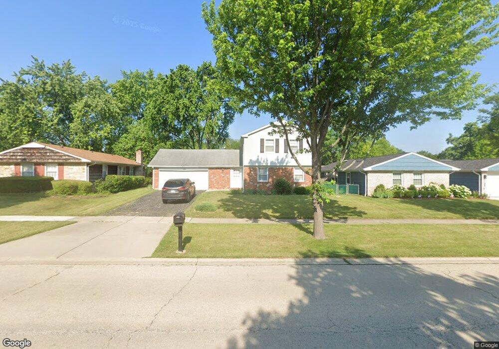
172 Weidner Rd Buffalo Grove, IL 60089
South Buffalo Grove NeighborhoodEstimated Value: $452,000 - $516,000
4
Beds
3
Baths
2,086
Sq Ft
$232/Sq Ft
Est. Value
About This Home
This home is located at 172 Weidner Rd, Buffalo Grove, IL 60089 and is currently estimated at $484,935, approximately $232 per square foot. 172 Weidner Rd is a home located in Cook County with nearby schools including Henry W Longfellow Elementary School, Cooper Middle School, and Buffalo Grove High School.
Ownership History
Date
Name
Owned For
Owner Type
Purchase Details
Closed on
Feb 17, 2001
Sold by
Madalinski Michael B
Bought by
Madalinski Michael B and The Michael B Madalinski Trust
Current Estimated Value
Purchase Details
Closed on
Oct 14, 1999
Sold by
Augustyn Edward and Augustyn Karen A
Bought by
Madalinski Michael B and Madalinski Carol A
Home Financials for this Owner
Home Financials are based on the most recent Mortgage that was taken out on this home.
Original Mortgage
$176,000
Interest Rate
7.81%
Purchase Details
Closed on
Sep 15, 1993
Sold by
Magnuson Robert Clifford and Magnuson Cynthia
Bought by
Augustyn Edward and Augustyn Karen A
Home Financials for this Owner
Home Financials are based on the most recent Mortgage that was taken out on this home.
Original Mortgage
$150,000
Interest Rate
7.24%
Create a Home Valuation Report for This Property
The Home Valuation Report is an in-depth analysis detailing your home's value as well as a comparison with similar homes in the area
Home Values in the Area
Average Home Value in this Area
Purchase History
| Date | Buyer | Sale Price | Title Company |
|---|---|---|---|
| Madalinski Michael B | -- | -- | |
| Madalinski Michael B | $231,000 | -- | |
| Augustyn Edward | $128,666 | -- |
Source: Public Records
Mortgage History
| Date | Status | Borrower | Loan Amount |
|---|---|---|---|
| Previous Owner | Madalinski Michael B | $176,000 | |
| Previous Owner | Augustyn Edward | $150,000 |
Source: Public Records
Tax History
| Year | Tax Paid | Tax Assessment Tax Assessment Total Assessment is a certain percentage of the fair market value that is determined by local assessors to be the total taxable value of land and additions on the property. | Land | Improvement |
|---|---|---|---|---|
| 2025 | $10,244 | $43,001 | $8,306 | $34,695 |
| 2024 | $10,244 | $35,322 | $7,119 | $28,203 |
| 2023 | $9,823 | $35,322 | $7,119 | $28,203 |
| 2022 | $9,823 | $35,322 | $7,119 | $28,203 |
| 2021 | $8,921 | $28,581 | $4,548 | $24,033 |
| 2020 | $8,760 | $28,581 | $4,548 | $24,033 |
| 2019 | $8,749 | $31,687 | $4,548 | $27,139 |
| 2018 | $9,650 | $31,455 | $3,955 | $27,500 |
| 2017 | $9,492 | $31,455 | $3,955 | $27,500 |
| 2016 | $9,095 | $31,455 | $3,955 | $27,500 |
| 2015 | $8,243 | $26,888 | $3,361 | $23,527 |
| 2014 | $8,125 | $26,888 | $3,361 | $23,527 |
| 2013 | $7,492 | $26,888 | $3,361 | $23,527 |
Source: Public Records
Map
Nearby Homes
- 170 Cherrywood Rd
- 267 Timber Hill Rd
- 271 Terrace Place
- 462 Longwood Dr
- 517 Longwood Dr
- 252 Appletree Ct
- 225 Thornapple Ct Unit 225
- 1096 Beechwood Rd
- 632 Weidner Rd
- 876 Stradford Cir Unit A1
- 91 Manchester Dr
- 334 Stillwell Dr
- 140 Manchester Dr Unit 408
- 800 Weidner Rd Unit 208
- 4210 N Walnut Ave
- 170 Manchester Dr Unit 306
- 760 Weidner Rd Unit 107
- 820 Weidner Rd Unit 4013
- 820 Weidner Rd Unit 409
- 222 Saint Marys Pkwy
- 184 Weidner Rd
- 160 Weidner Rd
- 171 Timber Hill Rd
- 159 Timber Hill Rd
- 194 Weidner Rd
- 181 Timber Hill Rd
- 167 Weidner Rd
- 179 Weidner Rd
- 193 Timber Hill Rd
- 206 Weidner Rd
- 155 Weidner Rd
- 191 Weidner Rd
- 136 Weidner Rd
- 135 Timber Hill Rd
- 203 Weidner Rd
- 141 Weidner Rd
- 203 Timber Hill Rd
- 174 Timber Hill Rd
- 160 Timber Hill Rd
Your Personal Tour Guide
Ask me questions while you tour the home.