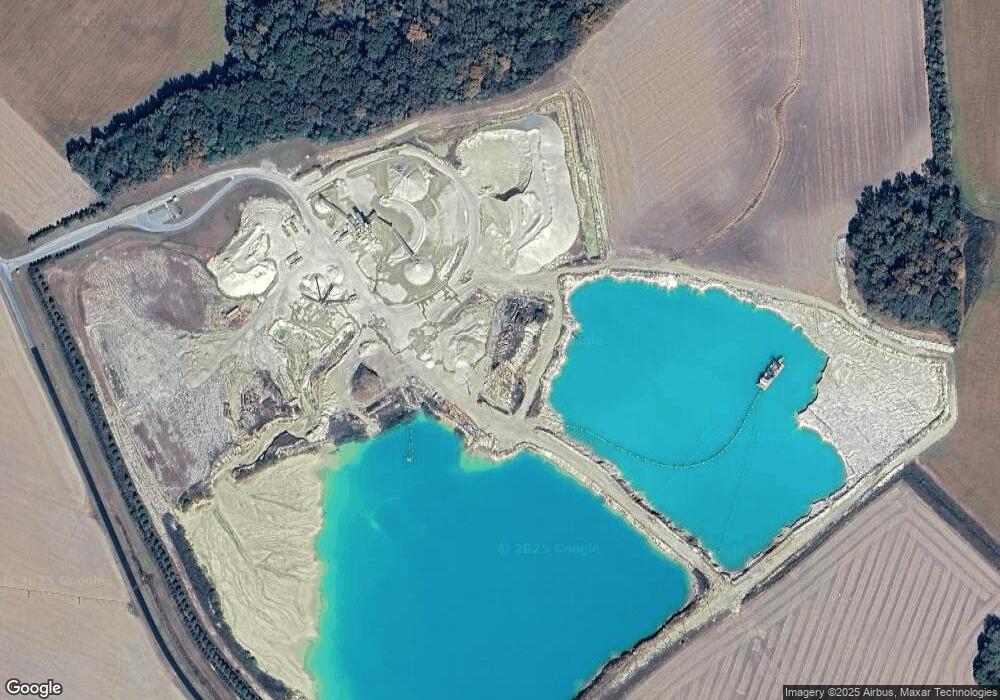
1720 Bridgetown Rd Henderson, MD 21640
Estimated Value: $1,068,655
--
Bed
--
Bath
--
Sq Ft
122.85
Acres
About This Home
This home is located at 1720 Bridgetown Rd, Henderson, MD 21640 and is currently estimated at $1,068,655. 1720 Bridgetown Rd is a home located in Queen Anne's County with nearby schools including Sudlersville Elementary School, Sudlersville Middle School, and Queen Anne's County High School.
Ownership History
Date
Name
Owned For
Owner Type
Purchase Details
Closed on
May 26, 2006
Sold by
Bridgetown Development
Bought by
Thompson Everett Barbara Thompson and Thompson John A
Current Estimated Value
Purchase Details
Closed on
Apr 12, 2006
Sold by
Thompson Pauline W
Bought by
Bridgetown Development Company
Purchase Details
Closed on
Feb 15, 2006
Sold by
Thompson Pauline W
Bought by
Bridgetown Development Company
Create a Home Valuation Report for This Property
The Home Valuation Report is an in-depth analysis detailing your home's value as well as a comparison with similar homes in the area
Home Values in the Area
Average Home Value in this Area
Purchase History
| Date | Buyer | Sale Price | Title Company |
|---|---|---|---|
| Thompson Everett Barbara Thompson | -- | -- | |
| Bridgetown Development Company | $740,000 | -- | |
| Bridgetown Development | $740,000 | -- | |
| Bridgetown Development Company | $740,000 | -- | |
| Bridgetown Development | $740,000 | -- |
Source: Public Records
Tax History Compared to Growth
Tax History
| Year | Tax Paid | Tax Assessment Tax Assessment Total Assessment is a certain percentage of the fair market value that is determined by local assessors to be the total taxable value of land and additions on the property. | Land | Improvement |
|---|---|---|---|---|
| 2025 | $10,833 | $1,126,000 | $1,098,600 | $27,400 |
| 2024 | $10,819 | $1,124,500 | $0 | $0 |
| 2023 | $10,579 | $1,123,000 | $0 | $0 |
| 2022 | $5,987 | $613,600 | $590,700 | $22,900 |
| 2021 | $0 | $612,000 | $0 | $0 |
| 2020 | $6,061 | $610,400 | $0 | $0 |
| 2019 | $6,046 | $608,800 | $590,700 | $18,100 |
| 2018 | $4,232 | $441,200 | $0 | $0 |
| 2017 | $2,624 | $273,600 | $0 | $0 |
| 2016 | -- | $88,200 | $0 | $0 |
| 2015 | $1,280 | $88,200 | $0 | $0 |
| 2014 | $1,280 | $88,200 | $0 | $0 |
Source: Public Records
Map
Nearby Homes
- 231 Ingleside Rd
- 0 Trunk Line Rd Unit MDCM2005918
- 104 Gadd Dr
- 0 5 281 Acres Schulyer Rd
- 112 Echo Ln
- 217 Austin Ct
- 1420 Barclay Rd
- 0 Goldsboro Rd
- 129 Thicket Ct
- 107 Thicket Ct
- 219 Songbird Ln
- 111 Dell Foxx Rd
- 408 Laurens Way
- 272 Granny Branch Rd
- 26355 Marydel Rd
- 252 Granny Branch Rd
- 15551 Wharton Rd
- 26623 Bee Tree Rd
- 17635 Cool Spring Rd
- PARCEL 91 Cool Spring Rd
- 1510 Bridgetown Rd
- 106 Carter Rd
- 1437 Bridgetown Rd
- 1440 Bridgetown Rd
- 920 Roe Ingleside Rd
- 1420 Roe Ingleside Rd
- 105 Carter Rd
- 914 Roe Ingleside Rd
- 251 Ell Downes Rd
- 836 Murphy Rd
- 109 Carter Rd
- 113 Carter Rd
- 832 Murphy Rd
- 1426 Bridgetown Rd
- 1504 Roe Ingleside Rd
- 1465 Roe Ingleside Rd
- 913 Roe Ingleside Rd
- 1219 Roe Ingleside Rd
- 1505 Roe Ingleside Rd
- 1420 Bridgetown Rd
