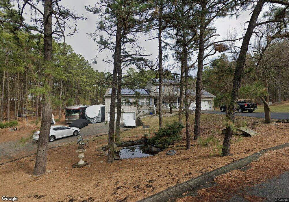
1720 Brooklyn Ave Whiting, NJ 08759
Manchester Township NeighborhoodEstimated Value: $574,722 - $673,000
4
Beds
4
Baths
3,554
Sq Ft
$177/Sq Ft
Est. Value
About This Home
This home is located at 1720 Brooklyn Ave, Whiting, NJ 08759 and is currently estimated at $629,181, approximately $177 per square foot. 1720 Brooklyn Ave is a home located in Ocean County with nearby schools including Manchester Township High School.
Ownership History
Date
Name
Owned For
Owner Type
Purchase Details
Closed on
Jul 15, 2002
Sold by
Barbarotta John
Bought by
Moss Scott and Moss Barbara
Current Estimated Value
Home Financials for this Owner
Home Financials are based on the most recent Mortgage that was taken out on this home.
Original Mortgage
$175,000
Outstanding Balance
$74,291
Interest Rate
6.73%
Estimated Equity
$554,890
Purchase Details
Closed on
Nov 18, 1999
Sold by
Aaron Developers Inc
Bought by
Barbarotta John C and Barbarotta Kathleen C
Home Financials for this Owner
Home Financials are based on the most recent Mortgage that was taken out on this home.
Original Mortgage
$125,920
Interest Rate
7.9%
Purchase Details
Closed on
Nov 16, 1999
Sold by
Krupnick Richard
Bought by
Aaron Developers Inc
Home Financials for this Owner
Home Financials are based on the most recent Mortgage that was taken out on this home.
Original Mortgage
$125,920
Interest Rate
7.9%
Purchase Details
Closed on
Oct 13, 1997
Sold by
Carter Joseph A and Carter Christine
Bought by
Krupnick Richard
Create a Home Valuation Report for This Property
The Home Valuation Report is an in-depth analysis detailing your home's value as well as a comparison with similar homes in the area
Home Values in the Area
Average Home Value in this Area
Purchase History
| Date | Buyer | Sale Price | Title Company |
|---|---|---|---|
| Moss Scott | $255,000 | -- | |
| Barbarotta John C | $135,920 | -- | |
| Aaron Developers Inc | -- | -- | |
| Krupnick Richard | $17,500 | -- |
Source: Public Records
Mortgage History
| Date | Status | Borrower | Loan Amount |
|---|---|---|---|
| Open | Moss Scott | $175,000 | |
| Previous Owner | Barbarotta John C | $125,920 |
Source: Public Records
Tax History Compared to Growth
Tax History
| Year | Tax Paid | Tax Assessment Tax Assessment Total Assessment is a certain percentage of the fair market value that is determined by local assessors to be the total taxable value of land and additions on the property. | Land | Improvement |
|---|---|---|---|---|
| 2025 | $9,341 | $641,900 | $195,000 | $446,900 |
| 2024 | $8,866 | $380,500 | $85,000 | $295,500 |
| 2023 | $8,428 | $380,500 | $85,000 | $295,500 |
| 2022 | $8,428 | $380,500 | $85,000 | $295,500 |
| 2021 | $8,245 | $380,500 | $85,000 | $295,500 |
| 2020 | $8,029 | $380,500 | $85,000 | $295,500 |
| 2019 | $8,567 | $334,000 | $85,000 | $249,000 |
| 2018 | $8,534 | $334,000 | $85,000 | $249,000 |
| 2017 | $8,567 | $334,000 | $85,000 | $249,000 |
| 2016 | $8,464 | $334,000 | $85,000 | $249,000 |
| 2015 | $8,307 | $334,000 | $85,000 | $249,000 |
| 2014 | $8,136 | $334,000 | $85,000 | $249,000 |
Source: Public Records
Map
Nearby Homes
- 1751 Chilvers Ave
- 1901 Chilvers Ave
- 1130 Monroe Ave
- 1901 Baltimore Ave
- 70 Norwalk Ave Unit 73
- 151 Adams St
- 519 Petunia La N
- 58 St John Place Unit C
- 53 St John Place Unit B
- 2 Verbena Ct Unit B
- 553 Petunia Ln N
- 22 Hummingbird Ln Unit 73
- 1 Chelsea Dr
- 636 Petunia Ln S
- 11 Hartford Rd Unit 70
- 550 Petunia Ln N
- 23 Brentwood St Unit 73
- 8 Morning Glory Ln
- 1 Morning Glory Ln
- 85 Falmouth Ave Unit 72
- 1740 Brooklyn Ave
- 1721 Newark Ave
- 1721 Brooklyn Ave
- 1741 Newark Ave
- 1741 Brooklyn Ave
- 1760 Brooklyn Ave
- 1761 Newark Ave
- 1761 Brooklyn Ave
- 1720 Trenton Ave
- 1720 Newark Ave
- 1740 Trenton Ave
- 1740 Newark Ave
- 1700 Trenton Ave
- 1050 Chilvers Ave
- 1760 Trenton Ave
- 1781 Newark Ave
- 1760 Newark Ave
- 1100 Chilvers Ave
- 1741 Paterson Ave
- 1721 Trenton Ave