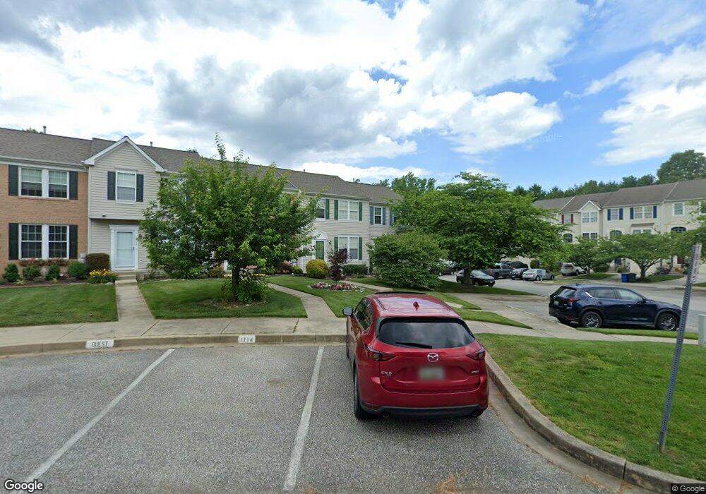
1720 Chrisara Ct Forest Hill, MD 21050
Estimated Value: $286,000 - $421,000
--
Bed
3
Baths
1,280
Sq Ft
$282/Sq Ft
Est. Value
About This Home
This home is located at 1720 Chrisara Ct, Forest Hill, MD 21050 and is currently estimated at $360,947, approximately $281 per square foot. 1720 Chrisara Ct is a home located in Harford County with nearby schools including Forest Hill Elementary School, Bel Air Middle School, and Bel Air High School.
Ownership History
Date
Name
Owned For
Owner Type
Purchase Details
Closed on
Jan 15, 2003
Sold by
Rippin Michael A
Bought by
Cramer Vanessa M
Current Estimated Value
Purchase Details
Closed on
May 11, 2001
Sold by
Vitale Damian F
Bought by
Rippin Michael A and Hammonds Victoriaus L
Purchase Details
Closed on
Mar 8, 1999
Sold by
Ryland Group Inc The
Bought by
Vitale Damian F and Vitale Nicole M
Purchase Details
Closed on
Dec 30, 1998
Sold by
Spenceola Farms Llc
Bought by
Ryland Group Inc The
Create a Home Valuation Report for This Property
The Home Valuation Report is an in-depth analysis detailing your home's value as well as a comparison with similar homes in the area
Home Values in the Area
Average Home Value in this Area
Purchase History
| Date | Buyer | Sale Price | Title Company |
|---|---|---|---|
| Cramer Vanessa M | $158,900 | -- | |
| Rippin Michael A | $130,000 | -- | |
| Vitale Damian F | $138,987 | -- | |
| Ryland Group Inc The | $117,400 | -- |
Source: Public Records
Mortgage History
| Date | Status | Borrower | Loan Amount |
|---|---|---|---|
| Closed | Vitale Damian F | -- |
Source: Public Records
Tax History Compared to Growth
Tax History
| Year | Tax Paid | Tax Assessment Tax Assessment Total Assessment is a certain percentage of the fair market value that is determined by local assessors to be the total taxable value of land and additions on the property. | Land | Improvement |
|---|---|---|---|---|
| 2025 | $2,746 | $263,800 | $72,500 | $191,300 |
| 2024 | $2,746 | $252,033 | $0 | $0 |
| 2023 | $2,615 | $240,267 | $0 | $0 |
| 2022 | $2,490 | $228,500 | $72,500 | $156,000 |
| 2021 | $1,262 | $223,567 | $0 | $0 |
| 2020 | $1,262 | $218,633 | $0 | $0 |
| 2019 | $2,466 | $213,700 | $65,500 | $148,200 |
| 2018 | $2,421 | $211,733 | $0 | $0 |
| 2017 | $2,399 | $213,700 | $0 | $0 |
| 2016 | $140 | $207,800 | $0 | $0 |
| 2015 | $2,572 | $207,800 | $0 | $0 |
| 2014 | $2,572 | $207,800 | $0 | $0 |
Source: Public Records
Map
Nearby Homes
- 1709 Chrisara Ct
- 275 Spencer Cir
- 1716 Landmark Dr Unit 3D
- 105 Sunshine Ct Unit G
- 102 Gwen Dr Unit G
- 1817 Rock Spring Rd
- 309 Cannery Ln
- 1803 Beth Bridge Cir
- 110 Meadow Rd
- 218 Aster Ln
- 1605 Samantha Dr
- 310 Willrich Cir
- 801 Oaklawn Dr
- 1993 Esther Ct
- 1405 Kahoe Rd
- 243 Bynum Ridge Rd
- 245 Bynum Ridge Rd
- 2139 Mardic Dr
- 2010 Brandy Dr
- 2294 Howland Dr
- 1718 Chrisara Ct
- 1716 Chrisara Ct
- 1714 Chrisara Ct
- 1712 Chrisara Ct
- 1710 Chrisara Ct
- 1708 Chrisara Ct
- 1706 Chrisara Ct
- 1727 Chrisara Ct
- 1725 Chrisara Ct
- 1729 Chrisara Ct
- 1723 Chrisara Ct
- 1731 Chrisara Ct
- 1721 Chrisara Ct
- 1733 Chrisara Ct
- 1717 Chrisara Ct
- 1719 Chrisara Ct
- 1715 Chrisara Ct
- 1713 Chrisara Ct
- 1711 Chrisara Ct
- 1707 Chrisara Ct