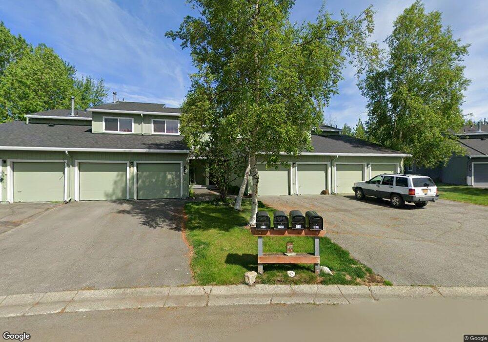
1720 Morningtide Ct Anchorage, AK 99501
Airport Heights NeighborhoodEstimated Value: $169,000 - $380,000
3
Beds
3
Baths
1,428
Sq Ft
$213/Sq Ft
Est. Value
About This Home
This home is located at 1720 Morningtide Ct, Anchorage, AK 99501 and is currently estimated at $304,497, approximately $213 per square foot. 1720 Morningtide Ct is a home located in Anchorage Municipality with nearby schools including Airport Heights Elementary School, Wendler Middle School, and Bettye Davis East Anchorage High School.
Ownership History
Date
Name
Owned For
Owner Type
Purchase Details
Closed on
Jul 2, 2001
Sold by
Hendrix Smith Veressa and Smith Robert London
Bought by
Mitchell Michael and Mitchell Patricia J
Current Estimated Value
Home Financials for this Owner
Home Financials are based on the most recent Mortgage that was taken out on this home.
Original Mortgage
$118,000
Outstanding Balance
$45,507
Interest Rate
7.15%
Estimated Equity
$258,990
Create a Home Valuation Report for This Property
The Home Valuation Report is an in-depth analysis detailing your home's value as well as a comparison with similar homes in the area
Home Values in the Area
Average Home Value in this Area
Purchase History
| Date | Buyer | Sale Price | Title Company |
|---|---|---|---|
| Mitchell Michael | -- | -- |
Source: Public Records
Mortgage History
| Date | Status | Borrower | Loan Amount |
|---|---|---|---|
| Open | Mitchell Michael | $118,000 |
Source: Public Records
Tax History Compared to Growth
Tax History
| Year | Tax Paid | Tax Assessment Tax Assessment Total Assessment is a certain percentage of the fair market value that is determined by local assessors to be the total taxable value of land and additions on the property. | Land | Improvement |
|---|---|---|---|---|
| 2025 | $1,514 | $332,000 | $80,200 | $251,800 |
| 2024 | $1,514 | $318,800 | $80,200 | $238,600 |
| 2023 | $5,077 | $298,100 | $80,200 | $217,900 |
| 2022 | $1,361 | $280,800 | $80,200 | $200,600 |
| 2021 | $4,689 | $260,200 | $80,200 | $180,000 |
| 2020 | $1,071 | $264,200 | $80,200 | $184,000 |
| 2019 | $1,054 | $264,400 | $80,200 | $184,200 |
| 2018 | $623 | $235,000 | $60,200 | $174,800 |
| 2017 | $1,018 | $235,000 | $60,200 | $174,800 |
| 2016 | $828 | $227,100 | $58,100 | $169,000 |
| 2015 | $828 | $232,500 | $58,100 | $174,400 |
| 2014 | $828 | $224,300 | $58,100 | $166,200 |
Source: Public Records
Map
Nearby Homes
- 2215 Sunburst Cir
- 1661 Eastridge Dr Unit 101
- 1635 Sitka St Unit 14-302
- 1611 Eastridge Dr Unit 201
- 1803 Parkside Dr
- 2066 Cliffside Dr Unit 10-B2
- 1701 Aleutian St
- 1729 Sunrise Dr
- 1403 Nelchina St
- 2620 Sorbus Cir
- 1251 Elegante Ln
- 1504 Medfra St
- 000 Tr A Thurston
- 2680 Lovejoy Dr
- 1210 E 16th Ave Unit 4
- 2456 Cottonwood St
- 1430 Columbine St
- 1101 E 16th Ave
- 911 Nelchina St Unit A
- 890 Orca St
- 1716 Morningtide Ct
- 1724 Morningtide Ct
- 1712 Morningtide Ct
- 1728 Morningtide Ct
- 1732 Morningtide Ct
- 1708 Morningtide Ct
- 1704 Morningtide Ct
- 1704 Morningtide Ct Unit 1704
- 1721 Morningtide Ct
- 1700 Morningtide Ct
- 1742 Morningtide Ct
- 1717 Morningtide Ct
- 1733 Morningtide Ct
- 1737 Morningtide Ct
- 1713 Morningtide Ct
- 1743 Morningtide Ct
- 1701 Morningtide Ct
- 1746 Morningtide Ct
- 1747 Morningtide Ct
- 1750 Morningtide Ct