Estimated Value: $291,953 - $375,000
3
Beds
2
Baths
1,608
Sq Ft
$200/Sq Ft
Est. Value
About This Home
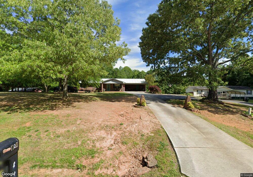
This home is located at 1720 Mud Creek Rd, Alto, GA 30510 and is currently estimated at $321,738, approximately $200 per square foot. 1720 Mud Creek Rd is a home located in Habersham County with nearby schools including Level Grove Elementary School, South Habersham Middle School, and Habersham Success Academy.
Ownership History
Date
Name
Owned For
Owner Type
Purchase Details
Closed on
Mar 13, 2024
Sold by
Mcduffie Anthony Taylor
Bought by
Moody James
Current Estimated Value
Purchase Details
Closed on
Mar 10, 2021
Sold by
Moody Sandra C
Bought by
Mcduffie Anthony Taylor
Home Financials for this Owner
Home Financials are based on the most recent Mortgage that was taken out on this home.
Original Mortgage
$133,838
Interest Rate
2.73%
Mortgage Type
New Conventional
Purchase Details
Closed on
Jan 20, 2018
Sold by
Moody Sandra C
Bought by
Moody Sandra C and Moody Jamie
Create a Home Valuation Report for This Property
The Home Valuation Report is an in-depth analysis detailing your home's value as well as a comparison with similar homes in the area
Home Values in the Area
Average Home Value in this Area
Purchase History
| Date | Buyer | Sale Price | Title Company |
|---|---|---|---|
| Moody James | $15,000 | -- | |
| Mcduffie Anthony Taylor | -- | -- | |
| Mcduffie Anthony Taylor | $132,500 | -- | |
| Moody Sandra C | -- | -- |
Source: Public Records
Mortgage History
| Date | Status | Borrower | Loan Amount |
|---|---|---|---|
| Previous Owner | Mcduffie Anthony Taylor | $133,838 |
Source: Public Records
Tax History Compared to Growth
Tax History
| Year | Tax Paid | Tax Assessment Tax Assessment Total Assessment is a certain percentage of the fair market value that is determined by local assessors to be the total taxable value of land and additions on the property. | Land | Improvement |
|---|---|---|---|---|
| 2025 | $2,138 | $111,546 | $10,000 | $101,546 |
| 2024 | -- | $104,328 | $20,000 | $84,328 |
| 2023 | $1,470 | $89,680 | $20,000 | $69,680 |
| 2022 | $1,756 | $67,328 | $11,248 | $56,080 |
| 2021 | $535 | $58,888 | $8,840 | $50,048 |
| 2020 | $534 | $51,832 | $8,784 | $43,048 |
| 2019 | $535 | $51,832 | $8,784 | $43,048 |
| 2018 | $524 | $51,832 | $8,784 | $43,048 |
| 2017 | $497 | $48,048 | $8,784 | $39,264 |
| 2016 | $451 | $120,120 | $8,784 | $39,264 |
| 2015 | $436 | $120,120 | $8,784 | $39,264 |
| 2014 | $429 | $117,330 | $8,784 | $38,148 |
| 2013 | -- | $46,932 | $8,784 | $38,148 |
Source: Public Records
Map
Nearby Homes
- 306 Travis Pless Rd
- 425 Crystal Way
- 1331 Garrison Rd
- 310 Georgian Terrace
- 1.73 ACRES TR3 Garrison Rd
- 1.18 ACRES Garrison Rd
- 1.70 ACRES Garrison Rd
- 2.16 ACRES Garrison Rd
- 0 Coon Creek Rd Unit 9363214
- 1307 Creasy Patch Rd
- 2000 Alto Mud Creek Rd
- 0 Heads Ferry Rd Unit 7269787
- 150 Pleasant Acres Dr
- 738 Wilbanks Rd
- 0 Pea Ridge Rd Unit 16740951
- 752 Dawn Place
- 1085 Smokey Rd
- 324 Highland Pointe Dr
- 933 Alto Mud Creek Rd
- 255 Laurel Place Dr
- 1716 Mud Creek Rd
- 1715 Mud Creek Rd
- 1715 Mud Creek Rd
- 1721 Mud Creek Rd
- 1798 Mud Creek Rd
- 1555 Payne Norton Rd
- 1820 Mud Creek Rd
- 1471 Payne Norton Rd
- 1836 Mud Creek Rd
- 1837 Mud Creek Rd
- 1636 Mud Creek Rd
- 1870 Mud Creek Rd
- 1611 Mud Creek Rd
- 1869 Mud Creek Rd
- 1442 Payne Norton Rd
- 1458 Payne Norton Rd
- 1907 Mud Creek Rd
- 1910 Mud Creek Rd
- 150 Palm Springs Dr
- 1440 Payne Norton Rd