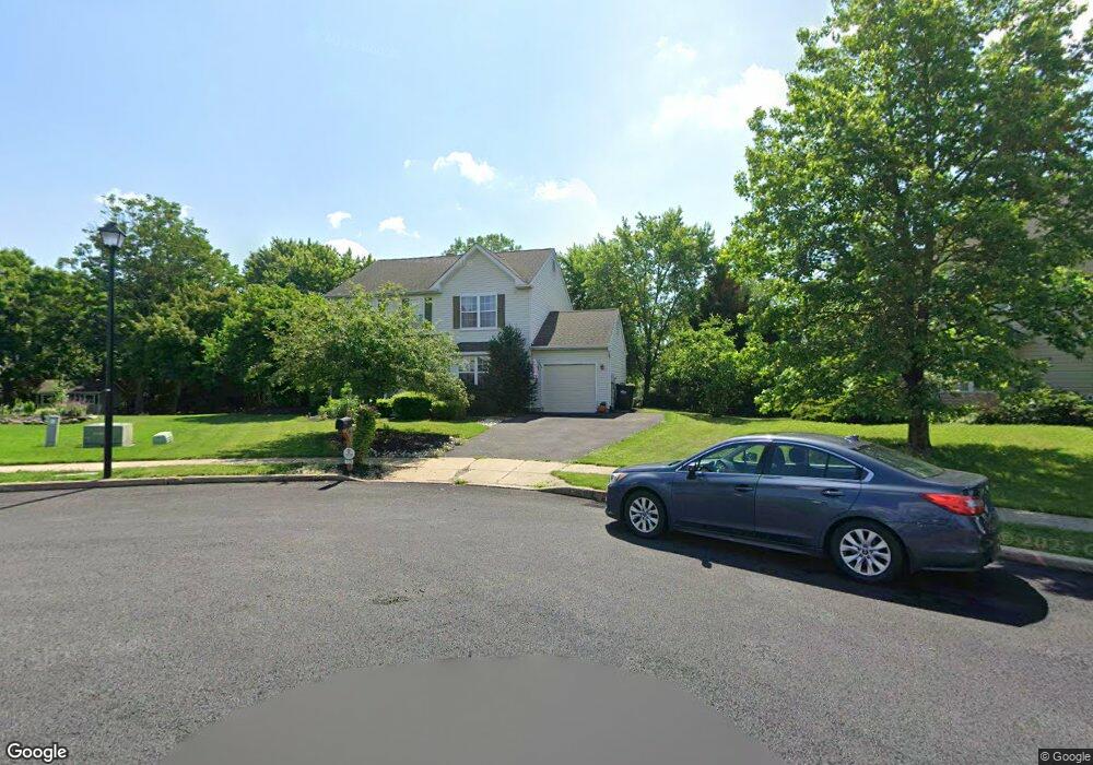
1720 Pheasant Ln Quakertown, PA 18951
Richland NeighborhoodEstimated Value: $515,000 - $522,000
3
Beds
3
Baths
1,848
Sq Ft
$281/Sq Ft
Est. Value
About This Home
This home is located at 1720 Pheasant Ln, Quakertown, PA 18951 and is currently estimated at $518,809, approximately $280 per square foot. 1720 Pheasant Ln is a home located in Bucks County with nearby schools including Trumbauersville Elementary School, Strayer Middle School, and Quakertown Community Senior High School.
Ownership History
Date
Name
Owned For
Owner Type
Purchase Details
Closed on
Feb 21, 2006
Sold by
Dougherty Kelly A and Dougherty Michael
Bought by
Albitz Denise J
Current Estimated Value
Home Financials for this Owner
Home Financials are based on the most recent Mortgage that was taken out on this home.
Original Mortgage
$50,000
Outstanding Balance
$39,387
Interest Rate
6.28%
Mortgage Type
Credit Line Revolving
Estimated Equity
$479,422
Purchase Details
Closed on
Feb 12, 1998
Sold by
Ulses Robert J and Ulses Anne E
Bought by
Ulses Michael J and Ulses Elizabeth A
Home Financials for this Owner
Home Financials are based on the most recent Mortgage that was taken out on this home.
Original Mortgage
$136,200
Interest Rate
6.9%
Mortgage Type
Balloon
Create a Home Valuation Report for This Property
The Home Valuation Report is an in-depth analysis detailing your home's value as well as a comparison with similar homes in the area
Home Values in the Area
Average Home Value in this Area
Purchase History
| Date | Buyer | Sale Price | Title Company |
|---|---|---|---|
| Albitz Denise J | $335,900 | None Available | |
| Ulses Michael J | -- | First American Title Ins Co |
Source: Public Records
Mortgage History
| Date | Status | Borrower | Loan Amount |
|---|---|---|---|
| Open | Albitz Denise J | $50,000 | |
| Open | Albitz Denise J | $268,720 | |
| Previous Owner | Ulses Michael J | $136,200 |
Source: Public Records
Tax History Compared to Growth
Tax History
| Year | Tax Paid | Tax Assessment Tax Assessment Total Assessment is a certain percentage of the fair market value that is determined by local assessors to be the total taxable value of land and additions on the property. | Land | Improvement |
|---|---|---|---|---|
| 2025 | $7,008 | $32,870 | $6,840 | $26,030 |
| 2024 | $7,008 | $32,870 | $6,840 | $26,030 |
| 2023 | $6,869 | $32,870 | $6,840 | $26,030 |
| 2022 | $6,757 | $32,870 | $6,840 | $26,030 |
| 2021 | $6,757 | $32,870 | $6,840 | $26,030 |
| 2020 | $6,757 | $32,870 | $6,840 | $26,030 |
| 2019 | $6,579 | $32,870 | $6,840 | $26,030 |
| 2018 | $6,361 | $32,870 | $6,840 | $26,030 |
| 2017 | $6,174 | $32,870 | $6,840 | $26,030 |
| 2016 | $6,174 | $32,870 | $6,840 | $26,030 |
| 2015 | -- | $32,870 | $6,840 | $26,030 |
| 2014 | -- | $32,870 | $6,840 | $26,030 |
Source: Public Records
Map
Nearby Homes
- 202 Andover Ct Unit 202
- 56 Dewsbury Ln
- 2060 Rohrbach Ln
- 94 Braithwaite Ln
- 112 Jefferson Ct
- 2285 Richland Terrace
- 1124 Longwood Dr
- 55 Morris Rd
- 4 Stonegate Village
- 136 Woodview Dr
- 1068 Freedom Ct
- 27 S 7th St
- 803 W Broad St
- 2228 Blue Gill Dr Unit 54
- 2500 Yankee Rd
- 811 W Mill St
- 444 Enclave Dr Unit SAVANNAH
- 444 Enclave Dr Unit COVINGTON
- 444 Enclave Dr Unit SEBASTIAN
- 444 Enclave Dr Unit DEVONSHIRE
- 1717 Pheasant Ln
- 1716 Pheasant Ln
- 1713 Pheasant Ln
- 1418 Mayflower Dr
- 1412 Mayflower Dr
- 1422 Mayflower Dr
- 1709 Pheasant Ln
- 1402 Mayflower Dr
- 1705 Pheasant Ln
- 1430 Mayflower Dr
- 1319 Harvest Ln
- 1323 Harvest Ln
- 1417 Mayflower Dr
- 1327 Harvest Ln
- 1315 Harvest Ln
- 1503 Pilgrim Ln
- 1423 Mayflower Dr
- 1311 Harvest Ln
- 1434 Mayflower Dr
- 1502 Pilgrim Ln