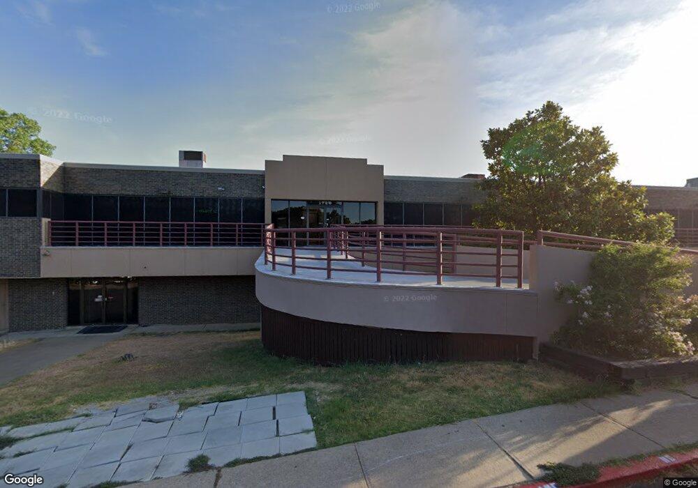
1720 S Edmonds Ln Unit B Lewisville, TX 75067
--
Bed
--
Bath
30,000
Sq Ft
3.75
Acres
About This Home
This home is located at 1720 S Edmonds Ln Unit B, Lewisville, TX 75067. 1720 S Edmonds Ln Unit B is a home located in Denton County with nearby schools including Creekside Elementary School, Marshall Durham Middle School, and Lewisville High School.
Ownership History
Date
Name
Owned For
Owner Type
Purchase Details
Closed on
Aug 5, 2015
Sold by
Willoughby Family Lp
Bought by
Denardo Development Llc
Home Financials for this Owner
Home Financials are based on the most recent Mortgage that was taken out on this home.
Original Mortgage
$1,000,000
Outstanding Balance
$787,296
Interest Rate
4.06%
Mortgage Type
Purchase Money Mortgage
Purchase Details
Closed on
Jul 12, 2007
Sold by
Brandenburger Jack R
Bought by
Willoughby Family Partnership
Purchase Details
Closed on
Mar 19, 1996
Sold by
Phoenix Properties
Bought by
Bcom Phoenix Properties Llc
Create a Home Valuation Report for This Property
The Home Valuation Report is an in-depth analysis detailing your home's value as well as a comparison with similar homes in the area
Home Values in the Area
Average Home Value in this Area
Purchase History
| Date | Buyer | Sale Price | Title Company |
|---|---|---|---|
| Denardo Development Llc | -- | Fatco | |
| Willoughby Family Partnership | -- | None Available | |
| Bcom Phoenix Properties Llc | -- | -- |
Source: Public Records
Mortgage History
| Date | Status | Borrower | Loan Amount |
|---|---|---|---|
| Open | Denardo Development Llc | $1,000,000 |
Source: Public Records
Tax History Compared to Growth
Tax History
| Year | Tax Paid | Tax Assessment Tax Assessment Total Assessment is a certain percentage of the fair market value that is determined by local assessors to be the total taxable value of land and additions on the property. | Land | Improvement |
|---|---|---|---|---|
| 2025 | $34,562 | $2,100,000 | $1,144,668 | $955,332 |
| 2024 | $34,562 | $2,000,000 | $1,144,668 | $855,332 |
| 2023 | $34,773 | $2,000,000 | $1,144,668 | $855,332 |
| 2022 | $41,748 | $2,200,000 | $817,620 | $1,382,380 |
| 2021 | $43,735 | $2,169,857 | $817,620 | $1,352,237 |
| 2020 | $43,529 | $2,169,857 | $817,620 | $1,352,237 |
| 2019 | $46,704 | $2,257,155 | $817,620 | $1,439,535 |
| 2018 | $26,138 | $1,255,784 | $245,286 | $1,010,498 |
| 2017 | $26,428 | $1,255,784 | $245,286 | $1,010,498 |
| 2016 | $26,238 | $1,246,781 | $245,286 | $1,001,495 |
| 2015 | -- | $1,225,000 | $245,286 | $979,714 |
| 2013 | -- | $1,295,300 | $245,286 | $1,050,014 |
Source: Public Records
Map
Nearby Homes
- 829 Blue Oak Dr
- 1004 League Rd
- 823 Blue Oak Dr
- 806 Red Oak Dr
- 1274 Granada Ln
- 1249 Granada St
- 758 Red Oak Dr
- 1255 Valencia Ln
- 725 Holly Oak Dr
- 2032 Kenny Ct
- 1737 Cliffrose Ln
- 2042 Vista Dr
- 2044 Hillshire Dr
- 847 Salem Trail
- 2036 Camelot Dr
- 1906 Buffalo Bend Dr
- 2050 Vista Dr
- 975 W Corporate Dr
- 1309 Kingston Dr
- 417 Elam Dr
- 1720 S Edmonds Ln Unit A
- 1720 S Edmonds Ln
- 918 Beverly Ct
- 915 Angela Dr
- 913 Angela Dr
- 917 Angela Dr
- 919 Beverly Ct
- 920 Beverly Ct
- 1726 Shufords Ct
- 911 Angela Dr
- 1716 S Edmonds Ln
- 919 Angela Dr
- 1724 Shufords Ct
- 920 Rachels Ct
- 920 Rachels Ct
- 918 Angela Dr
- 922 Beverly Ct
- 921 Beverly Ct
- 1728 Shufords Ct
- 921 Angela Dr