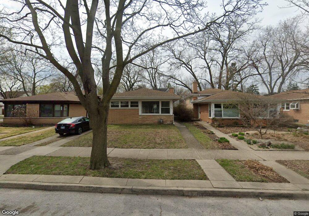
1720 South Blvd Evanston, IL 60202
Estimated Value: $463,000 - $548,552
3
Beds
3
Baths
1,511
Sq Ft
$334/Sq Ft
Est. Value
About This Home
This home is located at 1720 South Blvd, Evanston, IL 60202 and is currently estimated at $504,388, approximately $333 per square foot. 1720 South Blvd is a home located in Cook County with nearby schools including Dawes Elementary School, Chute Middle School, and Evanston Township High School.
Ownership History
Date
Name
Owned For
Owner Type
Purchase Details
Closed on
May 31, 1996
Sold by
Goldberg Lawrence and Goldberg Inez S
Bought by
Maranda Michael W
Current Estimated Value
Home Financials for this Owner
Home Financials are based on the most recent Mortgage that was taken out on this home.
Original Mortgage
$103,000
Outstanding Balance
$6,563
Interest Rate
7.97%
Estimated Equity
$497,825
Purchase Details
Closed on
Nov 30, 1995
Sold by
Goldberg Julian S
Bought by
Goldberg Lawrence and Julian Goldberg Revocable Trust
Create a Home Valuation Report for This Property
The Home Valuation Report is an in-depth analysis detailing your home's value as well as a comparison with similar homes in the area
Home Values in the Area
Average Home Value in this Area
Purchase History
| Date | Buyer | Sale Price | Title Company |
|---|---|---|---|
| Maranda Michael W | -- | -- | |
| Maranda Michael W | $171,500 | -- | |
| Goldberg Lawrence | -- | -- | |
| Goldberg Lawrence | -- | -- |
Source: Public Records
Mortgage History
| Date | Status | Borrower | Loan Amount |
|---|---|---|---|
| Open | Maranda Michael W | $103,000 |
Source: Public Records
Tax History Compared to Growth
Tax History
| Year | Tax Paid | Tax Assessment Tax Assessment Total Assessment is a certain percentage of the fair market value that is determined by local assessors to be the total taxable value of land and additions on the property. | Land | Improvement |
|---|---|---|---|---|
| 2024 | $5,578 | $41,000 | $7,722 | $33,278 |
| 2023 | $5,520 | $41,000 | $7,722 | $33,278 |
| 2022 | $5,520 | $41,000 | $7,722 | $33,278 |
| 2021 | $6,144 | $34,316 | $5,616 | $28,700 |
| 2020 | $5,645 | $34,316 | $5,616 | $28,700 |
| 2019 | $5,583 | $38,342 | $5,616 | $32,726 |
| 2018 | $6,351 | $29,747 | $4,680 | $25,067 |
| 2017 | $7,129 | $29,747 | $4,680 | $25,067 |
| 2016 | $6,985 | $29,747 | $4,680 | $25,067 |
| 2015 | $5,358 | $22,325 | $3,861 | $18,464 |
| 2014 | $5,321 | $22,325 | $3,861 | $18,464 |
| 2013 | $5,182 | $22,325 | $3,861 | $18,464 |
Source: Public Records
Map
Nearby Homes
- 1810 South Blvd
- 401 Dewey Ave
- 419 Florence Ave
- 604 Dodge Ave
- 1916 Keeney St
- 347 Florence Ave
- 1927 Warren St
- 532 Wesley Ave Unit WEST
- 325 Dodge Ave
- 309 Darrow Ave
- 704 Florence Ave
- 1408 Seward St
- 1810 Washington St
- 215 Brown Ave
- 1217 Hull Terrace Unit 3A
- 1214 Hull Terrace
- 235 Richmond St
- 647 Asbury Ave
- 2011 Brummel St
- 1406 Brummel St
- 1722 South Blvd
- 1718 South Blvd
- 1728 South Blvd
- 1725 Oakton St
- 1730 South Blvd
- 1717 Oakton St
- 1729 Oakton St
- 1800 South Blvd
- 1733 Oakton St
- 1708 South Blvd
- 1721 South Blvd
- 1725 South Blvd
- 1709 Oakton St
- 1727 South Blvd
- 1801 Oakton St
- 1804 South Blvd
- 1704 South Blvd
- 1731 South Blvd
- 1705 Oakton St
- 1803 South Blvd