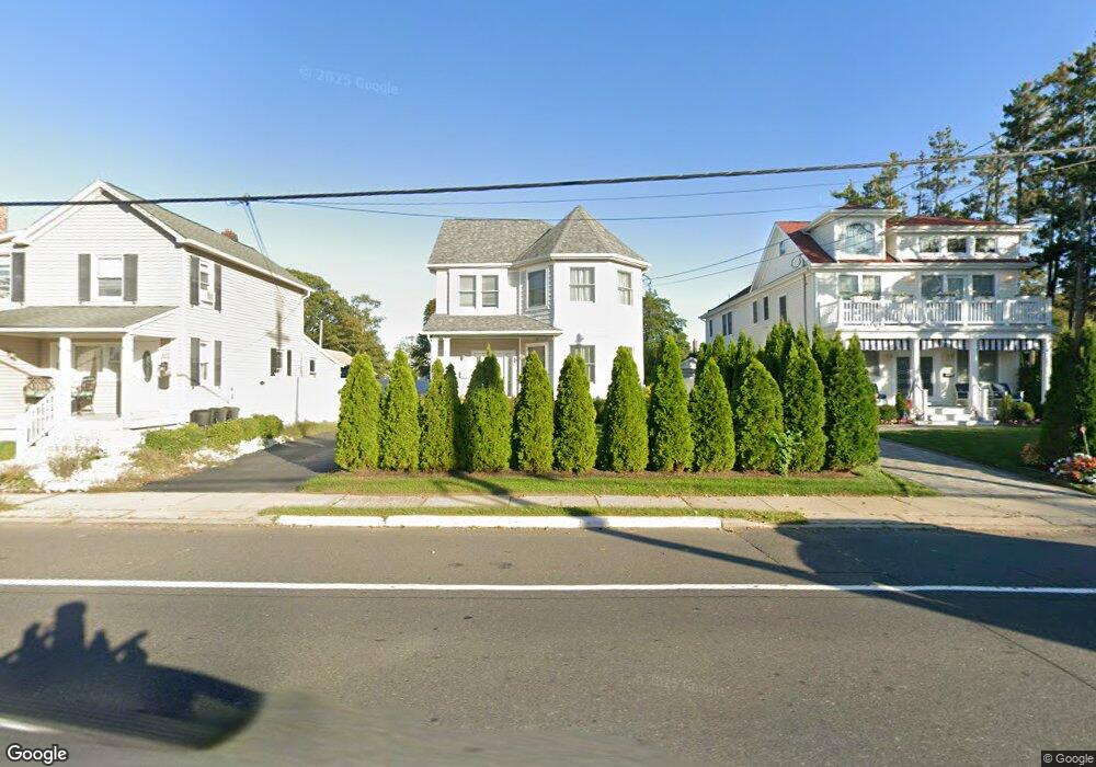
1720 State Route 71 Spring Lake, NJ 07762
Estimated Value: $1,134,000 - $2,259,501
4
Beds
5
Baths
3,002
Sq Ft
$585/Sq Ft
Est. Value
About This Home
This home is located at 1720 State Route 71, Spring Lake, NJ 07762 and is currently estimated at $1,756,125, approximately $584 per square foot. 1720 State Route 71 is a home with nearby schools including Spring Lake Heights Elementary School.
Ownership History
Date
Name
Owned For
Owner Type
Purchase Details
Closed on
Sep 23, 2015
Sold by
Judikic Joseph F and Judikic Shirle A
Bought by
Foux Mikhail and Lander Sonia
Current Estimated Value
Purchase Details
Closed on
Nov 1, 1999
Sold by
Maellaro Leonard
Bought by
Pukel Robert and Visco Maryann
Home Financials for this Owner
Home Financials are based on the most recent Mortgage that was taken out on this home.
Original Mortgage
$59,000
Interest Rate
7.73%
Mortgage Type
Commercial
Purchase Details
Closed on
Jun 28, 1996
Sold by
Tasian Hassan
Bought by
Maellaro Leonar
Home Financials for this Owner
Home Financials are based on the most recent Mortgage that was taken out on this home.
Original Mortgage
$35,000
Interest Rate
7.98%
Mortgage Type
Commercial
Create a Home Valuation Report for This Property
The Home Valuation Report is an in-depth analysis detailing your home's value as well as a comparison with similar homes in the area
Home Values in the Area
Average Home Value in this Area
Purchase History
| Date | Buyer | Sale Price | Title Company |
|---|---|---|---|
| Foux Mikhail | $210,000 | The Security Title Guarantee | |
| Pukel Robert | $59,000 | -- | |
| Maellaro Leonar | $45,000 | -- |
Source: Public Records
Mortgage History
| Date | Status | Borrower | Loan Amount |
|---|---|---|---|
| Previous Owner | Pukel Robert | $59,000 | |
| Previous Owner | Maellaro Leonar | $35,000 |
Source: Public Records
Tax History Compared to Growth
Tax History
| Year | Tax Paid | Tax Assessment Tax Assessment Total Assessment is a certain percentage of the fair market value that is determined by local assessors to be the total taxable value of land and additions on the property. | Land | Improvement |
|---|---|---|---|---|
| 2025 | $12,876 | $1,242,600 | $540,000 | $702,600 |
| 2024 | $12,909 | $1,222,800 | $520,200 | $702,600 |
| 2023 | $12,909 | $1,152,600 | $450,000 | $702,600 |
| 2022 | $12,509 | $1,023,000 | $278,200 | $744,800 |
| 2021 | $12,509 | $926,600 | $242,300 | $684,300 |
| 2020 | $11,726 | $863,500 | $242,300 | $621,200 |
| 2019 | $11,694 | $852,300 | $242,300 | $610,000 |
| 2018 | $11,947 | $847,300 | $242,300 | $605,000 |
| 2017 | $3,536 | $260,000 | $260,000 | $0 |
| 2016 | $5,333 | $260,000 | $260,000 | $0 |
| 2015 | $5,272 | $384,000 | $260,000 | $124,000 |
| 2014 | $5,616 | $418,200 | $295,000 | $123,200 |
Source: Public Records
Map
Nearby Homes
- 12 Wyckham Rd
- 15 Wyckham Rd
- 613 Warren Ave
- 905 Wall Rd
- 513 Mercer Ave
- 1905 3rd Ave
- 19 Willow Ln
- 2419 Kipling Ave
- 530 Highway 71 Unit 4
- 418 Monmouth Ave
- 118 Warren Ave
- 1027 2nd Ave
- 418 Salem Ave
- 24 Old Mill Ct
- 1838 Highway 35 Unit 36
- 1301 Warren Ave Unit 5
- 200 Monmouth Ave Unit 21
- 200 Monmouth Ave Unit 19
- 200 Monmouth Ave Unit 27
- 200 Monmouth Ave Unit 23
- 1718 State Route 71
- 1722 State Route 71
- 1724 State Route 71
- 1716 Highway 71 Unit D
- 1716 Highway 71
- 1714 New Jersey 71
- 1714 State Route 71
- 611 Saint Clair Ave
- 1717 Beverly Ave
- 100 Walnut Dr
- 1712 State Route 71
- 102 Walnut Dr
- 98 Walnut Dr Unit 4
- 88 Walnut Dr
- 1711 Beverly Ave
- 86 Walnut Dr
- 1719 Beverly Ave Unit FRONT
- 104 Walnut Dr
- 84 Walnut Dr
- 82 Walnut Dr