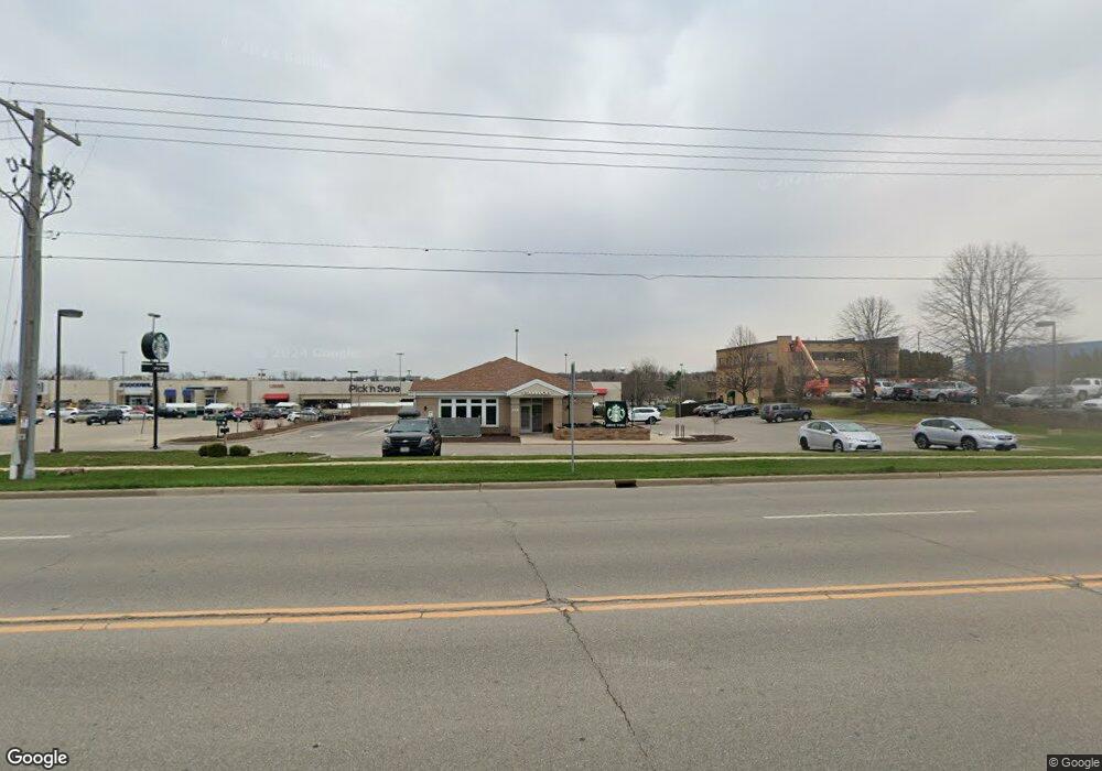
1720 Us Highway 51 Stoughton, WI 53589
--
Bed
--
Bath
11,252
Sq Ft
1.41
Acres
About This Home
This home is located at 1720 Us Highway 51, Stoughton, WI 53589. 1720 Us Highway 51 is a home located in Dane County with nearby schools including Fox Prairie Elementary School, River Bluff Middle School, and Stoughton High School.
Ownership History
Date
Name
Owned For
Owner Type
Purchase Details
Closed on
Jan 13, 2021
Sold by
Teslow Wade and Teslow Jennifer
Bought by
Stoughton 51 Llc
Purchase Details
Closed on
May 15, 2020
Sold by
Old National Bank
Bought by
Slow Llc
Home Financials for this Owner
Home Financials are based on the most recent Mortgage that was taken out on this home.
Original Mortgage
$372,000
Interest Rate
3.3%
Mortgage Type
Commercial
Create a Home Valuation Report for This Property
The Home Valuation Report is an in-depth analysis detailing your home's value as well as a comparison with similar homes in the area
Home Values in the Area
Average Home Value in this Area
Purchase History
| Date | Buyer | Sale Price | Title Company |
|---|---|---|---|
| Stoughton 51 Llc | -- | None Available | |
| Teslow Wade | -- | None Available | |
| Slow Llc | -- | None Available |
Source: Public Records
Mortgage History
| Date | Status | Borrower | Loan Amount |
|---|---|---|---|
| Open | Stoughton 51 Llc | $497,805 | |
| Open | Stoughton 51 Llc | $862,195 | |
| Closed | Slow Llc | $862,195 | |
| Previous Owner | Slow Llc | $372,000 | |
| Previous Owner | Slow Llc | $6,447 |
Source: Public Records
Tax History Compared to Growth
Tax History
| Year | Tax Paid | Tax Assessment Tax Assessment Total Assessment is a certain percentage of the fair market value that is determined by local assessors to be the total taxable value of land and additions on the property. | Land | Improvement |
|---|---|---|---|---|
| 2024 | $9,694 | $587,400 | $178,900 | $408,500 |
| 2023 | $8,065 | $510,800 | $178,900 | $331,900 |
| 2021 | $8,877 | $465,000 | $178,900 | $286,100 |
| 2020 | $13,532 | $661,800 | $178,900 | $482,900 |
| 2019 | $14,057 | $661,800 | $178,900 | $482,900 |
| 2018 | $14,314 | $661,800 | $178,900 | $482,900 |
| 2017 | $14,604 | $661,800 | $178,900 | $482,900 |
| 2016 | $14,625 | $661,800 | $178,900 | $482,900 |
| 2015 | $14,855 | $661,800 | $178,900 | $482,900 |
| 2014 | $14,810 | $661,800 | $178,900 | $482,900 |
| 2013 | $20,431 | $945,600 | $178,900 | $766,700 |
Source: Public Records
Map
Nearby Homes
- 408 Kings Lynn Rd
- 741 Kensington Square
- 730 Kensington Square Unit 730
- 2208 W Milwaukee St
- 2117 W Milwaukee St
- 832 Bergen Ct
- 105 N Harrison St
- 1420 Nygaard St
- 2316 Markens Gate Rd
- 2400 Markens Gate Rd
- 622 N Harrison St
- 2832 Jackson St
- 2832 Jackson St Unit 37
- 2833 Jackson St Unit 68
- 2848 Jackson St Unit 35
- The Juniper Plan at Nordic Ridge
- The Lincoln Plan at Nordic Ridge
- The Mckinley Plan at Nordic Ridge
- The Bergen Plan at Nordic Ridge
- The Filmore Plan at Nordic Ridge
- 1706-1716 Highway 51
- 1800 Us Highway 51
- 1850 U S 51
- 1609 Us Highway 51 and 138
- 221 Kings Lynn Rd
- 1616 Kenilworth Ct
- 1601 Kenilworth Ct
- 1512 Us Highway 51
- 1600 Kenilworth Ct
- 1600 Kenilworth Ct
- 1716 W Main St
- 1722 W Main St Unit B
- 1722 W Main St Unit A
- 1722 W Main St
- 1811 Jackson St
- 1718 W Main St Unit 4
- 1718 W Main St Unit 3
- 1718 W Main St Unit 1
- 1717 Jackson St
- 1725 Jackson St