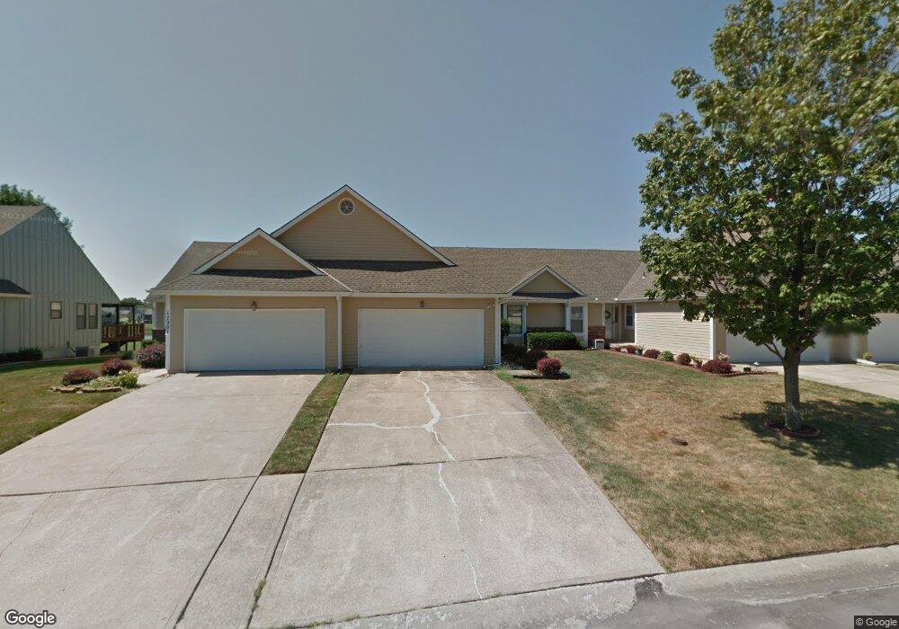
17205 E 52nd St S Independence, MO 64055
Highland Manor NeighborhoodEstimated Value: $243,000 - $276,000
2
Beds
2
Baths
1,145
Sq Ft
$229/Sq Ft
Est. Value
About This Home
This home is located at 17205 E 52nd St S, Independence, MO 64055 and is currently estimated at $262,543, approximately $229 per square foot. 17205 E 52nd St S is a home located in Jackson County with nearby schools including William Southern Elementary School, Bridger Middle School, and Pioneer Ridge Middle School.
Ownership History
Date
Name
Owned For
Owner Type
Purchase Details
Closed on
Nov 3, 2015
Sold by
Emadipour Hamid Henry and Swager Jui Su
Bought by
Scrutchfield Marilyn
Current Estimated Value
Home Financials for this Owner
Home Financials are based on the most recent Mortgage that was taken out on this home.
Original Mortgage
$55,000
Outstanding Balance
$22,230
Interest Rate
3.8%
Mortgage Type
New Conventional
Estimated Equity
$240,313
Purchase Details
Closed on
Aug 6, 2001
Sold by
Emadipour Hamid Henry
Bought by
Emadipour Hamid Henry and Swager Jui Su
Purchase Details
Closed on
Jun 20, 2000
Sold by
Lewis Terence V
Bought by
Emadipour Hamid H
Home Financials for this Owner
Home Financials are based on the most recent Mortgage that was taken out on this home.
Original Mortgage
$88,900
Interest Rate
8.66%
Mortgage Type
Purchase Money Mortgage
Create a Home Valuation Report for This Property
The Home Valuation Report is an in-depth analysis detailing your home's value as well as a comparison with similar homes in the area
Home Values in the Area
Average Home Value in this Area
Purchase History
| Date | Buyer | Sale Price | Title Company |
|---|---|---|---|
| Scrutchfield Marilyn | -- | Stewart Title Company | |
| Emadipour Hamid Henry | -- | -- | |
| Emadipour Hamid H | -- | Chicago Title Co |
Source: Public Records
Mortgage History
| Date | Status | Borrower | Loan Amount |
|---|---|---|---|
| Open | Scrutchfield Marilyn | $55,000 | |
| Previous Owner | Emadipour Hamid H | $88,900 |
Source: Public Records
Tax History
| Year | Tax Paid | Tax Assessment Tax Assessment Total Assessment is a certain percentage of the fair market value that is determined by local assessors to be the total taxable value of land and additions on the property. | Land | Improvement |
|---|---|---|---|---|
| 2025 | $2,264 | $37,582 | $7,834 | $29,748 |
| 2024 | $2,264 | $32,680 | $3,302 | $29,378 |
| 2023 | $2,213 | $32,680 | $3,302 | $29,378 |
| 2022 | $2,105 | $28,500 | $428 | $28,072 |
| 2021 | $2,104 | $28,500 | $428 | $28,072 |
| 2020 | $1,902 | $25,032 | $428 | $24,604 |
| 2019 | $1,872 | $25,032 | $428 | $24,604 |
| 2018 | $1,783 | $22,762 | $2,219 | $20,543 |
| 2017 | $1,755 | $22,762 | $2,219 | $20,543 |
| 2016 | $1,755 | $22,192 | $1,900 | $20,292 |
| 2014 | $1,717 | $22,192 | $1,900 | $20,292 |
Source: Public Records
Map
Nearby Homes
- 17209 E 51st Terrace Ct S
- 4916 S Shrank Dr
- 16524 E 53rd Terrace Ct S
- 4921 S Peck Ave
- 5712 NW Plantation Ln
- 5683 NW Plantation Ln Unit 194-B
- 5707 NW Sunrise Meadow Cir
- 5924 NE Parks View Place
- 5856 NW Plantation Ln
- 5820 NW Plantation Ln Unit 187D
- 332 NE Parks Edge Dr
- 5583 NW Sunrise Meadow Ln Unit 89-C
- 5581 NW Sunrise Meadow Ln
- 304 NE Hidden Valley Way
- 5929 NE Hidden Valley Dr
- 5568 NW Moonlight Meadow Dr
- 5900 NE Hidden Valley Dr
- 5300 Lees Summit Rd
- 5821 NE Coral Dr
- 225 NE Misty Meadow Dr
- 17203 E 52nd St S
- 17209 E 52nd St S
- 17201 E 52nd St S
- 17117 E 52nd St S
- 17211 E 52nd St S
- 17204 E 52nd St S
- 17208 E 52nd St S
- 17115 E 52nd St S
- 17301 E 52nd St S
- 5201 S Shrank Ave
- 17113 E 52nd St S
- 17303 E 52nd St S
- 17212 E 52nd St S
- 17300 E 52nd St S
- 17111 E 52nd St S
- 5119 S Shrank Ave
- 17307 E 52nd St S
- 17109 E 52nd St S
- 5120 S Shrank Ave
- 17205 E 51st Terrace Ct S
Your Personal Tour Guide
Ask me questions while you tour the home.