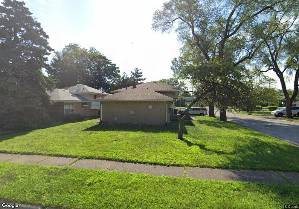
17205 Hawthorne Dr Hazel Crest, IL 60429
Estimated Value: $149,000 - $221,000
3
Beds
2
Baths
1,028
Sq Ft
$176/Sq Ft
Est. Value
About This Home
This home is located at 17205 Hawthorne Dr, Hazel Crest, IL 60429 and is currently estimated at $181,072, approximately $176 per square foot. 17205 Hawthorne Dr is a home located in Cook County with nearby schools including Thornwood High School.
Ownership History
Date
Name
Owned For
Owner Type
Purchase Details
Closed on
May 11, 2004
Sold by
Speller Wilbur and Speller Taffany K
Bought by
Joyner Robert E and Joyner Demetria L
Current Estimated Value
Home Financials for this Owner
Home Financials are based on the most recent Mortgage that was taken out on this home.
Original Mortgage
$121,600
Outstanding Balance
$60,201
Interest Rate
6.3%
Mortgage Type
Unknown
Estimated Equity
$120,871
Purchase Details
Closed on
Sep 30, 1997
Sold by
Miller Rolland E
Bought by
Speller Wilbur and Speller Taffany K
Home Financials for this Owner
Home Financials are based on the most recent Mortgage that was taken out on this home.
Original Mortgage
$112,415
Interest Rate
7.54%
Mortgage Type
FHA
Create a Home Valuation Report for This Property
The Home Valuation Report is an in-depth analysis detailing your home's value as well as a comparison with similar homes in the area
Home Values in the Area
Average Home Value in this Area
Purchase History
| Date | Buyer | Sale Price | Title Company |
|---|---|---|---|
| Joyner Robert E | $152,000 | Git | |
| Speller Wilbur | $75,333 | -- |
Source: Public Records
Mortgage History
| Date | Status | Borrower | Loan Amount |
|---|---|---|---|
| Open | Joyner Robert E | $121,600 | |
| Previous Owner | Speller Wilbur | $112,415 | |
| Closed | Joyner Robert E | $30,400 |
Source: Public Records
Tax History Compared to Growth
Tax History
| Year | Tax Paid | Tax Assessment Tax Assessment Total Assessment is a certain percentage of the fair market value that is determined by local assessors to be the total taxable value of land and additions on the property. | Land | Improvement |
|---|---|---|---|---|
| 2024 | $5,034 | $13,000 | $3,000 | $10,000 |
| 2023 | $2,272 | $13,000 | $3,000 | $10,000 |
| 2022 | $2,272 | $6,911 | $2,625 | $4,286 |
| 2021 | $2,287 | $6,911 | $2,625 | $4,286 |
| 2020 | $2,334 | $6,911 | $2,625 | $4,286 |
| 2019 | $4,285 | $10,594 | $2,437 | $8,157 |
| 2018 | $4,234 | $10,594 | $2,437 | $8,157 |
| 2017 | $4,291 | $10,594 | $2,437 | $8,157 |
| 2016 | $4,254 | $10,079 | $2,250 | $7,829 |
| 2015 | $4,046 | $10,079 | $2,250 | $7,829 |
| 2014 | $3,998 | $10,079 | $2,250 | $7,829 |
| 2013 | $4,163 | $11,105 | $2,250 | $8,855 |
Source: Public Records
Map
Nearby Homes
- 17212 Hawthorne Dr
- 17222 Country Ln
- 1903 171st St
- 1848 172nd St
- 1921 171st St
- 17308 Forestway Dr
- 17046 Winchester Ave
- 1913 170th St
- 17064 Shea Ave
- 1514 173rd St
- 16929 Wood St
- 16919 Wood St
- 16910 Lincoln St
- 16930 Winchester Ave
- 2030 170th St
- 17026 Bulger Ave
- 1710 169th St
- 17231 Laflin Ave
- 16918 Shea Ave
- 2131 170th St
- 17203 Hawthorne Dr
- 17201 Hawthorne Dr
- 17209 Hawthorne Dr
- 17123 Hawthorne Dr
- 17211 Hawthorne Dr
- 17202 Hawthorne Dr
- 17204 Hawthorne Dr
- 17206 Hawthorne Dr
- 17213 Hawthorne Dr
- 17208 Hawthorne Dr
- 1812 172nd St
- 17215 Hawthorne Dr
- 17210 Hawthorne Dr
- 1816 172nd St
- 1823 172nd St
- 17217 Hawthorne Dr
- 1825 172nd St
- 1820 172nd St
- 17214 Hawthorne Dr
- 17219 Hawthorne Dr