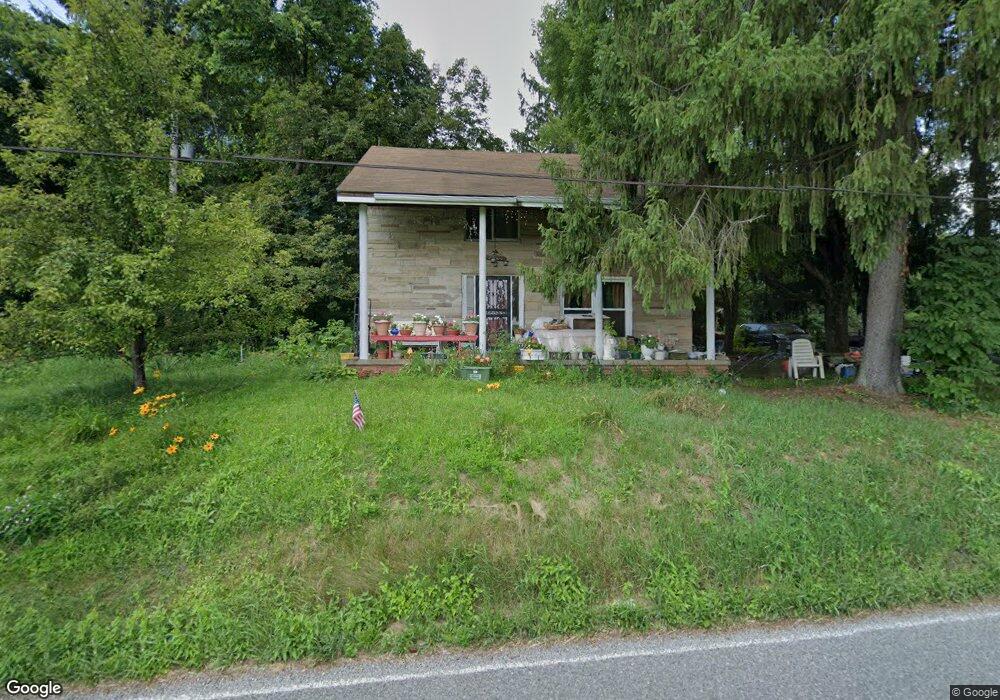
1721 Annesley Rd East Liverpool, OH 43920
Estimated Value: $164,000 - $172,000
3
Beds
2
Baths
1,456
Sq Ft
$115/Sq Ft
Est. Value
About This Home
This home is located at 1721 Annesley Rd, East Liverpool, OH 43920 and is currently estimated at $167,916, approximately $115 per square foot. 1721 Annesley Rd is a home with nearby schools including Westgate Middle School, LaCroft Elementary School, and East Liverpool High School.
Ownership History
Date
Name
Owned For
Owner Type
Purchase Details
Closed on
Dec 8, 2005
Sold by
Salsberry Timothy J and Salsberry Amber M
Bought by
Ammon Patricia L
Current Estimated Value
Home Financials for this Owner
Home Financials are based on the most recent Mortgage that was taken out on this home.
Original Mortgage
$91,600
Outstanding Balance
$46,544
Interest Rate
4.87%
Mortgage Type
Purchase Money Mortgage
Estimated Equity
$121,372
Purchase Details
Closed on
Nov 18, 2005
Sold by
Norton Charles W and Estate Of Margaret J Cox
Bought by
Spahr Richard and Spahr Hannah M
Home Financials for this Owner
Home Financials are based on the most recent Mortgage that was taken out on this home.
Original Mortgage
$91,600
Outstanding Balance
$46,544
Interest Rate
4.87%
Mortgage Type
Purchase Money Mortgage
Estimated Equity
$121,372
Create a Home Valuation Report for This Property
The Home Valuation Report is an in-depth analysis detailing your home's value as well as a comparison with similar homes in the area
Home Values in the Area
Average Home Value in this Area
Purchase History
| Date | Buyer | Sale Price | Title Company |
|---|---|---|---|
| Ammon Patricia L | -- | None Available | |
| Spahr Richard | $102,000 | None Available | |
| Salsberry Timothy J | $77,000 | None Available |
Source: Public Records
Mortgage History
| Date | Status | Borrower | Loan Amount |
|---|---|---|---|
| Open | Spahr Richard | $91,600 |
Source: Public Records
Tax History Compared to Growth
Tax History
| Year | Tax Paid | Tax Assessment Tax Assessment Total Assessment is a certain percentage of the fair market value that is determined by local assessors to be the total taxable value of land and additions on the property. | Land | Improvement |
|---|---|---|---|---|
| 2024 | $1,523 | $37,240 | $8,260 | $28,980 |
| 2023 | $1,523 | $37,240 | $8,260 | $28,980 |
| 2022 | $1,524 | $37,240 | $8,260 | $28,980 |
| 2021 | $1,508 | $35,180 | $8,580 | $26,600 |
| 2020 | $1,511 | $35,180 | $8,580 | $26,600 |
| 2019 | $1,510 | $35,180 | $8,580 | $26,600 |
| 2018 | $1,462 | $32,000 | $7,810 | $24,190 |
| 2017 | $1,542 | $32,000 | $7,810 | $24,190 |
| 2016 | $1,403 | $28,740 | $7,560 | $21,180 |
| 2015 | $1,403 | $28,740 | $7,560 | $21,180 |
| 2014 | $1,495 | $33,080 | $7,560 | $25,520 |
Source: Public Records
Map
Nearby Homes
- 1170 Dillworth Rd
- 2492 Irish Ridge Rd
- 967 7th Ave
- 17140 Cannons Mill Rd
- 978 Center Rd
- 1952 Dunn Rd
- 657 6th Ave
- 602 9th Ave
- 539 7th Ave
- 468 6th Ave
- 2476 Lisbon St
- 2249 Lisbon St
- 16573 Annesley Rd
- 16467 Staunton Ave
- 46150 Y and O Rd
- 564 Williams Ave
- 2512 Boring Ln
- 118 S Shadylane Dr
- 106 N Surry Rd
- 504 Williams Ave
- 1743 Annesley Rd
- 1725 Annesley Rd
- 1736 Annesley Rd
- 1740 Annesley Rd
- 1750 Annesley Rd
- 1730 Annesley Rd
- 1413 John Campbell Rd
- 1691 Annesley Rd
- 1746 Shadyside Ave
- 1754 Annesley Rd
- 1758 Annesley Rd
- 1354 Owens Rd
- 1431 John Campbell Rd
- 1762 Campground Rd
- 1398 Owens Rd
- 1765 Campground Rd
- 1731 Hess Rd
- 1731 Hess Rd
- 1754 Hess Rd
- 1436 John Campbell Rd