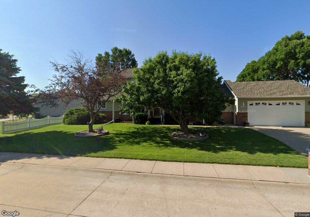
1721 Apache Ave Hastings, NE 68901
Estimated Value: $331,445 - $478,000
5
Beds
5
Baths
2,538
Sq Ft
$151/Sq Ft
Est. Value
About This Home
This home is located at 1721 Apache Ave, Hastings, NE 68901 and is currently estimated at $383,111, approximately $150 per square foot. 1721 Apache Ave is a home located in Adams County with nearby schools including Hastings Senior High School, St. Michael's Preschool & Elementary School, and Zion Lutheran School.
Ownership History
Date
Name
Owned For
Owner Type
Purchase Details
Closed on
Mar 4, 2015
Sold by
Franklin County Land Co Inc
Bought by
Long Cory D and Long Jami L
Current Estimated Value
Home Financials for this Owner
Home Financials are based on the most recent Mortgage that was taken out on this home.
Original Mortgage
$212,500
Outstanding Balance
$160,829
Interest Rate
3.6%
Mortgage Type
New Conventional
Estimated Equity
$222,282
Create a Home Valuation Report for This Property
The Home Valuation Report is an in-depth analysis detailing your home's value as well as a comparison with similar homes in the area
Home Values in the Area
Average Home Value in this Area
Purchase History
| Date | Buyer | Sale Price | Title Company |
|---|---|---|---|
| Long Cory D | $23,555 | None Available |
Source: Public Records
Mortgage History
| Date | Status | Borrower | Loan Amount |
|---|---|---|---|
| Open | Long Cory D | $212,500 |
Source: Public Records
Tax History
| Year | Tax Paid | Tax Assessment Tax Assessment Total Assessment is a certain percentage of the fair market value that is determined by local assessors to be the total taxable value of land and additions on the property. | Land | Improvement |
|---|---|---|---|---|
| 2025 | $4,803 | $307,182 | $36,000 | $271,182 |
| 2024 | $4,979 | $307,182 | $36,000 | $271,182 |
| 2023 | $5,499 | $266,504 | $36,000 | $230,504 |
| 2022 | $6,111 | $271,280 | $36,000 | $235,280 |
| 2021 | $5,883 | $268,280 | $33,000 | $235,280 |
| 2020 | $5,785 | $268,280 | $33,000 | $235,280 |
| 2019 | $5,723 | $268,280 | $33,000 | $235,280 |
| 2018 | $5,560 | $259,280 | $24,000 | $235,280 |
| 2017 | $5,457 | $254,665 | $0 | $0 |
| 2016 | $5,098 | $237,705 | $24,000 | $213,705 |
| 2011 | -- | $221,100 | $21,600 | $199,500 |
Source: Public Records
Map
Nearby Homes
- 1720 Apache Ave
- 1406 Sheridan Place
- 1253 Westridge Dr
- 1401 Heritage Dr
- 1233 Heritage Dr
- 1225 Heritage Dr
- 1250 Heritage Place
- 1909 W 10th St
- 1105 Jefferson Ave
- 1934 W 9th St
- 2019 W 9th St
- 2412 W 8th St
- 910 Jefferson Ave
- 736 N Barnes Ave
- 1334 W 12th St
- 1810 W 8th St
- 1831 W 8th St
- 2603 Bateman St
- 1701 Boyce St
- 810 Maplewood Ave
- 1705 Apache Ave
- 1718 Apache Ave
- 1627 Apache Ave
- 1706 Apache Ave
- 1710 Apache Ave
- 1700 Apache Ave
- 1617 Apache Ave
- 1620 Apache Ave
- 1613 Apache Ave
- 1616 Apache Ave
- 1518 Arapahoe Ave
- 1612 Apache Ave
- 1607 Apache Ave
- 1514 Arapahoe Ave
- 1606 Apache Ave
- 1601 Apache Ave
- 1521 Arapahoe Ave
- 2013 Crane Circle Dr
- 1600 Apache Ave
- 1510 Arapahoe Ave
Your Personal Tour Guide
Ask me questions while you tour the home.