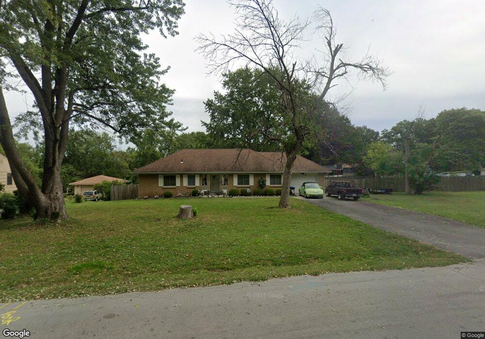
1721 James Downey Rd Independence, MO 64057
Bridger NeighborhoodEstimated Value: $216,000 - $248,000
2
Beds
1
Bath
1,475
Sq Ft
$155/Sq Ft
Est. Value
About This Home
This home is located at 1721 James Downey Rd, Independence, MO 64057 and is currently estimated at $228,568, approximately $154 per square foot. 1721 James Downey Rd is a home located in Jackson County with nearby schools including Blackburn Elementary School, Bridger Middle School, and Bingham Middle School.
Ownership History
Date
Name
Owned For
Owner Type
Purchase Details
Closed on
Oct 6, 2004
Sold by
Powers Joyce and Powers George M
Bought by
Waterfield Cathy
Current Estimated Value
Home Financials for this Owner
Home Financials are based on the most recent Mortgage that was taken out on this home.
Original Mortgage
$96,000
Outstanding Balance
$49,538
Interest Rate
6.4%
Mortgage Type
New Conventional
Estimated Equity
$179,030
Create a Home Valuation Report for This Property
The Home Valuation Report is an in-depth analysis detailing your home's value as well as a comparison with similar homes in the area
Home Values in the Area
Average Home Value in this Area
Purchase History
| Date | Buyer | Sale Price | Title Company |
|---|---|---|---|
| Waterfield Cathy | -- | Stewart Title Of Ks City Inc |
Source: Public Records
Mortgage History
| Date | Status | Borrower | Loan Amount |
|---|---|---|---|
| Open | Waterfield Cathy | $96,000 |
Source: Public Records
Tax History Compared to Growth
Tax History
| Year | Tax Paid | Tax Assessment Tax Assessment Total Assessment is a certain percentage of the fair market value that is determined by local assessors to be the total taxable value of land and additions on the property. | Land | Improvement |
|---|---|---|---|---|
| 2025 | $2,502 | $25,128 | $8,229 | $16,899 |
| 2024 | $2,445 | $36,119 | $7,843 | $28,276 |
| 2023 | $2,445 | $36,119 | $6,916 | $29,203 |
| 2022 | $1,403 | $19,000 | $3,373 | $15,627 |
| 2021 | $1,403 | $19,000 | $3,373 | $15,627 |
| 2020 | $1,376 | $18,105 | $3,373 | $14,732 |
| 2019 | $1,354 | $18,105 | $3,373 | $14,732 |
| 2018 | $1,356 | $17,308 | $4,056 | $13,252 |
| 2017 | $1,356 | $17,308 | $4,056 | $13,252 |
| 2016 | $1,337 | $16,898 | $3,131 | $13,767 |
| 2014 | $1,270 | $16,406 | $3,040 | $13,366 |
Source: Public Records
Map
Nearby Homes
- 16805 Sunset Dr
- 1800 S M 291 Hwy
- 17604 E 19th Street Ct S
- 2100 James Downey Rd
- 17904 E Whitney Rd S
- 1909 S Ellison Way
- 17824 Greentree Ave
- 17815 Greentree Ave
- 1626 S Whitney Dr
- 1912 S Viking Ct
- 2100 & 2105 S Ellison Way
- 17813 Aqueduct Dr
- 2501 S R D Mize Rd
- 2008 S Lees Summit Rd
- 1525 E Sea Ave Unit B
- 704 S Lacy Rd
- 607 S Lacy Rd
- 1749 Sinnott Cir
- 18710 E Truman Rd
- 2316 S Ponca Ave
- 1717 James Downey Rd
- 1725 James Downey Rd
- 1716 James Downey Rd
- 1712 James Downey Rd
- 1800 James Downey Rd
- 1713 James Downey Rd
- 1806 James Downey Rd
- 1748 Berry Rd
- 1744 Berry Rd
- 16811 James Downey Rd
- 1740 Berry Rd
- 1709 Highland Dr
- 1810 James Downey Rd
- 1801 James Downey Rd
- 1736 Berry Rd
- 1708 Highland Dr
- 16809 James Downey Rd
- 1749 Berry Rd
- 1705 Highland Dr
- 1741 Berry Rd