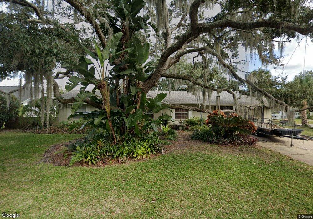
1721 Missouri Ave Sanford, FL 32771
Estimated Value: $367,361 - $550,000
3
Beds
2
Baths
1,372
Sq Ft
$332/Sq Ft
Est. Value
About This Home
This home is located at 1721 Missouri Ave, Sanford, FL 32771 and is currently estimated at $455,840, approximately $332 per square foot. 1721 Missouri Ave is a home located in Seminole County with nearby schools including Wilson Elementary School, Idyllwilde Elementary School, and Bentley Elementary School.
Ownership History
Date
Name
Owned For
Owner Type
Purchase Details
Closed on
Jul 28, 1997
Sold by
Hoffman Ronald J and Hoffman Sandra
Bought by
Liebelt Daniel D
Current Estimated Value
Home Financials for this Owner
Home Financials are based on the most recent Mortgage that was taken out on this home.
Original Mortgage
$129,600
Interest Rate
7.7%
Mortgage Type
New Conventional
Purchase Details
Closed on
May 1, 1994
Bought by
Liebelt Daniel D
Purchase Details
Closed on
Jan 1, 1977
Bought by
Liebelt Daniel D
Create a Home Valuation Report for This Property
The Home Valuation Report is an in-depth analysis detailing your home's value as well as a comparison with similar homes in the area
Home Values in the Area
Average Home Value in this Area
Purchase History
| Date | Buyer | Sale Price | Title Company |
|---|---|---|---|
| Liebelt Daniel D | $144,000 | -- | |
| Liebelt Daniel D | $130,000 | -- | |
| Liebelt Daniel D | $58,900 | -- |
Source: Public Records
Mortgage History
| Date | Status | Borrower | Loan Amount |
|---|---|---|---|
| Open | Liebelt Daniel D | $128,000 | |
| Closed | Liebelt Daniel D | $18,228 | |
| Closed | Liebelt Daniel D | $129,600 |
Source: Public Records
Tax History Compared to Growth
Tax History
| Year | Tax Paid | Tax Assessment Tax Assessment Total Assessment is a certain percentage of the fair market value that is determined by local assessors to be the total taxable value of land and additions on the property. | Land | Improvement |
|---|---|---|---|---|
| 2024 | $2,289 | $209,574 | -- | -- |
| 2023 | $2,226 | $203,470 | $0 | $0 |
| 2021 | $2,086 | $191,790 | $0 | $0 |
| 2020 | $2,064 | $189,142 | $0 | $0 |
| 2019 | $2,038 | $184,890 | $0 | $0 |
| 2018 | $2,014 | $181,443 | $0 | $0 |
| 2017 | $2,241 | $177,711 | $0 | $0 |
| 2016 | $2,283 | $175,274 | $0 | $0 |
| 2015 | $2,084 | $172,846 | $0 | $0 |
| 2014 | $2,084 | $171,474 | $0 | $0 |
Source: Public Records
Map
Nearby Homes
- 1811 Missouri Ave
- 4600 Nebraska Ave
- 1700 Missouri Ave
- 4970 Nebraska Ave
- 1405 Captiva Cove
- 1425 Paget Cove
- 4981 Rock Rose Loop
- 5040 Rock Rose Loop
- 1601 Stargazer Terrace
- 1649 Stargazer Terrace
- 793 Hyperion Dr
- 106 Palm Dr
- 0 Michigan Ave Unit MFRO6281220
- 102 Oak Tree Dr
- 4558 Redmond Place
- 105 Cypress Dr
- 138 Maple Dr
- 109 Fern Dr
- 130 Oak Tree Dr
- 726 Porter Rye Ave
- 1731 Missouri Ave
- 1701 Missouri Ave
- 1720 Beacon Dr
- 1741 Missouri Ave
- 1710 Beacon Dr
- 1730 Beacon Dr
- 1740 Beacon Dr
- 1751 Missouri Ave
- 1700 Beacon Dr
- 4700 Canal Dr
- 1750 Beacon Dr
- 1761 Missouri Ave
- 1731 Beacon Dr
- 1721 Beacon Dr
- 1711 Beacon Dr
- 1760 Beacon Dr
- 1701 Beacon Dr
- 1741 Beacon Dr
- 1751 Beacon Dr
- 1800 Beacon Dr