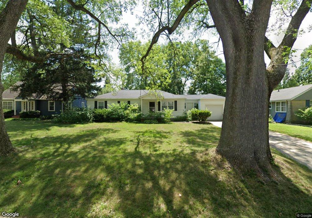
1721 Summit Dr West Lafayette, IN 47906
Estimated Value: $301,698 - $359,000
4
Beds
2
Baths
1,600
Sq Ft
$211/Sq Ft
Est. Value
About This Home
This home is located at 1721 Summit Dr, West Lafayette, IN 47906 and is currently estimated at $337,675, approximately $211 per square foot. 1721 Summit Dr is a home located in Tippecanoe County with nearby schools including West Lafayette Intermediate School, West Lafayette Elementary School, and West Lafayette Junior/Senior High School.
Ownership History
Date
Name
Owned For
Owner Type
Purchase Details
Closed on
May 16, 2019
Sold by
Avast Properties Llc
Bought by
Hch Fund Llc
Current Estimated Value
Home Financials for this Owner
Home Financials are based on the most recent Mortgage that was taken out on this home.
Original Mortgage
$95,889
Outstanding Balance
$62,416
Interest Rate
4.1%
Mortgage Type
New Conventional
Estimated Equity
$275,259
Purchase Details
Closed on
Aug 12, 2014
Sold by
Rch Properties Llc
Bought by
Avast Properties Llc
Purchase Details
Closed on
Jul 20, 2012
Sold by
Reg Of Indiana Llc
Bought by
Rch Properties Llc
Home Financials for this Owner
Home Financials are based on the most recent Mortgage that was taken out on this home.
Original Mortgage
$16,800
Interest Rate
3.64%
Mortgage Type
Purchase Money Mortgage
Create a Home Valuation Report for This Property
The Home Valuation Report is an in-depth analysis detailing your home's value as well as a comparison with similar homes in the area
Home Values in the Area
Average Home Value in this Area
Purchase History
| Date | Buyer | Sale Price | Title Company |
|---|---|---|---|
| Hch Fund Llc | -- | None Available | |
| Avast Properties Llc | -- | -- | |
| Rch Properties Llc | -- | None Available |
Source: Public Records
Mortgage History
| Date | Status | Borrower | Loan Amount |
|---|---|---|---|
| Open | Hch Fund Llc | $95,889 | |
| Previous Owner | Rch Properties Llc | $16,800 |
Source: Public Records
Tax History Compared to Growth
Tax History
| Year | Tax Paid | Tax Assessment Tax Assessment Total Assessment is a certain percentage of the fair market value that is determined by local assessors to be the total taxable value of land and additions on the property. | Land | Improvement |
|---|---|---|---|---|
| 2024 | $4,709 | $198,700 | $84,800 | $113,900 |
| 2023 | $4,574 | $193,000 | $55,000 | $138,000 |
| 2022 | $4,574 | $193,000 | $55,000 | $138,000 |
| 2021 | $4,048 | $170,800 | $55,000 | $115,800 |
| 2020 | $3,799 | $160,300 | $55,000 | $105,300 |
| 2019 | $3,645 | $153,800 | $55,000 | $98,800 |
| 2018 | $3,522 | $148,600 | $41,000 | $107,600 |
| 2017 | $3,505 | $147,900 | $41,000 | $106,900 |
| 2016 | $3,460 | $146,040 | $41,000 | $105,040 |
| 2014 | $3,207 | $135,300 | $36,000 | $99,300 |
| 2013 | $3,181 | $134,200 | $36,000 | $98,200 |
Source: Public Records
Map
Nearby Homes
- 1201 Lindberg Rd
- 1190 Camelback Blvd
- 2212 Sycamore Ln
- 701 Carrolton Blvd
- 2306 Carmel Dr
- 1912 Indian Trail Dr
- 500 Carrolton Blvd
- 509 Carrolton Blvd
- 1220 Ravinia Rd
- 1744 Sandpiper Dr
- 106 W Navajo St
- 631 Kent Ave
- 624 Kent Ave
- 231 Schilling St
- 448 Westview Cir
- 2843 Barlow St
- 2801 Henderson St
- 2825 Henderson St
- 2861 Linda Ln W
- 416 Catherwood Dr
- 1725 Summit Dr
- 1717 Summit Dr
- 1724 Sheridan Rd
- 1715 Summit Dr
- 1730 Sheridan Rd
- 1718 Sheridan Rd
- 1730 Summit Dr
- 1712 Sheridan Rd
- 1801 Summit Dr
- 1726 Summit Dr
- 1011 Oakhurst Dr
- 1709 Summit Dr
- 1722 Summit Dr
- 1114 Oakhurst Dr
- 1716 Summit Dr
- 1700 Sheridan Rd
- 1805 Summit Dr
- 1705 Summit Dr
- 1010 Oakhurst Dr
- 1806 Sheridan Rd