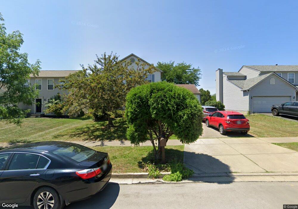
1721 Tecumseh Dr Lancaster, OH 43130
Estimated Value: $300,160 - $325,000
3
Beds
3
Baths
1,384
Sq Ft
$226/Sq Ft
Est. Value
About This Home
This home is located at 1721 Tecumseh Dr, Lancaster, OH 43130 and is currently estimated at $313,040, approximately $226 per square foot. 1721 Tecumseh Dr is a home located in Fairfield County with nearby schools including Tarhe Elementary School, General Sherman Junior High School, and Lancaster High School.
Ownership History
Date
Name
Owned For
Owner Type
Purchase Details
Closed on
Apr 5, 2001
Sold by
Walker Kirt B
Bought by
Scott David M and Scott Anitra A
Current Estimated Value
Home Financials for this Owner
Home Financials are based on the most recent Mortgage that was taken out on this home.
Original Mortgage
$136,500
Interest Rate
7.13%
Mortgage Type
VA
Purchase Details
Closed on
Jul 7, 1999
Sold by
Mckenzie Cory P
Bought by
Walker Kirt B
Home Financials for this Owner
Home Financials are based on the most recent Mortgage that was taken out on this home.
Original Mortgage
$128,441
Interest Rate
7.28%
Mortgage Type
FHA
Purchase Details
Closed on
Jun 24, 1997
Sold by
Dominion Homes Inc
Bought by
Mckenzie Cory P and Mckenzie Christie R
Home Financials for this Owner
Home Financials are based on the most recent Mortgage that was taken out on this home.
Original Mortgage
$100,450
Interest Rate
8.01%
Mortgage Type
Balloon
Create a Home Valuation Report for This Property
The Home Valuation Report is an in-depth analysis detailing your home's value as well as a comparison with similar homes in the area
Home Values in the Area
Average Home Value in this Area
Purchase History
| Date | Buyer | Sale Price | Title Company |
|---|---|---|---|
| Scott David M | $136,500 | -- | |
| Walker Kirt B | $129,500 | -- | |
| Mckenzie Cory P | $125,575 | -- |
Source: Public Records
Mortgage History
| Date | Status | Borrower | Loan Amount |
|---|---|---|---|
| Previous Owner | Scott David M | $136,500 | |
| Previous Owner | Walker Kirt B | $128,441 | |
| Previous Owner | Mckenzie Cory P | $100,450 |
Source: Public Records
Tax History Compared to Growth
Tax History
| Year | Tax Paid | Tax Assessment Tax Assessment Total Assessment is a certain percentage of the fair market value that is determined by local assessors to be the total taxable value of land and additions on the property. | Land | Improvement |
|---|---|---|---|---|
| 2024 | $5,809 | $64,620 | $11,180 | $53,440 |
| 2023 | $2,350 | $64,620 | $11,180 | $53,440 |
| 2022 | $2,360 | $64,620 | $11,180 | $53,440 |
| 2021 | $1,939 | $49,750 | $10,160 | $39,590 |
| 2020 | $1,858 | $49,750 | $10,160 | $39,590 |
| 2019 | $1,767 | $49,750 | $10,160 | $39,590 |
| 2018 | $1,605 | $44,110 | $10,160 | $33,950 |
| 2017 | $1,606 | $42,940 | $9,170 | $33,770 |
| 2016 | $1,564 | $42,940 | $9,170 | $33,770 |
| 2015 | $1,555 | $41,440 | $9,170 | $32,270 |
| 2014 | $1,481 | $41,440 | $9,170 | $32,270 |
| 2013 | $1,481 | $41,440 | $9,170 | $32,270 |
Source: Public Records
Map
Nearby Homes
- 1715 Tecumseh Dr
- 1639 Tecumseh Dr
- 1638 Quail Meadows Dr
- 1889 Salt Lick Dr
- 1632 Bush Hill Dr
- 2387 Zachariah Ave
- 2422 Long Bow Ave
- 2445 Columbus Lancaster Rd NW Unit Lot 176
- 2445 Columbus Lancaster Rd NW Unit Lot 408 Walnut St
- 2445 Columbus Lancaster Rd NW Unit lot 463
- 218 Marvel Dr
- 260 Scott Dr
- 1917 Nichole Cir
- 226 Whittier Dr S
- 340 16th St
- 282 14th St
- 420 Twentyfirst St
- 331 16th St
- 2610 Misty Meadows Ave
- 1835 Marrose Dr
- 1727 Tecumseh Dr
- 1707 Tecumseh Dr
- 1733 Tecumseh Dr
- 1703 Tecumseh Dr
- 1703 Tecumseh Dr Unit T
- 1756 Fern Trail Dr
- 1750 Fern Trail Dr
- 1762 Fern Trail Dr
- 1716 Tecumseh Dr
- 1722 Tecumseh Dr
- 1744 Fern Trail Dr
- 1712 Tecumseh Dr
- 1730 Tecumseh Dr
- 1695 Tecumseh Dr
- 1706 Tecumseh Dr
- 1738 Fern Trail Dr
- 1774 Fern Trail Dr
- 1743 Tecumseh Dr
- 1738 Tecumseh Dr
- 1700 Tecumseh Dr