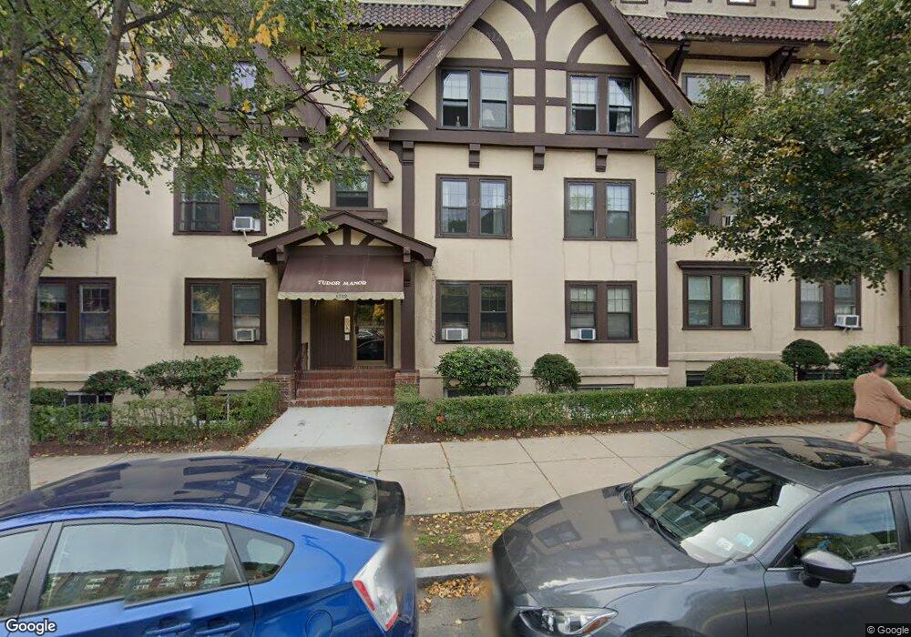
1722 Commonwealth Ave Unit 6 Brighton, MA 02135
Commonwealth NeighborhoodEstimated Value: $460,000 - $487,000
2
Beds
1
Bath
800
Sq Ft
$593/Sq Ft
Est. Value
About This Home
This home is located at 1722 Commonwealth Ave Unit 6, Brighton, MA 02135 and is currently estimated at $474,364, approximately $592 per square foot. 1722 Commonwealth Ave Unit 6 is a home located in Suffolk County with nearby schools including Shaloh House Jewish Day School, St Columbkille Partnership School, and Bais Yaakov Of Boston High School.
Ownership History
Date
Name
Owned For
Owner Type
Purchase Details
Closed on
Aug 5, 2025
Sold by
Haskal Haim M and Haskal Ruth
Bought by
Haim M Haskal Ret and Haskal
Current Estimated Value
Purchase Details
Closed on
Mar 18, 2021
Sold by
Haskal Ft and Haskal
Bought by
Haskal Haim and Haskal Ruth
Purchase Details
Closed on
Dec 1, 2006
Sold by
Haskal Haim
Bought by
Haskal Ft and Haskal
Purchase Details
Closed on
Oct 19, 1999
Sold by
Ricker Road Nt
Bought by
Haskal Haim and Haskel Ruth
Create a Home Valuation Report for This Property
The Home Valuation Report is an in-depth analysis detailing your home's value as well as a comparison with similar homes in the area
Home Values in the Area
Average Home Value in this Area
Purchase History
| Date | Buyer | Sale Price | Title Company |
|---|---|---|---|
| Haim M Haskal Ret | -- | -- | |
| Haim M Haskal Ret | -- | -- | |
| Haskal Haim | -- | None Available | |
| Haskal Haim | -- | None Available | |
| Haskal Ft | -- | -- | |
| Haskal Ft | -- | -- | |
| Haskal Haim | $119,500 | -- | |
| Haskal Haim | $119,500 | -- |
Source: Public Records
Tax History
| Year | Tax Paid | Tax Assessment Tax Assessment Total Assessment is a certain percentage of the fair market value that is determined by local assessors to be the total taxable value of land and additions on the property. | Land | Improvement |
|---|---|---|---|---|
| 2025 | $4,896 | $422,800 | $0 | $422,800 |
| 2024 | $4,220 | $387,200 | $0 | $387,200 |
| 2023 | $4,159 | $387,200 | $0 | $387,200 |
| 2022 | $3,974 | $365,300 | $0 | $365,300 |
| 2021 | $3,898 | $365,300 | $0 | $365,300 |
| 2020 | $3,627 | $343,500 | $0 | $343,500 |
| 2019 | $3,550 | $336,800 | $0 | $336,800 |
| 2018 | $3,299 | $314,800 | $0 | $314,800 |
| 2017 | $3,088 | $291,600 | $0 | $291,600 |
| 2016 | $2,943 | $267,500 | $0 | $267,500 |
| 2015 | $3,006 | $248,200 | $0 | $248,200 |
| 2014 | $2,837 | $225,500 | $0 | $225,500 |
Source: Public Records
Map
Nearby Homes
- 100 Lanark Rd Unit A
- 100 Lanark Rd Unit 8
- 30 Kinross Rd Unit 1
- 8 Kinross Rd Unit 2
- 1754 Commonwealth Ave Unit B
- 24 Selkirk Rd Unit 24-4
- 140 Kilsyth Rd Unit 8
- 1691 Commonwealth Ave Unit 31
- 15 Colliston Rd Unit 6
- 56-58 Selkirk Rd
- 36 Cummings Rd Unit 1
- 38 Ransom Rd Unit 12
- 47 Englewood Ave
- 60 Sutherland Rd Unit 4
- 32 Ransom Rd Unit 4
- 26 Chiswick Rd Unit 6
- 113-115 Nottinghill Rd
- 1641 Commonwealth Ave Unit 16
- 123 Nottinghill Rd Unit 1
- 114 Strathmore Rd Unit 102
- 1722 Commonwealth Ave Unit 8
- 1722 Commonwealth Ave Unit 7
- 1722 Commonwealth Ave Unit 5
- 1722 Commonwealth Ave Unit 4
- 1722 Commonwealth Ave Unit 3
- 1722 Commonwealth Ave Unit 2
- 1722 Commonwealth Ave Unit 1
- 1722 Commonwealth Ave Unit 1722-1
- 1722 Commonwealth Ave
- 1722 Commonwealth Ave
- 1722 Commonwealth Ave Unit 3, 1722
- 1722 Commonwealth Ave Unit 5, 1722
- 1726 Commonwealth Ave Unit 8
- 1726 Commonwealth Ave Unit 7
- 1726 Commonwealth Ave Unit 6
- 1726 Commonwealth Ave Unit 5
- 1726 Commonwealth Ave Unit 4
- 1726 Commonwealth Ave Unit 3
- 1726 Commonwealth Ave Unit 2
- 1726 Commonwealth Ave Unit 1
Your Personal Tour Guide
Ask me questions while you tour the home.