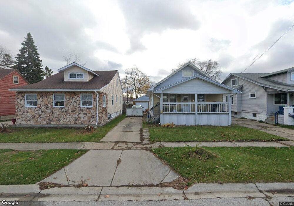
1722 Martin Ave Port Huron, MI 48060
Estimated Value: $132,000 - $148,757
3
Beds
1
Bath
864
Sq Ft
$163/Sq Ft
Est. Value
About This Home
This home is located at 1722 Martin Ave, Port Huron, MI 48060 and is currently estimated at $140,939, approximately $163 per square foot. 1722 Martin Ave is a home located in St. Clair County with nearby schools including Michigamme Elementary School, Central Middle School, and Port Huron High School.
Ownership History
Date
Name
Owned For
Owner Type
Purchase Details
Closed on
Mar 13, 2013
Sold by
Residential Group 231 Llc
Bought by
Kenney Jeremy and Kenney Kristine
Current Estimated Value
Purchase Details
Closed on
Sep 29, 2011
Sold by
Livingston Lucille
Bought by
Residential Group 231 Llc
Purchase Details
Closed on
Dec 17, 2004
Sold by
Lewis Christopher
Bought by
Livingstone Lucille
Home Financials for this Owner
Home Financials are based on the most recent Mortgage that was taken out on this home.
Original Mortgage
$112,000
Interest Rate
7.99%
Mortgage Type
Adjustable Rate Mortgage/ARM
Create a Home Valuation Report for This Property
The Home Valuation Report is an in-depth analysis detailing your home's value as well as a comparison with similar homes in the area
Home Values in the Area
Average Home Value in this Area
Purchase History
| Date | Buyer | Sale Price | Title Company |
|---|---|---|---|
| Kenney Jeremy | $5,000 | None Available | |
| Residential Group 231 Llc | -- | None Available | |
| Livingstone Lucille | $112,000 | Alpha Title Agency Inc |
Source: Public Records
Mortgage History
| Date | Status | Borrower | Loan Amount |
|---|---|---|---|
| Previous Owner | Livingstone Lucille | $112,000 |
Source: Public Records
Tax History Compared to Growth
Tax History
| Year | Tax Paid | Tax Assessment Tax Assessment Total Assessment is a certain percentage of the fair market value that is determined by local assessors to be the total taxable value of land and additions on the property. | Land | Improvement |
|---|---|---|---|---|
| 2025 | $1,829 | $72,000 | $0 | $0 |
| 2024 | $1,374 | $69,200 | $0 | $0 |
| 2023 | $1,298 | $63,000 | $0 | $0 |
| 2022 | $1,325 | $55,400 | $0 | $0 |
| 2021 | $1,259 | $50,700 | $0 | $0 |
| 2020 | $1,273 | $46,100 | $46,100 | $0 |
| 2019 | $1,250 | $33,300 | $0 | $0 |
| 2018 | $1,223 | $33,300 | $0 | $0 |
| 2017 | $1,093 | $28,900 | $0 | $0 |
| 2016 | $928 | $28,900 | $0 | $0 |
| 2015 | $911 | $26,100 | $26,100 | $0 |
| 2014 | $911 | $25,400 | $25,400 | $0 |
| 2013 | -- | $25,600 | $0 | $0 |
Source: Public Records
Map
Nearby Homes
- 1718 Martin Ave
- 1726 Martin Ave
- 1730 Martin Ave
- 1714 Martin Ave
- 1734 Martin Ave
- 1710 Martin Ave
- 1738 Martin Ave
- 1714 Lapeer Ave Unit Bldg-Unit
- 1714 Lapeer Ave
- 1702 Martin Ave
- 1723 Jenks St
- 1719 Jenks St
- 1737 Jenks St
- 1718 Lapeer Ave
- 715 17th St
- 1722 Lapeer Ave
- 1710 Lapeer Ave
- 721 17th St
- 1802 Martin Ave
- 713 18th St