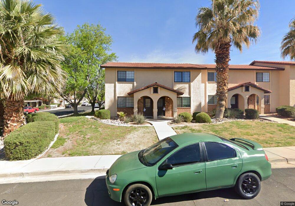
1722 W 1020 N Unit 139 Saint George, UT 84770
Estimated Value: $228,000 - $244,851
2
Beds
2
Baths
1,054
Sq Ft
$226/Sq Ft
Est. Value
About This Home
This home is located at 1722 W 1020 N Unit 139, Saint George, UT 84770 and is currently estimated at $238,213, approximately $226 per square foot. 1722 W 1020 N Unit 139 is a home located in Washington County with nearby schools including Paradise Canyon, Snow Canyon Middle School, and Lava Ridge Intermediate School.
Ownership History
Date
Name
Owned For
Owner Type
Purchase Details
Closed on
Mar 16, 2022
Sold by
Hutchings Andrew P and Hutchings Penny R
Bought by
A & P Enterprises Llc
Current Estimated Value
Purchase Details
Closed on
Oct 6, 2014
Sold by
Larsen Micah S and Larsen Sonia A
Bought by
Hutchings Andrew P and Hutchings Penny R
Home Financials for this Owner
Home Financials are based on the most recent Mortgage that was taken out on this home.
Original Mortgage
$73,100
Interest Rate
4.07%
Mortgage Type
New Conventional
Purchase Details
Closed on
Sep 29, 2005
Sold by
Folland Don T
Bought by
Larsen Micah S and Larsen Sonia A
Home Financials for this Owner
Home Financials are based on the most recent Mortgage that was taken out on this home.
Original Mortgage
$23,000
Interest Rate
5.67%
Mortgage Type
Stand Alone Second
Create a Home Valuation Report for This Property
The Home Valuation Report is an in-depth analysis detailing your home's value as well as a comparison with similar homes in the area
Home Values in the Area
Average Home Value in this Area
Purchase History
| Date | Buyer | Sale Price | Title Company |
|---|---|---|---|
| A & P Enterprises Llc | -- | None Listed On Document | |
| A & P Enterprises Llc | -- | None Listed On Document | |
| Hutchings Andrew P | -- | Magellan Title | |
| Larsen Micah S | -- | United Title Services |
Source: Public Records
Mortgage History
| Date | Status | Borrower | Loan Amount |
|---|---|---|---|
| Previous Owner | Hutchings Andrew P | $73,100 | |
| Previous Owner | Larsen Micah S | $23,000 | |
| Previous Owner | Larsen Micah S | $91,900 |
Source: Public Records
Tax History Compared to Growth
Tax History
| Year | Tax Paid | Tax Assessment Tax Assessment Total Assessment is a certain percentage of the fair market value that is determined by local assessors to be the total taxable value of land and additions on the property. | Land | Improvement |
|---|---|---|---|---|
| 2025 | $944 | $132,550 | $30,250 | $102,300 |
| 2023 | $1,681 | $251,200 | $50,000 | $201,200 |
| 2022 | $1,146 | $132,110 | $27,500 | $104,610 |
| 2021 | $798 | $167,200 | $35,000 | $132,200 |
| 2020 | $728 | $143,700 | $30,000 | $113,700 |
| 2019 | $700 | $134,900 | $30,000 | $104,900 |
| 2018 | $682 | $65,945 | $0 | $0 |
| 2017 | $583 | $56,320 | $0 | $0 |
| 2016 | $524 | $46,860 | $0 | $0 |
| 2015 | $541 | $46,420 | $0 | $0 |
| 2014 | $500 | $43,175 | $0 | $0 |
Source: Public Records
Map
Nearby Homes
- 1742 W 1020 N Unit 123
- 1711 W 1020 N Unit 60
- 1782 W 1020 N Unit 133
- 1122 N 1620 W Unit 11
- 954 N 1725 W Unit 32
- 1840 W 1100 N Unit 28
- 1840 W 1100 N Unit 1
- 1811 W 1300 N
- 1075 N 1400 W Unit 32
- 1040 N 2000 W
- 1360 N Dixie Downs Dr Unit 4
- 1373 N 1610 W
- 1360 N Dixie Downs Rd Unit 55
- 1360 N Dixie Downs Rd Unit 24
- 1360 N Dixie Downs Rd Unit 5
- 1360 N Dixie Downs Rd Unit 14
- 1070 1400 St W
- 1074 1400 St W
- 1724 W 1020 N Unit 138
- 1720 W 1020 N Unit 140
- 1718 W 1020 N Unit 141
- 1714 W 1020 N Unit 143
- 1712 W 1020 N Unit 144
- 1710 W 1020 N Unit 145
- 1708 W 1020 N Unit 146
- 1046 N 1725 W Unit 187
- 1046 N 1725 W Unit 186
- 1046 N 1725 W Unit 185
- 1046 N 1725 W Unit 182
- 1046 N 1725 W Unit 181
- 1046 N 1725 W Unit 180
- 1046 N 1725 W Unit 179
- 1046 N 1725 W Unit 178
- 1046 N 1725 W Unit 177
- 1046 N 1725 W Unit 153
- 1046 N 1725 W Unit 154
- 1046 N 1725 W
- 1715 W 1020 N Unit 59