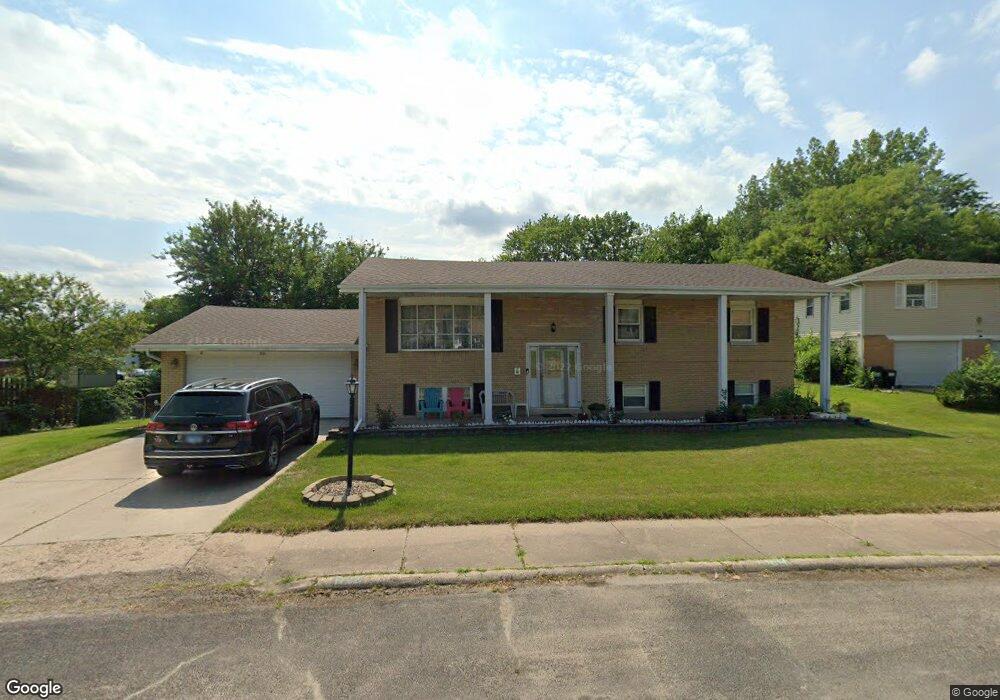
1722 W Tiffany Ct Peoria, IL 61614
North Peoria NeighborhoodEstimated Value: $239,000 - $294,000
3
Beds
3
Baths
1,344
Sq Ft
$193/Sq Ft
Est. Value
About This Home
This home is located at 1722 W Tiffany Ct, Peoria, IL 61614 and is currently estimated at $259,781, approximately $193 per square foot. 1722 W Tiffany Ct is a home located in Peoria County with nearby schools including Kellar Primary School, Liberty Leadership Middle School, and Richwoods High School.
Ownership History
Date
Name
Owned For
Owner Type
Purchase Details
Closed on
Jul 7, 1998
Sold by
Dixon Owen P and Dixon Margaret H
Bought by
Vo Cang
Current Estimated Value
Home Financials for this Owner
Home Financials are based on the most recent Mortgage that was taken out on this home.
Original Mortgage
$75,000
Interest Rate
6.75%
Mortgage Type
New Conventional
Create a Home Valuation Report for This Property
The Home Valuation Report is an in-depth analysis detailing your home's value as well as a comparison with similar homes in the area
Home Values in the Area
Average Home Value in this Area
Purchase History
| Date | Buyer | Sale Price | Title Company |
|---|---|---|---|
| Vo Cang | $135,500 | Attorney Only |
Source: Public Records
Mortgage History
| Date | Status | Borrower | Loan Amount |
|---|---|---|---|
| Previous Owner | Vo Cang | $75,000 |
Source: Public Records
Tax History Compared to Growth
Tax History
| Year | Tax Paid | Tax Assessment Tax Assessment Total Assessment is a certain percentage of the fair market value that is determined by local assessors to be the total taxable value of land and additions on the property. | Land | Improvement |
|---|---|---|---|---|
| 2024 | $5,661 | $68,590 | $12,380 | $56,210 |
| 2023 | $5,356 | $62,930 | $11,360 | $51,570 |
| 2022 | $4,956 | $57,380 | $10,590 | $46,790 |
| 2021 | $4,837 | $54,650 | $10,090 | $44,560 |
| 2020 | $4,821 | $54,110 | $9,990 | $44,120 |
| 2019 | $4,902 | $55,210 | $10,190 | $45,020 |
| 2018 | $4,845 | $55,750 | $10,290 | $45,460 |
| 2017 | $4,850 | $56,310 | $10,390 | $45,920 |
| 2016 | $4,704 | $56,310 | $10,390 | $45,920 |
| 2015 | $4,411 | $55,210 | $10,190 | $45,020 |
| 2014 | $4,418 | $53,920 | $9,950 | $43,970 |
| 2013 | -- | $54,570 | $10,070 | $44,500 |
Source: Public Records
Map
Nearby Homes
- 1720 W Queens Court Rd
- 1720 W Willow Wood Dr
- 1511 W Queens Court Rd
- 6909 N Patricia Ln
- 1320 W Cress Creek Ct
- 7120 N Manning Dr
- 7103 N Manning Dr
- 7133 N Terra Vista Dr Unit 3202
- 7610 Walnut Bend Dr Unit 27
- 7615 Walnut Bend Dr Unit 30
- 936 W Trailcreek Dr Unit 936
- 7408 N Brittany Park Place Unit 8
- 7408 N Brittany Park Place
- 7223 N Lakeside Ct Unit 12
- 6616 N Greenmont Rd
- 6217 N Knoll Aire Dr
- 6300 N Allen Rd Unit 10
- 7112 N Willow Bend Pointe Unit 21
- 6002 N Keenland Ave
- 2209 W Kensington Dr
- 1724 W Tiffany Ct
- 1714 W Tiffany Ct
- 1719 W Tiffany Ct
- 7150 N University St
- 1708 W Tiffany Ct
- 1730 W Tiffany Ct
- 1725 W Tiffany Ct
- 7200 N University St
- 1711 W Tiffany Ct
- 1731 W Tiffany Ct
- 1702 W Tiffany Ct
- 1702 W Tiffany Ct Unit 3
- 1702 W Tiffany Ct Unit 4
- 1703 W Tiffany Ct
- 1703 W Tiffany Ct Unit 1705 W. Tiffany
- 1705 W Tiffany Ct
- 1710 W Queens Court Rd
- 1716 W Queens Court Rd
- 1710 W Tiffany Ct Unit B
- 1710 W Tiffany Ct Unit A