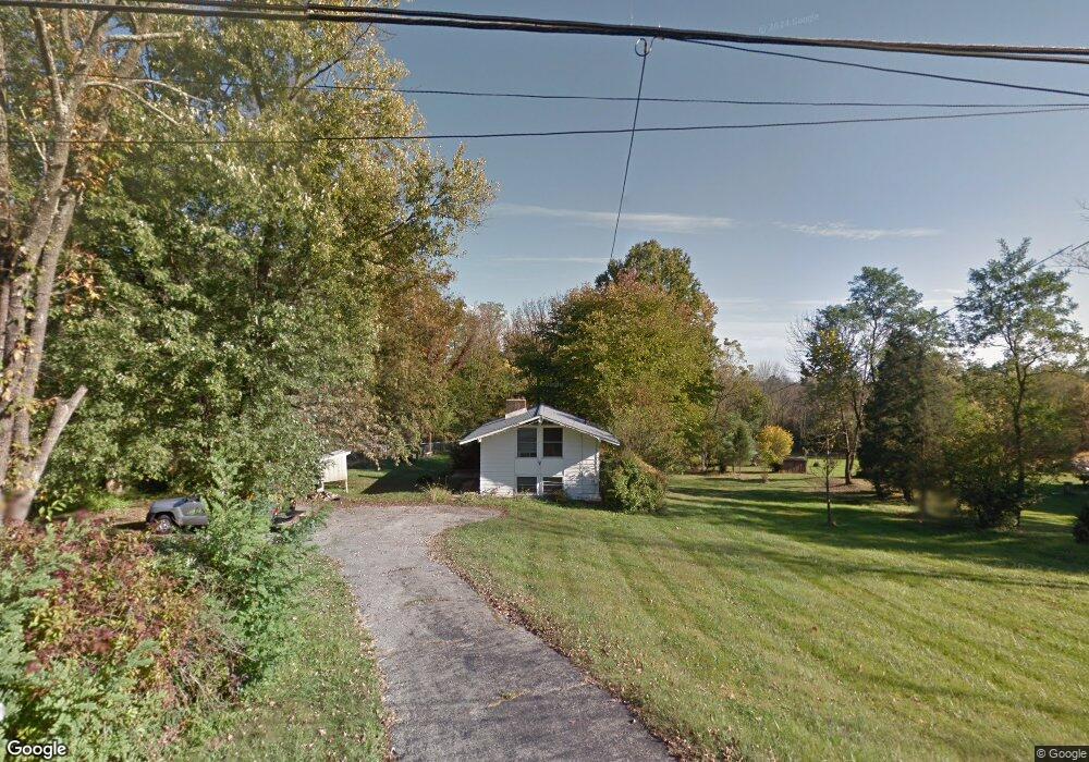
1722 Whitehall Rd Norristown, PA 19403
Estimated Value: $478,000 - $649,000
3
Beds
2
Baths
1,764
Sq Ft
$311/Sq Ft
Est. Value
About This Home
This home is located at 1722 Whitehall Rd, Norristown, PA 19403 and is currently estimated at $548,882, approximately $311 per square foot. 1722 Whitehall Rd is a home located in Montgomery County with nearby schools including Worcester Elementary School, Skyview Upper Elementary School, and Arcola Intermediate School.
Ownership History
Date
Name
Owned For
Owner Type
Purchase Details
Closed on
Sep 23, 2008
Sold by
Gearhart Rodney
Bought by
Florkowski Raymond and Michele Florkowski E
Current Estimated Value
Home Financials for this Owner
Home Financials are based on the most recent Mortgage that was taken out on this home.
Original Mortgage
$209,000
Outstanding Balance
$138,414
Interest Rate
6.43%
Estimated Equity
$410,468
Purchase Details
Closed on
Mar 30, 2005
Sold by
Not Provided
Bought by
Gerhart Rodney
Home Financials for this Owner
Home Financials are based on the most recent Mortgage that was taken out on this home.
Original Mortgage
$190,550
Interest Rate
5.78%
Mortgage Type
New Conventional
Purchase Details
Closed on
Mar 29, 2005
Sold by
Not Provided
Bought by
Gerhart Rodney
Home Financials for this Owner
Home Financials are based on the most recent Mortgage that was taken out on this home.
Original Mortgage
$190,550
Interest Rate
5.78%
Mortgage Type
New Conventional
Create a Home Valuation Report for This Property
The Home Valuation Report is an in-depth analysis detailing your home's value as well as a comparison with similar homes in the area
Home Values in the Area
Average Home Value in this Area
Purchase History
| Date | Buyer | Sale Price | Title Company |
|---|---|---|---|
| Florkowski Raymond | $225,000 | None Available | |
| Gerhart Rodney | $190,550 | -- | |
| Gerhart Rodney | $190,550 | -- |
Source: Public Records
Mortgage History
| Date | Status | Borrower | Loan Amount |
|---|---|---|---|
| Open | Florkowski Raymond | $209,000 | |
| Previous Owner | Gerhart Rodney | $190,550 | |
| Previous Owner | Gerhart Rodney | $190,550 |
Source: Public Records
Tax History Compared to Growth
Tax History
| Year | Tax Paid | Tax Assessment Tax Assessment Total Assessment is a certain percentage of the fair market value that is determined by local assessors to be the total taxable value of land and additions on the property. | Land | Improvement |
|---|---|---|---|---|
| 2025 | $5,928 | $156,500 | $86,210 | $70,290 |
| 2024 | $5,928 | $156,500 | $86,210 | $70,290 |
| 2023 | $5,686 | $156,500 | $86,210 | $70,290 |
| 2022 | $5,576 | $156,500 | $86,210 | $70,290 |
| 2021 | $5,466 | $156,500 | $86,210 | $70,290 |
| 2020 | $5,364 | $156,500 | $86,210 | $70,290 |
| 2019 | $5,312 | $156,500 | $86,210 | $70,290 |
| 2018 | $610 | $156,500 | $86,210 | $70,290 |
| 2017 | $5,108 | $156,500 | $86,210 | $70,290 |
| 2016 | $5,047 | $156,500 | $86,210 | $70,290 |
| 2015 | $4,867 | $156,500 | $86,210 | $70,290 |
| 2014 | $4,867 | $156,500 | $86,210 | $70,290 |
Source: Public Records
Map
Nearby Homes
- 2624 Hawthorn Dr
- 2617 Hawthorn Dr
- 41 Umbrell Dr
- 2564 W Skippack Pike
- 2648 Hawthorn Dr
- 15 Umbrell Dr
- 1600 Potshop Rd
- 107 Caspian Ln
- 2036 Bethel Rd
- 1815 - LOT 1A Yost Rd
- 1734 Hallman Dr
- 2 Capri Ln Unit KINSLEY
- 2725 Skippack Pike
- 3218 Nottingham Rd
- 1105 Whitpain Hills Unit 5
- 2023 Stony Creek Rd
- 2099 Deep Meadow Ln
- 1411 Whitpain Hills
- 1604 Whitpain Hills
- 1698 Daws Rd
- 1728 Whitehall Rd
- 1716 Whitehall Rd
- 1734 Whitehall Rd
- 1734 Whitehall Rd
- 1729 Whitehall Rd
- 1710 Whitehall Rd
- 1729 Whitehall Rd
- 1733 Whitehall Rd
- 1700 Whitehall Rd
- 1701 Whitehall Rd
- 1700 N Whitehall Rd
- 2579 Bean Rd
- 2617 Bean Rd
- 2590 Bean Rd
- 2600 Bean Rd
- 1801 Whitehall Rd
- 2614 Bean Rd
- 2610 Bean Rd
- 1813 Whitehall Rd
- 2618 Bean Rd