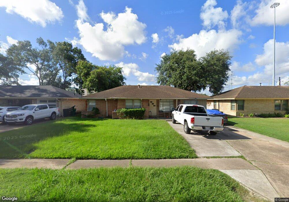
1723 Ansbury Dr Houston, TX 77018
Oak Forest-Garden Oaks NeighborhoodEstimated Value: $374,000 - $418,859
4
Beds
1
Bath
1,312
Sq Ft
$301/Sq Ft
Est. Value
About This Home
This home is located at 1723 Ansbury Dr, Houston, TX 77018 and is currently estimated at $394,465, approximately $300 per square foot. 1723 Ansbury Dr is a home located in Harris County with nearby schools including Garden Oaks Montessori, Frank Black Middle School, and Waltrip High School.
Ownership History
Date
Name
Owned For
Owner Type
Purchase Details
Closed on
Sep 7, 2010
Sold by
New Day Asset Management Inc
Bought by
Vanho At
Current Estimated Value
Home Financials for this Owner
Home Financials are based on the most recent Mortgage that was taken out on this home.
Original Mortgage
$108,482
Outstanding Balance
$72,033
Interest Rate
4.55%
Mortgage Type
Purchase Money Mortgage
Estimated Equity
$322,432
Create a Home Valuation Report for This Property
The Home Valuation Report is an in-depth analysis detailing your home's value as well as a comparison with similar homes in the area
Home Values in the Area
Average Home Value in this Area
Purchase History
| Date | Buyer | Sale Price | Title Company |
|---|---|---|---|
| Vanho At | -- | None Available | |
| New Day Asset Management Inc | -- | Driggs Title Agency Inc |
Source: Public Records
Mortgage History
| Date | Status | Borrower | Loan Amount |
|---|---|---|---|
| Open | New Day Asset Management Inc | $108,482 | |
| Closed | Vanho At | $107,200 |
Source: Public Records
Tax History Compared to Growth
Tax History
| Year | Tax Paid | Tax Assessment Tax Assessment Total Assessment is a certain percentage of the fair market value that is determined by local assessors to be the total taxable value of land and additions on the property. | Land | Improvement |
|---|---|---|---|---|
| 2025 | $4,623 | $352,039 | $315,400 | $36,639 |
| 2024 | $4,623 | $327,474 | $315,400 | $12,074 |
| 2023 | $4,623 | $297,935 | $275,975 | $21,960 |
| 2022 | $6,055 | $285,000 | $236,550 | $48,450 |
| 2021 | $5,827 | $250,000 | $197,125 | $52,875 |
| 2020 | $5,539 | $262,901 | $197,125 | $65,776 |
| 2019 | $5,261 | $240,000 | $197,125 | $42,875 |
| 2018 | $3,544 | $194,000 | $157,700 | $36,300 |
| 2017 | $4,345 | $206,000 | $157,700 | $48,300 |
| 2016 | $3,950 | $237,007 | $157,700 | $79,307 |
| 2015 | -- | $222,548 | $157,700 | $64,848 |
| 2014 | -- | $185,994 | $118,275 | $67,719 |
Source: Public Records
Map
Nearby Homes
- 1726 Ansbury Dr
- 1635 Wilde Rock Way
- 1919 Ansbury Dr
- 2532 Ohsfeldt St
- 3042 Oak Forest Dr
- 1906 W 25th St
- 1902 W 25th St
- 1821 W 24th St
- 2428 Ella Blvd
- 2006 Lou Ellen Ln Unit H
- 2203 Bron Holly Dr
- 1615 W 24th St Unit B
- 1235 Ansbury Dr
- 2634 Couch St
- 2215 Ansbury Dr
- 2505 Couch St Unit A
- 3506 Oak Forest Dr
- 1413 W 26th St
- 1226 Stonecrest Dr
- 3527 Ella Blvd
- 1727 Ansbury Dr
- 1719 Ansbury Dr
- 1715 Ansbury Dr
- 1731 Ansbury Dr
- 1711 Ansbury Dr
- 1722 Ansbury Dr
- 1718 Ansbury Dr
- 1730 Ansbury Dr
- 1714 Ansbury Dr
- 1707 Ansbury Dr
- 1803 Ansbury Dr
- 1710 Ansbury Dr
- 1703 Ansbury Dr
- 1727 Wilde Rock Way
- 1723 Wilde Rock Way
- 1706 Ansbury Dr
- 3003 Guese Rd
- 1719 Wilde Rock Way
- 1731 Wilde Rock Way
- 1807 Ansbury Dr