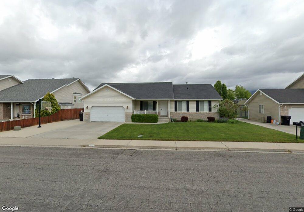
1723 E 410 S Spanish Fork, UT 84660
Estimated Value: $526,000 - $577,000
3
Beds
2
Baths
3,290
Sq Ft
$169/Sq Ft
Est. Value
About This Home
This home is located at 1723 E 410 S, Spanish Fork, UT 84660 and is currently estimated at $555,251, approximately $168 per square foot. 1723 E 410 S is a home located in Utah County with nearby schools including Larsen Elementary School, Spanish Fork Jr High School, and Diamond Fork Junior High School.
Ownership History
Date
Name
Owned For
Owner Type
Purchase Details
Closed on
Feb 19, 2025
Sold by
Muirbrook Ladd R and Muirbrook Lisa A
Bought by
Ladd And Lisa Muirbrook Family Trust and Muirbrook
Current Estimated Value
Purchase Details
Closed on
Jun 21, 2000
Sold by
Matheny David L and Matheny Halli K
Bought by
Muirbrook Ladd R and Muirbrook Lisa A
Home Financials for this Owner
Home Financials are based on the most recent Mortgage that was taken out on this home.
Original Mortgage
$156,500
Interest Rate
8.53%
Purchase Details
Closed on
Jun 15, 1998
Sold by
Taylor Homes Inc
Bought by
Matheny David L and Matheny Halli K
Home Financials for this Owner
Home Financials are based on the most recent Mortgage that was taken out on this home.
Original Mortgage
$120,000
Interest Rate
7.17%
Create a Home Valuation Report for This Property
The Home Valuation Report is an in-depth analysis detailing your home's value as well as a comparison with similar homes in the area
Home Values in the Area
Average Home Value in this Area
Purchase History
| Date | Buyer | Sale Price | Title Company |
|---|---|---|---|
| Ladd And Lisa Muirbrook Family Trust | -- | None Listed On Document | |
| Muirbrook Ladd R | -- | Empire Land Title Company | |
| Matheny David L | -- | First American Title |
Source: Public Records
Mortgage History
| Date | Status | Borrower | Loan Amount |
|---|---|---|---|
| Previous Owner | Muirbrook Ladd R | $156,500 | |
| Previous Owner | Matheny David L | $120,000 |
Source: Public Records
Tax History Compared to Growth
Tax History
| Year | Tax Paid | Tax Assessment Tax Assessment Total Assessment is a certain percentage of the fair market value that is determined by local assessors to be the total taxable value of land and additions on the property. | Land | Improvement |
|---|---|---|---|---|
| 2025 | $2,428 | $271,535 | $188,800 | $304,900 |
| 2024 | $2,428 | $250,305 | $0 | $0 |
| 2023 | $2,498 | $257,730 | $0 | $0 |
| 2022 | $2,492 | $252,175 | $0 | $0 |
| 2021 | $2,092 | $338,700 | $106,500 | $232,200 |
| 2020 | $1,981 | $311,800 | $96,800 | $215,000 |
| 2019 | $1,820 | $301,400 | $86,400 | $215,000 |
| 2018 | $1,735 | $277,800 | $78,100 | $199,700 |
| 2017 | $1,608 | $138,325 | $0 | $0 |
| 2016 | $1,460 | $123,970 | $0 | $0 |
| 2015 | $1,374 | $115,280 | $0 | $0 |
| 2014 | $1,369 | $115,280 | $0 | $0 |
Source: Public Records
Map
Nearby Homes
- 1658 Dover Dr
- 551 S 1750 E
- 563 S 1850 E
- 641 S 1700 E
- 3687 E 1270 S
- 636 S 1850 E
- 2127 Rio Grande Dr
- 882 N 1650 E Unit 265
- 858 N 1650 E Unit 266
- 857 N 1650 E Unit 267
- 1455 E 100 S
- 1222 E 500 S
- 832 S 1430 E
- 2262 E Rio Grande Dr
- 762 S 1360 E
- 762 S 1360 E Unit 25
- 2064 E 800 S
- 938 S 1740 E
- 246 E 860 S Unit 162
- 232 E 860 S Unit 158
- 1715 E 410 S
- 1735 E 410 S
- 1718 Mountain View Dr
- 1732 Mountain View Dr
- 1694 Mountain View Dr
- 1722 E 410 S
- 1703 E 410 S
- 1703 Dover Dr
- 1716 E 410 S
- 1736 E 410 S
- 1728 Mountain View Dr
- 1679 Dover Dr
- 1758 E 410 S
- 1672 Mountain View Dr
- 1771 E 410 S
- 1692 E 410 S
- 1725 E 500 S
- 1743 E 500 S
- 1721 Mountain View Dr
- 1739 Mountain View Dr