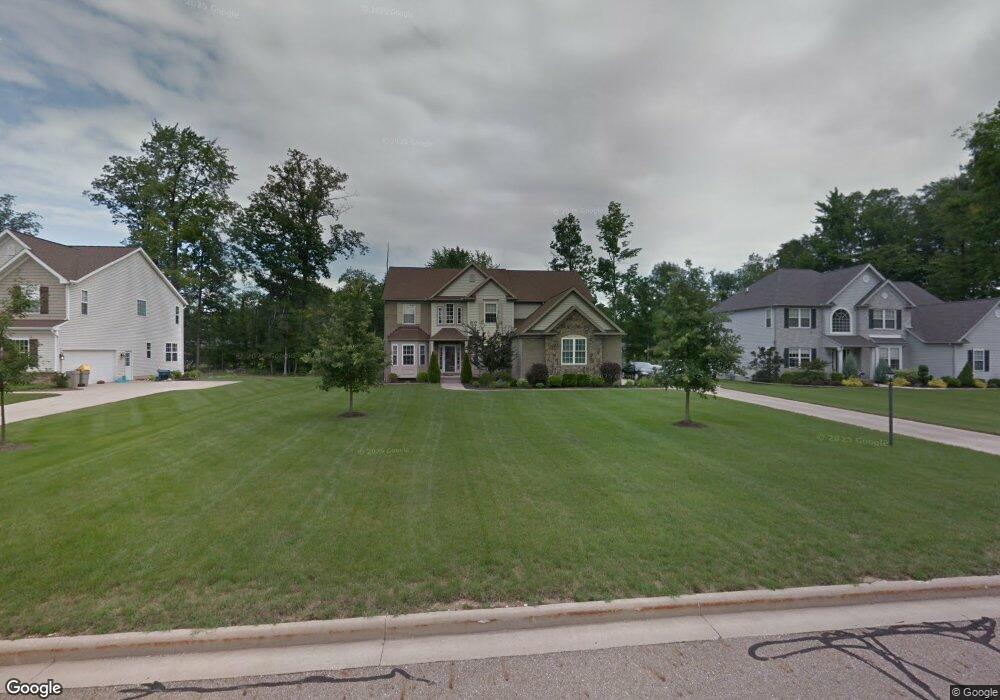
1723 Mccausland Dr Hudson, OH 44236
Estimated Value: $526,973 - $544,000
4
Beds
3
Baths
2,692
Sq Ft
$199/Sq Ft
Est. Value
About This Home
This home is located at 1723 Mccausland Dr, Hudson, OH 44236 and is currently estimated at $535,993, approximately $199 per square foot. 1723 Mccausland Dr is a home located in Summit County with nearby schools including Wilcox Primary School, Dodge Intermediate School, and Samuel Bissell Elementary School.
Ownership History
Date
Name
Owned For
Owner Type
Purchase Details
Closed on
Jul 6, 2005
Sold by
Millstone Building Co Ltd
Bought by
Lowe Andre B and Lowe Lisa R
Current Estimated Value
Home Financials for this Owner
Home Financials are based on the most recent Mortgage that was taken out on this home.
Original Mortgage
$271,940
Outstanding Balance
$147,325
Interest Rate
6.25%
Mortgage Type
Fannie Mae Freddie Mac
Estimated Equity
$388,668
Purchase Details
Closed on
Nov 24, 2004
Sold by
Darrow Road Investment Group Inc
Bought by
Millstone Building Co Ltd
Home Financials for this Owner
Home Financials are based on the most recent Mortgage that was taken out on this home.
Original Mortgage
$68,400
Interest Rate
5.86%
Mortgage Type
Purchase Money Mortgage
Create a Home Valuation Report for This Property
The Home Valuation Report is an in-depth analysis detailing your home's value as well as a comparison with similar homes in the area
Home Values in the Area
Average Home Value in this Area
Purchase History
| Date | Buyer | Sale Price | Title Company |
|---|---|---|---|
| Lowe Andre B | $339,925 | Revere Title Summit County | |
| Millstone Building Co Ltd | $85,500 | Buckeye Reserve Title Agency |
Source: Public Records
Mortgage History
| Date | Status | Borrower | Loan Amount |
|---|---|---|---|
| Open | Lowe Andre B | $271,940 | |
| Closed | Millstone Building Co Ltd | $68,400 | |
| Closed | Lowe Andre B | $67,985 |
Source: Public Records
Tax History Compared to Growth
Tax History
| Year | Tax Paid | Tax Assessment Tax Assessment Total Assessment is a certain percentage of the fair market value that is determined by local assessors to be the total taxable value of land and additions on the property. | Land | Improvement |
|---|---|---|---|---|
| 2025 | $8,587 | $141,502 | $31,840 | $109,662 |
| 2024 | $8,587 | $141,502 | $31,840 | $109,662 |
| 2023 | $8,587 | $141,502 | $31,840 | $109,662 |
| 2022 | $7,050 | $101,073 | $22,743 | $78,330 |
| 2021 | $6,608 | $101,073 | $22,743 | $78,330 |
| 2020 | $6,674 | $101,070 | $22,740 | $78,330 |
| 2019 | $8,437 | $110,220 | $27,700 | $82,520 |
| 2018 | $8,117 | $110,220 | $27,700 | $82,520 |
| 2017 | $7,377 | $110,220 | $27,700 | $82,520 |
| 2016 | $7,689 | $110,220 | $27,700 | $82,520 |
| 2015 | $7,377 | $110,220 | $27,700 | $82,520 |
| 2014 | $7,035 | $110,220 | $27,700 | $82,520 |
| 2013 | $7,420 | $111,970 | $27,700 | $84,270 |
Source: Public Records
Map
Nearby Homes
- 2219 Fairway Blvd Unit 4E
- 2142 Kirtland Place
- 1366 Twinsburg Rd E
- 2061 Garden Ln
- 1593 Stonington Dr
- 1644 Stonington Dr
- 8021 Valley View Rd
- VL Valley View Rd
- 7488 Valley View Rd
- 2346 Danbury Ln
- 1440 E Hines Hill Rd
- 1453 Prospect Rd
- 7511 Herrick Park Dr
- 2064 Case St
- 1556 W Prospect St
- 1897 Case St
- 2055 Rugby St
- V/L- Eton St
- 1959 Rugby St
- 930 Chinaberry Cir S
- 1733 Mccausland Dr
- 1713 Mccausland Dr
- 1703 Mccausland Dr
- 1818 Marwell Blvd
- 1724 Mccausland Dr
- 1734 Mccausland Dr
- 1714 Mccausland Dr
- 1792 Marwell Blvd
- 1693 Mccausland Dr
- 1704 Mccausland Dr
- 1694 Mccausland Dr
- 1683 Mccausland Dr
- 7523 Estate Ave
- 1850 Marwell Blvd
- 7513 Estate Ave
- 7533 Estate Ave
- 1684 Mccausland Dr
- 1772 Marwell Blvd
- 1825 Marwell Blvd
- 7543 Estate Ave